Important Update: November 21, 2014There was a NASA Satellite timelapse video posted with regards the Earth and weather pattern anomalies. However, the reason and subject for why this was posted had zero to do with weather patterns. But what I noticed in the first four frames are what I am assuming is the southerly Somali-Ethiopia monsoonal current pattern which carries moisture north, but not necessarily in the form of clouds, as is often the case with the Mexican monsoonal pattern which flows into the southwest. Once this moist warm flow interacts with the electrical conductivity of deeply rooted old growth vegetation and the aerosols they release at the same time, only then do the clouds form and create storm systems which even travel 100s of miles away. Eventually someone is going to get this. Once again, please pay close attention to the first four frames and notice where western Saudi Arabia is and the vegetated mountain range running along the Red Sea between Yemen and Jordan. Especially in late afternoon before the sunset horizon reaches that point, each day there is an explosion of clouds and then stretching all the way to Iran. Such important geological locations should be preserved and not allowed to be deforested and remain intact. Also, other important regions should be targeted and replanted to create weather systems which will effect weather down stream in agricultural areas. If they really are serious about Climate Change, then they'll start redirecting where the conversations are headed.
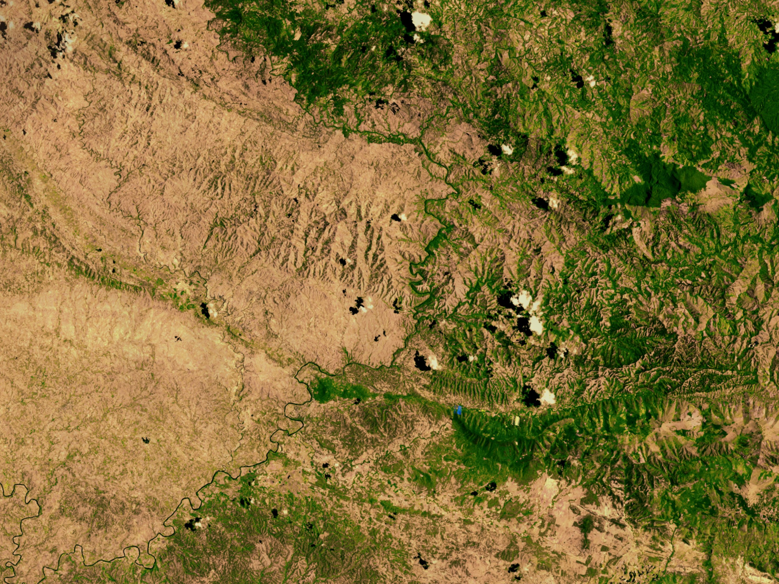
Below is the start of this original post February 2013I was just briefly looking up some pictures of the Haitian Deforestation problem and stumbled across a picture of something that caught my eye. I've written several posts on the ability and actual necessity of health fully vegetation ecosystems and the relationship between these plants and cloud formation and rainfall. While I have seen many of the moon-scape photos taken of Haiti's terrible problem with stripping completely bare the land by either greedy commercial interests or just plain desperate poor people through lack of education trying to survive and provide for their families. But something clearly unusual captured my attention this time. On the left of this photo from Wiki-uploads is Haiti which is pretty much bare. To the right is Dominican Republic which though not exactly perfect in their custodianship of the land either, they haven't gone as far and still have a good measure of vegetation cover on the ground. In the old days before European occupation and exploitation of natural resources, such a view from a Satellite would reveal a solid lush green-scape. Now look at this photo and notice where most of the clouds are located. The first photo of the same region is from a site called Logic Manager along with a well animated enhanced borderline and comments.
 |
| Credit: New York Times |
Now the purpose of the above photo is to show vivid contrast along the bold white borderline, and you can see some of the cloud formation puffs visible with their shadows underneath on the land itself. Now let's look at the Wiki-Upload Photo. I'll provide the actual link to that photo below and you may magnify it greatly on the map with the zoom symbol.
 |
| Satellite Photo Credit: Wikipedia |
 |
| Contrast Photo Credit: City-Data |
http://upload.wikimedia.org/wikipedia/commons/1/15/Haiti_deforestation.jpg
 |
| Credit: NOAA |
Further Update: July 23, 2014
Emissions from forests influence very first stage of cloud formation
 |
| (NASA image courtesy Jeff Schmaltz, MODIS Rapid Response at NASA GSFC ) |
"These clouds are almost certainly a result of evapotranspiration. The clouds are distributed evenly across the forest, but no clouds formed over the Amazon River and its floodplain, where there is no tall canopy of trees. While water may evaporate from the Amazon River itself, the air near the ground is too warm for clouds to form. Trees, on the other hand, release water vapor at higher levels of the atmosphere, so the water vapor more quickly reaches an altitude where the air is cool enough for clouds to form. When water vapor condenses, it releases heat into the atmosphere."
"Clouds are the largest source of uncertainty in present climate models. Much of the uncertainty surrounding clouds' effect on climate stems from the complexity of cloud formation. New research sheds light on new particle formation -- the very first step of cloud formation. The findings closely match observations in the atmosphere and can help make climate prediction models more accurate."
(Source)
Here is another reference:
Emissions from forests influence very first stage of cloud formation
~~~~~~~~~~~~~~~~~~~~~~~~~~~~~~~~I don't have much more to point out, but I hope others will keep an eye out on such phenomena and post it here. I've written about the various mechanical components of cloud formation before over land, but I understand this is probably a boring subject for most since very little interest has been shown. Not surprising since our planet's sad state of health reflects a lack of any interest in such things whatsoever. But pay attention as these things are far more important towards this planet functioning properly and sustaining life on it. You can very any of my archives here as I see no need to re-post them on this page. Keep in mind that I'm specifically talking about cloud formation that has ZERO to do with storm clouds coming in off oceans. Thanks for listening.
No comments:
Post a Comment
Thanks for visiting and stopping by with your comments!
I will try to respond to each comment within a few days, though sometimes I take longer if I'm too busy which appears to be increasing.