Pages

Tuesday, May 21, 2013

Engelmann Oak (Quercus engelmannii) an Often Ignored Native in the Landscape


Credit: Jose C Juarez
I really admire many Oak species for various individual characteristic reasons. But one that I've always admired for it's ability to grow in the harshest of conditions of any I have observed from toughness stand point is Engelmann Oak (Qurecus engelmannii). While there are many photos out there showing a luxuriant example in an ideal location in the sense of habitat, soil and water availability which make for majestic Oak photo opportunity, it's the Engelmann examples that impress me far more. Many giant oaks are going to be found growing in Valleys, floodplains where ample water & deep soils are to be found. But I'm talking about the ability of Engelmann Oak growing to large stature on a steep southern exposed slope. In SoCal and inland, these are some of the hottest driest locations. This speaks volumes to me as to this Oak's toughness under harsh extremes and a hot dry southern mountain slope doesn't get any more extreme than that. Now that's in the backcountry of a rural area of the southwest which has some of the nasty conditions imaginable for plants to survive and yet Engelmann Oaks thrive here. This makes an urban landscape environment an ideal paradise by comparison, where such plants should thrive under the loving care of a gardener or Landscaper. Although admittedly many well meaning gardeners and landscapers can mother their native plants to death sometimes. One of the best areas to observe prime examples of tough Engelmann in the wild beating the odds of a typical nasty drought condition habitat is at the Santa Ysabel Open Space Preserve. The sign above is west of Santa Ysabel and east of Witch Creek (area of the infamous 2007 fire). Below are some photos I took when I first arrived at the beginning of April on my way to Ranchita CA.

Credit Intermountain Fire and Rescue, Hwy 78, Ramona CA
This location above with the hill behind is a great starting point to view Engelmann Oak in a dry hot scenario is on a southern slope. This is also an area ravaged by another infamous megafire named the  2007 Witch Creek Fire which swept through the area. It is located directly across from the well known Pine Hills Egg Ranch. The following photo is just to the east of this shot.
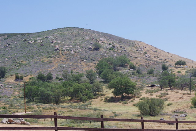
Credit: Mine
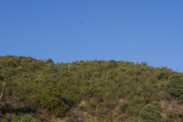
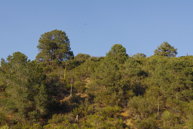
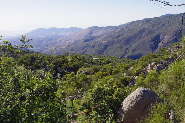
This picture is facing the southern slope in an usually dry hot location in the San Diego backcountry where most plants fail other than low growing inland sage scrub plant community with Sages and Buchwheats. And yet we find large specimens of Engelmann Oak not only making this their home, but actually thriving on such an inhospitable location.
Credit: Mine
Santa Ysabel Creek is just beyond the foreground grassland hill with the Engelmann Oak covered mountain as the background. The gray coloured shrubs between the Oak Trees are actually a very low growing White Sage (Salvia apiana) and some small shrubby Silver Sagebrush (Artemisia cana). Interestingly the chaparral here facilitates the grow of this tree's acorns for which the Western Scrub Jay is the landscape designer. Oddly enough the Oaks do better within the interior sage scrub than the annual weedy grasses, much of which is non-native.
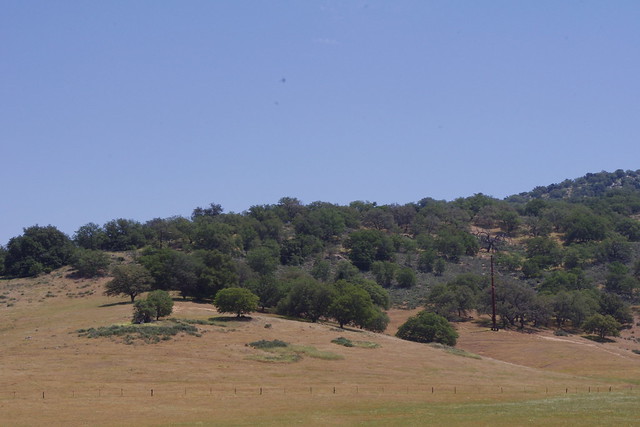
Photo: Mine

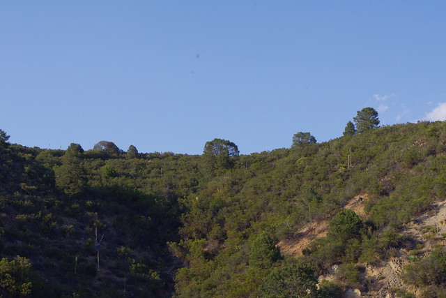
This is looking directly east from the eastern portion of the Santa Ysabel Preserve entrance on Hwy 79 north of Santa Ysabel itself. While in this picture there may be one or two other trees like Interior Live Oak (Quercus wislizeni), but it is mostly the tough Engelmann Oak trees which dominates here.
Okay shifting some gears here for a bit on or in another area of San Diego County and subject of viewing these trees. One of the most remarkable things I like specifically about these Oak Trees when comparing them to other Oaks is their ability to self prune themselves into twisted picturesque shapes and/or forms. The California Sycamore also has an amazing ability to twist and shape itself and much of this is environmental and no doubt the same with the Engelmann Oak. Cal-Sycamores are influenced by what is called Anthracnose Canker which effects newer leaves causing side shoots to become the new leader bud which often may grow in a different direction than the original. Often this may even cause quite a bit of leaf drop, but I've never noticed this to be fatal to the tree. The result really is the picturesque contorted or twisted features for which they are known. In the shaping of the Engelmann Oak, they are drought-stress deciduous which may account for their amazing ability to survive where the other oaks will not. It also may allow them to not only drop leaves, but perhaps also twigs and even small branches giving it, it's often picturesque shapes. For me the best place for viewing these almost tropical picturesque shapes was on the switched back grade on Hwy 76 between the Junction of the Valley Center Road and the Oak Knoll Campground on the La Jolla Indian Reservation. This has always had some of the most beautiful forms of Engelmann Oak I've ever seen. I haven't visited there this time as I've had a lot on my photo shoot plate, but I'm not sure of their condition after that 2007 Poomacha Fire which burned at the same time as other notorious fires back then like 2007 Witch Creek Fire. Still I'm curious as to what these areas look like since the region was almost pure Engelmann Oak woodlands

Shifting gears again, I have another interesting note about the Engelmann Oak's acorn germination. In the early/middle 1970s, much of the literature I first found on acorn germination mentioned an interesting phenomena noted with one oak, the Gambel (Quercus gambelii) in particular which when it dropped it's acorns, the acorn germinated immediately upon to toughing the ground. With many acorns Scrub Jays often collect and bury acorns and germination under a favourite chaparral commences. With the Gambel it made sense because of the heavy monsoonal rains which are prevalent in it's range in Colorado, Utah, New Mexico and Arizona. But during the 1980s wet monsoonal seasons I also saw the same germination effect with Engelmann Oak as with Gambel Oaks. Below is a photo of just the exact tree where I first saw this phenomena. It is a single Engelmann Oak along Hwy 79 across from the Old Schoolhouse Road turnoff on Santa Ysabel Indian Reservation in San Diego Co. Below is a picture of that very oak i stopped at to collect acorns for germination at my home in Anza California.
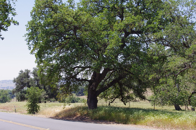

Photo: Mine
This oak tree was always beautiful and I considered it easy access for collecting acorns in the early 1980s. What a surprise to find most all of them germinating under the vicinity of this parent tree. That summer was extremely wet and the grasslands were all a rich green. The soils in the Fall were still damp from Summer Monsoons. Mind you, I say Fall, but actually it was late September. Notice to the left of the tree the smaller younger Engelmann Oak ??? This is one of those offspring. I know because I kept checking on all of the survival abily of those seedlings for a couple decades on and off. It wasn't so much that drought, predation etc was a factor as was the CalTrans spraying and mowing of roadside weeds. Below is a close up of that younger tree in 2013. To my knowledge, oaks like the Gambel Oak which are from the white oak group have little or no dormancy requirements and will germinate after maturing, while acorns of the black oak group exhibit embryo dormancy requirements and germinate the spring following fall sowing either by ScrubJays or Squirrels. Or people!
Photo: Mine 
Here is one of those young trees that made it. There were many others, but as checks and balances circumstances dictate, only a few can make it to maturity. Such a beautiful healthy tree and I highly doubt commuters and tourists ever give it a second look or even know of it's early on history of germination.
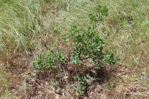
Photo Mine
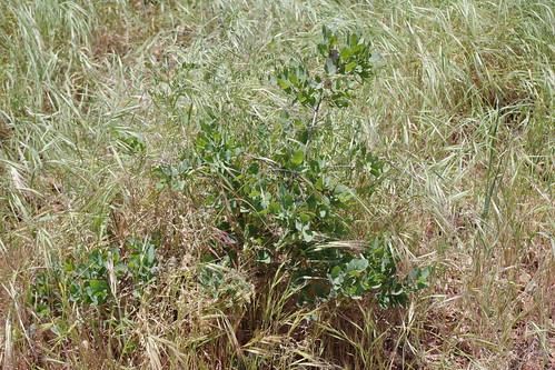
This is another much younger oak located on the north side of the parent tree. Notice the  chocking foxtail grasses and then the scene where I've pulled them away from the tree. Invasive non-native weeds are a hindrance to regeneration and no amount of control or prescribed burn is going to increase this trees numbers. Any burning would also destroy any seedling or saplings like the ones above or even Cal-Trans shoulder mowing operations. Now below here is an updated photo of the original seedling I saw back in the middle 1980s. What a difference from the 2013 photo. This was taken from Google Earth 2020. The foliage in this photo is a little sparse comared to the previous one, but partial summer dormancy is an important survival mechanism for Engelmann Oak.
Photo Update from Google Earth (2020)

Now look at tthese photos from Pasadena streetscapes
Image from Barbara Eisenstein (May 13 2004)
  
Weeding Wild Suburbia - Engelmann Oaks in Pasadena
Image - Barbara Eisenstein (October 12 2013)
In conclusion on these Acorns I found at the Santa Ysabel roadside tree, take a close look at the collection of acorns on the right by by Barabara Eisenstain and notice the very largest acorns where some are still green ??? These are about the exact size I saw of acorns fallen underneath the Engelmann Oak across the Hwy 79 a few meters south of School House Canyon Road and the Santa Ysabel Tribal Headquarters. They were so big and heavy that wet monssonal season that all fell out of their caps and almost every single one was laying on the ground and sprouting in September in the early 1980s.  Torrey Pines for me are another favourite to landscape with because they also are chaparral friendly, not overly dense allowing light to enter and reach low growing chaparral plants under them. This makes them perfect for urban landscapes for home owners, commercial landscapes and Municipal Park Projects. Unfortunately I have not seen enough of them in the cities, although I have seen them used in some places. Mostly the darker green Coast Live Oak gets favour because of it's dark greener foliage. Maybe the Engelmann Oak is overlooked because it has a bit of a bluegreen look which is not desired. Either way, landscapers are missing out and more field work by observing them in picturesque natural settings are what is needed for inspiration. At my mum's place when I first arrived I hit Las Pilitas Nursery north of Escondido CA along old Hwy 395 across from Champagne Lakes Campground and purchased a one gallon Engelmann Oak, planted it and have been excitedly watching it perform so well. In planting this and any other Cal Native plant (actually any plant period) DO NOT amend the soil ever. Simply loosen the soil around the sterile soil hole and heavily incorporate a blended multiple species mycorrhizal inoculum and water. Apply generous amounts of clean wood chip mulch on top of the soil and leave it alone. This should be the simple money saving rule with everything you plant. Once colonized with beneficial organisms, then NO FERTILIZERS should EVER be used. Do it and you'll lose everything. Water waaaaay too much and you'll also lose everything.

On a side note, most of the studies literature has suggested there is fossil evidence that Engelmann Oak was widespread during wetter time periods across the Mojave and Sonoran Deserts. I don't this for an instant since I am already fascinated with ancient wetter times anyway. Oaks like Maples which are given the title "Cloud Trees", are major cloud producing trees because of their great ability to produces large quantities of aerosols for water droplet nuclei formation in clouds and I have no doubt among other missing mechanisms that they played major roles in wetter summer monsoons. This is where I wonder about such a role during the days of ancient Lake Cahuilla. I have a future post on the vast oak woodlands of Anza Valley coming up soon. Humans have disrespected and butchered their environment for centuries. In times past the greed and selfishness while inexcusable was also coupled with ignorance on natural ecosystem functions. There is no such ignorance today, so the deliberate irresponsible behavior makes modern humans more accountable, I doubt fault anyone for being ignrant, but I do fault them for choosing to stay that way. In the mean time, the Southern california city of Pasadena is loaded with mature old growth Engelmann Oaks, sadly many now dying and not being replaced. Here is a photo and link to galley below from Weeding Wild Suburbia.
Two more photos of city streets from Pasadena with older Engelmann Oaks used or kept in the Landscape
Image by Barbara Eisenstein (2010)


Image by Barbara Eisenstein (2003)

Weeding Wild Suburbia - Emgelmann Oaks in Pasadena
Before I leave California, I'll publish the photos and progress of my mum's front yard Engelmann Oak which suddenly is showing a rapid healthy growth. Just wish I could see the end of the year's results. Note to Mary Ann Kiger and Jerry Thornton, that hill you mentioned and showed me last week which was bare from the fire at the southwestern corner of your property would be an excellent spot to try these oaks. 
Further reading Material:
Santa Ysabel Open Space Preserve map
County of San Diego: Santa Ysabel Preserves
100 Peaks.com - "Santa Ysabel Open Space Preserve West"
http://www.pacifichorticulture.org - Engelmann Oak
Landscape Deprogramming courses & tools below>
http://www.laspilitas.com/
http://www.californianativeplants.com/


Monday, May 20, 2013

Chamise (Greasewood) Adenostoma fasciculatum a Major Forest Plant Facilitator

Image - Josh Williams
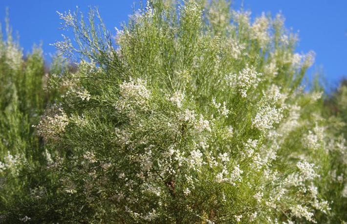
Contrary to the Chamise (Adenostoma fasciculatum) chaparral plant's derogatory other name as "Greasewood" which attempts to exaggerate it's Biogenic Volatile Organic Compounds (BVOC) Sap content which will readily burn like any other plant, the plant gives more life than it supposedly takes. Yes it contains oils that will burn, but so do other plants. Even Tropical Rainforests can and do in our modern world burn with a voracity, but usually only as a result of human intervention.  Yes it is most notable in Brushfire events, but only because it usually is the most abundant interior region plant for which human developments themselves invade it's habitat for housing projects. Recent findings however are proving just how valuable this chaparral shrub and possibly it's cousin Redshank or Ribbonwood really are in forest re-establishment. Not only for it's incredible ability at Hydraulic redistribution, but also the fact that during wetter years, both of these chaparral species can be colonized by an ectomycorrhizae called Pisolithus tinctorius which under the conventional belief, was never supposed to happen. They have always been listed strictly under endomycorrhizal hosting. I'll have to write about this in a future post. But it clearly does illustrate why during these wetter rainfall events such as "El Nino", that the spread of woodlands is much greater within the chaparral plant community. A plant community often demonized by those charge with it's management and trust as to custodianship like US Forestry.

Image - Mine

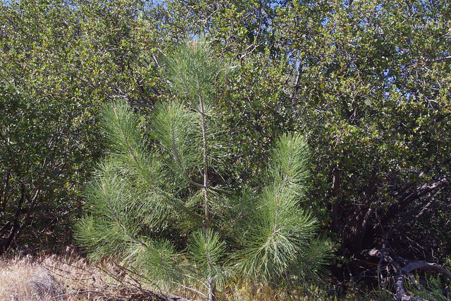
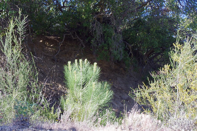
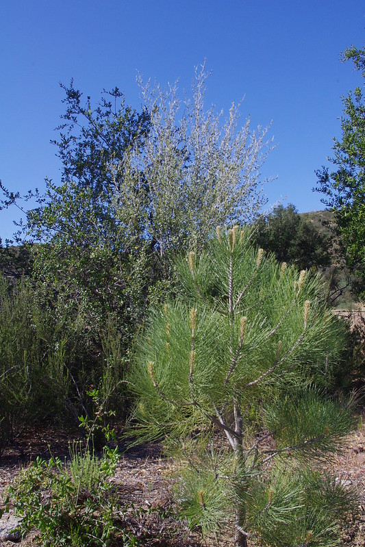
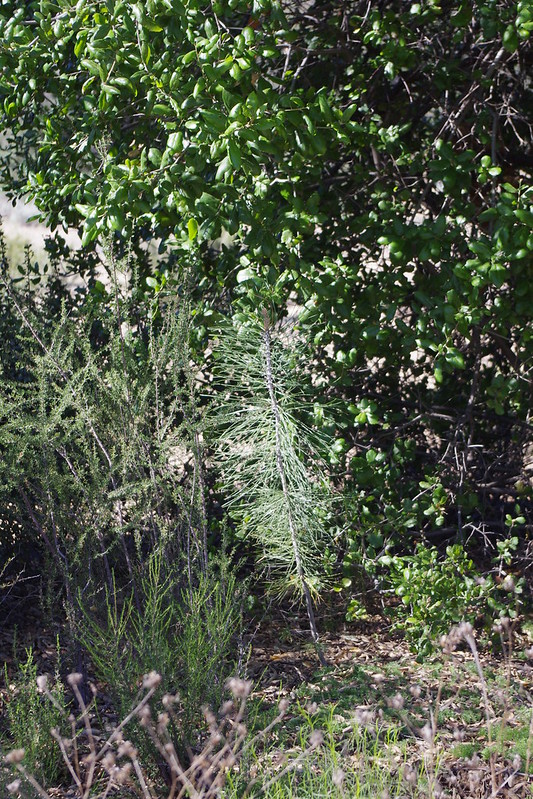
This young Coulter Pine is wedged in between two Chamise chaparral plants near Ranchita California. These chaparral plants have extremely deep soil holding roots and can extract water from deeper soil layers and redistribute the moisture through the fungal grid network underground to sustain the young trees until they can manage on their own. In time the Chamise itself will yield to the woodland as opposed to the unfair reputation of chocking tree planting programs for which they are mechanically and chemically eradicated before a restoration project proceeds. 

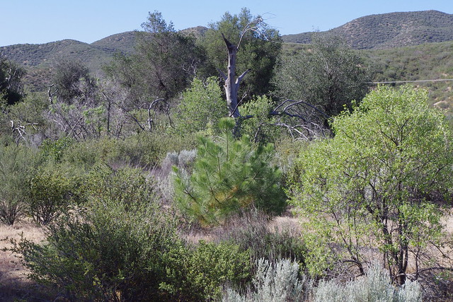
These next photos are a gallery of examples taken from the Burnt Valley Rd area of Anza CA and Hwy 371 traveling north from the eastern Burnt Valley Rd Jct and heading northeastwards towards Paradise Corners near Garner Valley. My main reason for taking these shots if you examine them carefully is that these slopes are all South and West facing and temps in summer here are extreme with drying winds. However, amazingly over the years, these particular Chamise (Greasewood) Adenostoma fasciculatum have acted as Nurse Plants to countless Parry Pinyon (Pinus quadrafolia). These Pinyons would not have made the transition from pinyon nut germination to young decade old sapling had it not been for Greasewood. 

Photo Mine
Steep Southern facing slope off Hwy 371 from Burnt Valley Rd Jct to Paradise Corners to the north. These are extreme hot dry locations where no self respecting tree would dare attempt to germinate and survive on it's own without the help of a nurse plant. In this case, Greasewood, with some stunted Redshank or Ribbonwood present. The soils here have very little organic matter on the surface, are known for continual dry (hot or cold) windy conditions along with shallow top soils and loads of fractured rock. As long as mycorrhizae is present, no problem. In this case, the area is extremely rich in Pisolithus tinctorius which is abundant everywhere and one of my most favourite personal major truffle or puffball collection areas. Most of my collecting has been around the old Dunn Ranch now owned by Agri-Empire.

Photo Mine
Another scene from the highway 371 showing mature trees and numerous younger ones if you can pick them out in the photo. I wish I could have hiked over there and got some close ups, but time & money has not been friendly to me here. Fortunately I have not needed to start from scratch and explore for the first time. Bert Wilson of Las Pilitas Nursery asked me where I found the time to document this stuff. The reality is I've had 20+ years to explore this region and I have known exactly where to go and located what I truly discovered decades earlier to be prime examples of where Chmise or Greasewood is a valuable asset for the advancement and spread of forest and other woodland trees, something NEVER spoken about in most of the literature, with the exception of a couple examples.

Photo Credit: Mine
This is another close up of the steep southern face of the hills in late afternoon. Had this been the right time of year and during a wetter rainy season, the contrasting background creamy white blooms of the Chamise  would have allowed the bluegreen colour of the Parry Pinyon to stand out. Younger smaller trees would have been more identifiable. The planter of the Pinyon nuts of course is the Scrub Jay. The large nut itself is incapable of finding a spot and burying itself a couple inches under the dander of any  Nurse plant.

Photo Credit Mine 
This is another close up of bigger trees and smaller ones in between. The location is steep south facing slope taken in late afternoon with Sun to the left of the photo. Unfortunately this was taken at the wrong time of the year. Had this been a very wet season, the bluegreen of the Parry Pinyon (Pinus quadrafolia) would have contrasted nicely with the creamy white blooms of the Chamise and then every tree (including and especially the smaller ones) would have stood out. 

Photo Credit: Mine

This is the same scene of the Baldy Mountain stream drainage which no longer flows and in which I wrote a post of it's history a couple days ago here:  Cal-Trans Diversion of Baldy Mountain Creek Shut Down One Ecosystem and Destroyed Another  Notice the Chamise and the chaparral wild Honeysuckle for which that plant was as abundant as the Greasewood and was itself supported by the Greasewood as a lattice and no doubt hydration mechanism. Now look over across the Cold Water or Dry Creek Valley at the north side with it's steep south facing slopes. the predominant chaparral plant is the infamous Greasewood. This is the major foundation plant all around the foothills of the San Jacinto Mountains. 
~~~~~~~~~~~~~~~~~~~~~~~~~~~~~~~~~~ 
Update June 8, 2014
Relationship found between Chamise (Adenostoma fasciculatumPisolithus/Rhizopogon symbiotic relationship during periods of excessive rainfall years.
When Mycorrhizae debunks the Scientific Orthodoxy on what & who they'll colonize

The above reference has major implications of how Chamise can be utilized as an important tool for forest rebuilding as opposed to demonizing the chaparral plant and stripping it off the surface of the soil imagining it to be competitive and invasive within it's own natural range. The later is an absurd and completely asinine belief based on a flawed worldview of survival of the fittest. The reality is they both mutually cooperate for the survival of each other.


Sunday, May 19, 2013

Climate Shift May effect Monsoon Season in the Southwest

Shift from traditional July/August to a later September/October Monsoonal Summer Weather pattern.
Image Credit - US Forest Service
QUOTE:
"A delayed monsoon could affect growth of grasslands and other vegetation in the southwestern US and northwestern Mexico. One of my most favourite times to pay a visit to Arizona was always sometime in July/August. The reason is because after the first summer rains, everything comes to life and turns vibrant green. Especially the Bunch Grass Savannas which are normally dry." 
 "A delay in the summer monsoon rains that fall over the southwestern United States and northwestern Mexico is expected in the coming decades according to a new study in the Journal of Geophysical Research. The North American monsoon delivers as much as 70 percent of the region's annual rainfall, watering crops and rangelands for an estimated 20 million people."
Source: Earth Institute:"Study Predicts Lag in Summer Rains Over Parts of U.S. and Mexico"
Sonoran Desert Image - Jeremy Weiss
 
A delayed monsoon could effect vegetation across the Sonoran desert, including Saguaro Cacti. Personally I'm curious about such a delayed effect on Southern California's chaparral plant species like Redshank/Ribbonwood  (Adenostoma sparsifoliumwhich bloom in the traditional time of the summer season in August after the start of the Monsoon in July. 
Rich Spring and early Summer green before the onset of the summer monsoon rains the Southern California Mountains.
Credit: Bert Wilsonhttp://www.laspilitas.com

Redshank chaparral in bloom just after the summer monsoons hit the southwest. This time of year with the monsoons the air is filled with the sweetest and spiciest aroma you can imagine. Redshank is predominantly responsible for this. Redshank gives off these Aerosols (VOCs) which are also responsible for cloud formation in which water molecules utilize aerosol particals for a nuclei droplet formation (billions upon billions of which make our clouds), along with other trees like Oaks and other Chaparral plants which manufacture other isoprenes, terpenes and monoprenes. All these plant as well are deeply ground into the earth and provide the release into the air under just the right atmospheric conditions negative ions which also contribute to weather creation.

Image by Arleen Webster

Last week I drove up Burnt Valley Road to my old place. I should have taken a photo of the thick dense healthy Redshank. This valley driving up has one of the richest in green colour of  Redshank elsewhere. It is almost pure Redshank or Ribbonwood stands. What was sad is that more and more property owners have moved in and have removed massive quantities on their land. I often wonder why people move to an area they beautiful, only to destroy it. Most new and old Anza residents continue to bring up exotic nonnative plant species to this high desert/mountain area and most all look terrible. Very few things succeed in these areas, including some people. 
This is what the hills will be as far as colour when the flower blooms are dried to a rusty red colour. This will most often be in September/October. One does wonder how all of this will change when and if the monsoonal moisture is actually delayed as Researcher insist.
Sadly, it is a bit scary how all of this might change if global weather patterns disrupt such a wonderful southwestern localized phenomena.
Further Reading of Interest:
University of Arizona: "Monsoon failure key to long droughts in Southwest"

Friday, May 17, 2013

Lessons Observed From the Ranchita Hwy Beautification Project

A Chaparral Ecosystem versus a Grassland Ecosystem or perhaps a Mycorrhizal system versus a Bacterial System one and how both either hinder or facilitate the forest growth movement.


Photo Credit: CalFireSanDiego


2002 Pines Fire


This scene could be either along the S-2 or San Felipe Road or Montezuma Valley Road near Ranchita California. In any event, 80 or 90 % of the chaparral, trees and grassland was obliterated in an instant. But curiously I wonder back then about the Pine and Incense Cedar Trees that the locals had planted back in the late 1970s - early 1980s as a means of scenic Hwy beautification project which I believe was accomplished by local volunteers. I must admit that I have found no info on the project anywhere. By the time of the 2002 Pines Fire event, the trees  were actually quite large and made the drive truly scenic, especially during those wetter years. So this post is about what has happened to the areas ecosystem with regards these trees since that terrible fire season. 


Photo Credit: Mine

S-2 San Felipe Rd & Pine Tree landcaping
The Pines & Cedar Planting Project actually starts at the Jct of State Hwy 79 and S-2 San Felipe Road where a group of five or six Coulter Pines are grouped on the north side next to a large Truck and RV Turnout. It then cruises past the old Butterfield Stage Line Station which has recently been fixed up and restored. It is sad that, unfortunately for forest regeneration, grasslands are predominantly a bacterial system that does not facilitate the regeneration of forests very well. Trees need a mycorrhizal system in the underground networks to survive. If you visit the North Rim of the Grand Canyon on the Kaibab Plateau, you will find many pristine meadows where trees are unable to encroach upon. A roadside sign will explain the reasons why trees cannot make any headway into such a system. Grassland systems are mostly a Bacterial System. Trees that you do observe there are actually stunted in growth around the fringes of the meadows and forest edge boundaries. This also explains why Coulter Pine regeneration on the stretch of roadway between Jct 79 and Montezuma Valley Road turnoff is almost nonexistent with the exception of two small side by side trees near the Butterfield Stage Station.


Photo Credit & Text by John Malcolm Penn

San Felipe Valley Butterfield Stage Station
"Here the southern trail of explorers, trappers, soldiers, and immigrants crossed ancient trade routes of Kamia, Cahuilla, Diegueno, and Luiseno Indians. On the flat southwest across the creek, Warren f. Hall built and operated the San Felipe home station of the Butterfield Mail, which operated from 1858 to 1861. Later the station was used by Banning Stages and by the military during the Civil War." 
by John Malcolm Penn 


Photo Credit Mine

Butterfield Stage Station location today is on County Hwy S-2 near the intersection or Jct of State Route Hwy 79 near Anza Borrego Desert State Park. The Station has since been restored and renovated for tourists.


Photo Credit: Mine


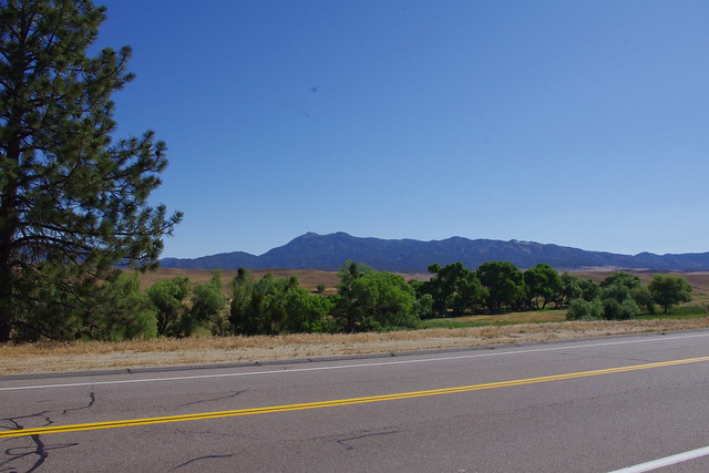
This view is just east of the Stage Station and looking north towards the lush greener bottomlands of the San Felipe Valley. However from this point east to Montezuma Valley Rd leading to Ranchita, the area is dry grassland and most, but not all of the Coulter Pine & Incense Cedar trees were destroyed in the 2002 Pines fire which actually burned to the Hwy 79 Jct.


Photo Credit: Mine
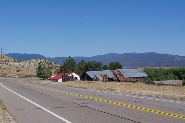
This is what most of the western part of the road to Ranchita CA from the Jct at hwy 79 looks like. After the fire in 2002, the hills you see in the background were stripped bare and later a major Summer monsoonal Thunderstorm created a massive flash flood which closed this highway for weeks. Notice the large boulders in the Bajada or Alluvial Fan ? I'll have a future post on these features and lessons that can be extrapolated from such observations during wetter times of flooding. This is very important as huge practical applications can be made in ALL urban landscapes for establishing mature landscape plants.


Photo Mine

Charred and chain sawed Stump
Both sides of Highways S-2 (San Felipe rad) and Montezuma Valley road which travels through Ranchita California on it's route to Borrego Springs had many many Coulter Pine and Incense Cedar trees burned and destroyed by fire , but certainly not all. The remarkable thing is the contrasting forest tree regeneration which takes place along tree lined roadway of San Felipe Rd in which I ONLY found two 3 foot high Coulter Pines growing side by side each other below an area clear of the dead mother trees removed by the San Diego County Road Dept near the Butterfield Stage Station location and the contrasting abundant growth of 100s of  Pines and Cedars in the thick chaparral growth along the roadway of Montezuma Valley Rd turnoff point eastward. Follow the photo gallery where I photo document first showing the pines regenerating along the roadside where we would expect them and then followed by photos taken well off and away from the Montezuma Valley Rd into the Chaparral where the Pines and indeed even Incense Cedars are actually encroaching on the chaparral Plant community.
image: aaroads.com
From this Jct on eastward to Ranchita, the plant life regeneration takes on a whole new life within the Chaparral Plant Community which has actually enhanced the growth of both Pine and Cedar trees and actually protects these young Saplings on their journey through life, something the powerful Scientific Orthodoxy that is employed by many governmental agencies insist will never happen unless such plants such as invasive Chaparral Plants are removed before tree planting programs are moved forward towards completion. This has been proven an unfortunate untruth over and over which in turn has actually hurt Nature rather than help.


Photo Credit: Mine
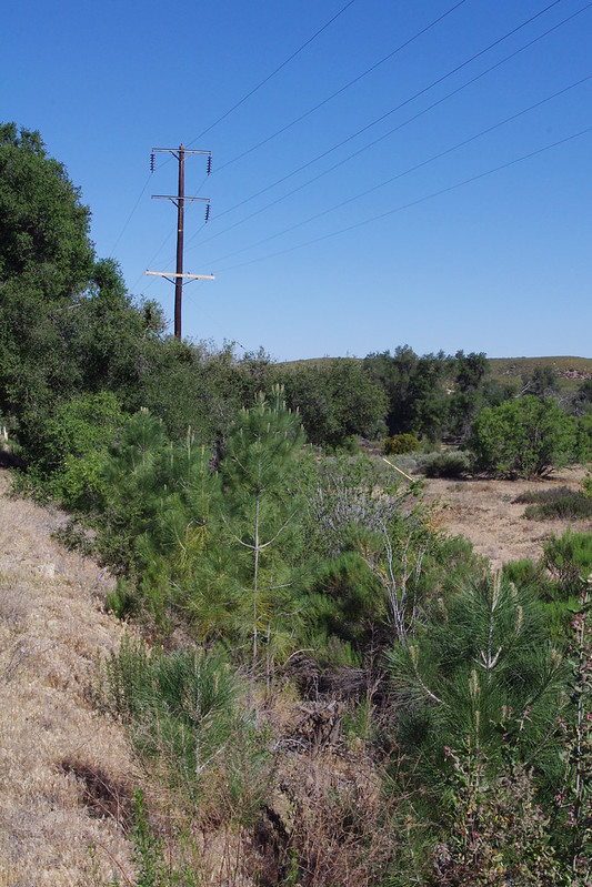
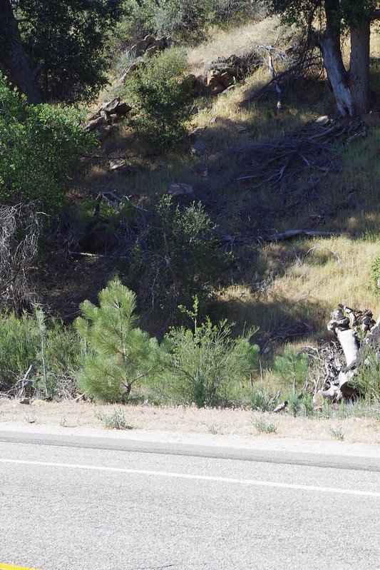
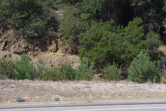
These two above photos are north and south of each other along Montezuma Valley Road west of Ranchita California just where we would expect to find regeneration of new pine seedlings and saplings around former older growth parent trees now removed along the highway as a result of the 2002 Pines Brushfire. BTW, many local residents collected many seedlings way back when they first appeared along the roadways and transplanted them to their properties. This is fine as many many seedlings were there for the taking and are better thinned anyway. I saw some along a fence line at my brother's neighbour's house at a BAR-B-Q  we went to a few weeks back.


All three Photos: Mine
Okay, I believe these next three photos also clearly illustrate where we would expect to find young regenerating pines under their former parent tree's location along Montezuma Valley Road. Of course the dead charred parent trees were removed for safety reasons along the road and we understand that. Notice though that even along the roadway they are growing along side the native chaparral plants to the areas. Most of these plants are Desert CeanothusGreasewood or ChamiseSilver SagebrushRedshank or RibbonwoodMountain Mahogany, assorted Scrub Oaks, etc. There does not appear any restrictive or chocking behavior of the Chaparral against the tree seedlings or young Pine Saplings


Above Photos: Mine
I was of course curious as to whether or not I would find any pine regeneration off a good distance from the SD County Road through the Ranchita community within the deeper chaparral cover. I wasn't disappointed whatsoever.  Many examples were actually thriving within the Chaparral plant ecosystem. 


Photo Credits: Mine

Anybody see any strangulation and competition going on here ?  On the contrary we see mutual cooperation. Clearly all of the examples are healthy and fit. The process of a phenomena I wrote about previously,  "Phenotypic Plasticity"  , for which environmental changes in which a plant finds itself will cause the plant to grow differently, yet successfully under whatever newer circumstance. The point here is that these trees are plugged into a healthy viable underground fungal network in which they are the main beneficiary as they will eventually out perform and over take the Chaparral mother Trees which will eventually yield to the larger Forest tree canopy. 

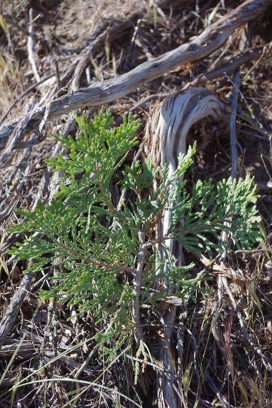
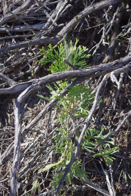
These next group of photos are of Incense Cedar (Calocedrus decurrensregeneration which I absolutely did not expect to find through dry hot excessively windy Ranchita area. Even in present day Anza I don't expect to find Incense Cedar, although I have found dried mummified remnants of them in Burnt Valley and Table Mountain and on some of Agri-Empire's property of the old Dunn Ranch complex. Still the idea that successful germination and growth in such an ecosystem with climate change was still unexpected. Take a look below at the gallery of just a handful of what were actually hundreds of examples. Mostly in my photo trek this particular day, I was only focused on Coulter Pine re-establishment. Had I not stopped and looked closely, I would have assumed the bright green patches were the same perennial chaparral plants which are common along roadways in these areas.


Photo Credits: Mine

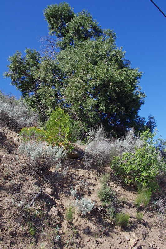
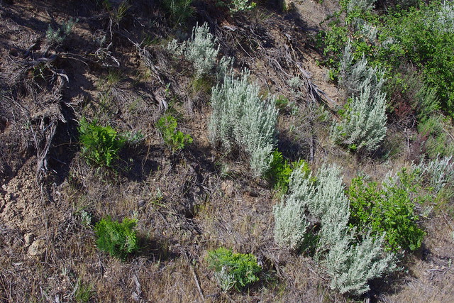
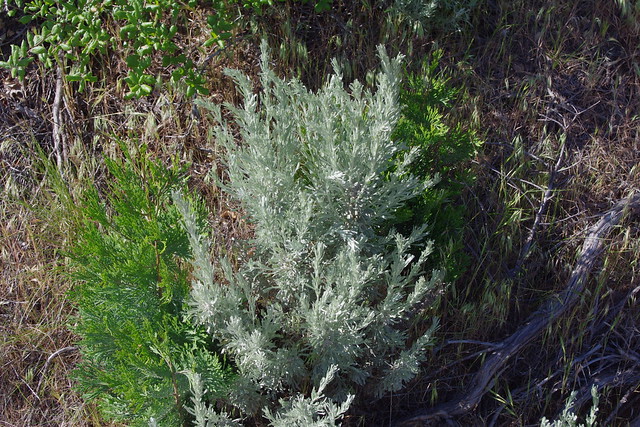
There were not many Incense Cedar Trees that survived the 2002 Pines Fire which devastated everything. The pines of course did fair better because their foliage density is not as great as the Cedars. Very few Cedars made it, but the two large examples above which did escape are also responsible for producing massive amounts of Seed which resulted in the 100s of seedlings that I found along the highway and back into some of the Chaparral Plant Community well away from the road shoulder. As the lower photo illustrates, it was the Silver Sagebrush, which is actually a great facilitator of Hydraulic Lift and Redistribution of water from deeper layers of subsoil for the benefit of others, that has certainly helped the survival of this small Cedar at the bottom shot.


Above Photos: Mine
All of the above photos here in this post are meant to illustrate the benefits and real importance of Chaparral Plant Communities at actually establishing higher plant communities like Pine, cedar, Fir and Oak Forest Ecosystems. Why the various Government & Private Commercial Forest Departments and their supporting Scientific Orthodoxy doesn't get this is beyond me. Of course not all scientists and researchers follow the conventional rules as their own research papers reveal, but they are drowned out by those with power and authority who are either beholding to big business economic interests or too prideful to admit their inept irresponsible methods are killing this planet.  It's okay and no one is to blame for having  been ignorant in the past, I was and I failed following the conventional thinking, wisdom and flawed techniques taught at School. But it is your fault if you stay there given all the newer evidence and understanding that we now know.

Hopefully private land holders and other property owners will get a clue and make practical applications on their own properties by learning from Nature. Most Governmental Institutions are too giant and disconnected to listen or take notice, but private groups and individuals can make successes on their own lands and put these to shame. Maybe they'll take notice after being embarrassed by things they should have known and taken the lead in doing all along. I doubt that will happen or take place, but either way, your local community can and will eventually look far more beautiful than it does at present!