"Earth's Internet" attempts to document, reference as much of the natural world networking abilities and strategies as possible. Such Scientific findings are at odds with industrial scientific approaches maintaining our planet. Be warned. If your learning approach it based on Memes with short clever quips, you may be disappointed here.
Showing posts with label Santa Rosa Mountains. Show all posts
Showing posts with label Santa Rosa Mountains. Show all posts
Maybe the title should have been - "Climate's Ancient Past, but recent Demise". Scientific myths abound as to what once was in the southwest's moister climate history which helped establish and maintain far more extensive forests than at present. We are told that forest cover was far greater than today in California, but that was 1000s of years ago. Part of learning & extrapolating the truth of a matter can be found by looking up old archive references and reading historical diaries and other official accounts from the recent past. Much of the problem is we don't have many photographs documenting things we'd truly love to know and understand about Nature. People from a couple hundred years ago are long gone and their memories and valuable experiences are long gone. Without them we are left to the biased speculative assumptions which motivate researchers today. (Including me I suppose) For me, even if I appreciate a written paper, I've just got to verify it for myself, know what I mean ? Pouring over such old documents and even gleaning clues from literature which was never intended to be written from a Naturalist perspective still can reveal important informational clues.
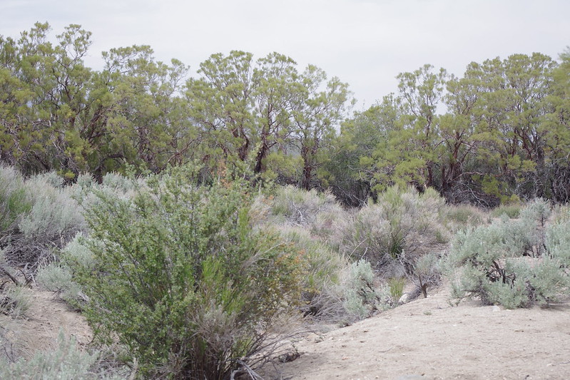
First off, I have to admit, I this fascination [okay obsession] with the past climate influence of the area's Ancient Lake Cahuilla which was located directly to the east and south of this mountain range and what caused it's decline. Then there there is the recent research material released this past year of two different volcanoes ( Salton Buttes &Sunset Crater -AZ) erupting very closing during this same time period in the southwest and the same uncanny decline of the Ancient Anasazi civilization almost simultaneously ? Seriously, all these events [volcanic eruptions (earthquakes?), Lake Cahuilla's decline, Anazasi decline as result of environmental change] happen in close time frame proximity with one another in the southwest. Hmmmmm, this is where I've always wondered if there could possibly be any unusual plant anomalies held over from the change to provide any clues to a wetter climate's historical past ? Well maybe. I have yet another post on possibilities of ancient Lake Cahuilla's influence on climate and vegetation in the next month or so. Keep a watch out for it. But for now, I actually have two examples of plants that I found fascinating years ago. It was actually back in the early 1980s, but I never before gave a thought to document them as I had no interest in proving anything to anyone else but myself. What a mistake that was. I wish I had documented more. Sad how things change so rapidly in a downhill fashion in our modern times, especially when it comes to the Natural World. Anyway, take a look at two important examples I have now documented on my 2013 trip back to the USA.
Photo credit:Mine!
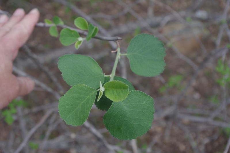
I know, it's not much to look at, but this small tree wasn't always like this. It was always heavily adorned with green delicate looking foliage which would loose it's leaves in the Autumn. Flowers were five separate distinct white petals, and a small green to purple fruit at the end of the season. This particular remnant of a tree is perhaps an indication of a once wetter moister climate is listed as,
Utah Serviceberry (Amelanchier utahensis)
Thanks to TomChester for the official identification
photo - Sally & Andy Wasowski
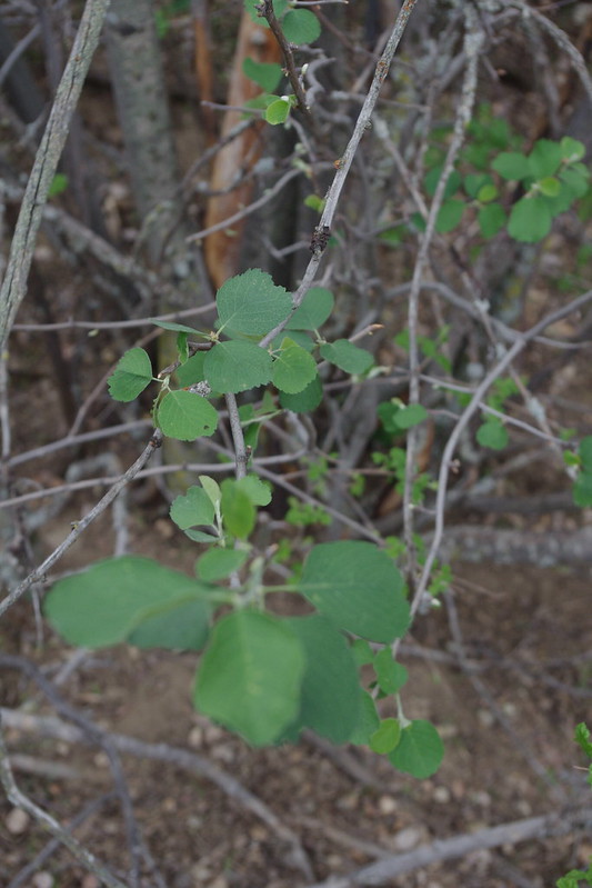
For my first few years living on Table Mountain in Anza just above where this tree is located in the watershed of Hamilton Creek in Burnt Valley. Truthfully I never noticed it before as it must have simply blended in with the surrounding chaparral plant community. That is UNTIL one Spring during those heavy rainfall Winter periods in the early 1980s, I saw the most spectacular white blooms on this small tree which were gorgeous in their mass display. The photo to the right here shows an example of such spectacular flower display potential in wetter times. Unfortunately, this present 2013 drought in Anza CA would not produce anything. But this year in 1984 I stop and got a closer look. How could I not. The scene stood out in stark contrast to the surrounding vegetation. It was just of course unusual because it didn't seem to fit the surrounding profile of the other trees and the chaparral. After all, the Anza region was normally a very dry summer hot and dry winter cold area and I thought, 'how could such a plant be so out of place' ? But it was just a few feet from the creek which no doubt was an advantage. The only other place I had later ever seen this small tree was in the North Fork of the San Jacinto River watershed just to the west of the Hwy 243 north of Pine Cove / Idyllwild regions. Interestingly, those particular Utah Serviceberry specimens were inside an old growth forest setting where it was darker and far more moister than the Burnt Valley location. That was the start of my thinking about a different type of climate that may well have existed way back when. I tried like crazy to find another example of this plant all through this watershed and have never ever found a single one other than this one and it's barely hanging on. This is it. Clearly it's seed came from somewhere, just like the Seed source for the small colony of Lemonade Berry on Rattlesnake Mountain. Odd plant puzzles like this should challenge all people to investigate and learn more about the environment around them. At the very least it keeps hikes interesting if you challenge yourself to set out to specifically explore and find newer treasures. Not everything in the nature has been found, discovered or becomes known to mankind, despite what this world's leadership may want you to believe. To this very day, I have never found another single tree of this species in this region, but that doesn't mean there is none. The hills, canyons and dry washes above and around this tree are also littered with 100s of mummified remains of both Coulter Pineand Jeffrey Pine logs, with only a few living stunted remnants to give any clues of a different climate past. I also found some mummified remains of some small Incense cedar, but that remains to be photographed if I can find them again. I also need permission from Agri-Empire to go back onto their land to investigate. When I found those, I brought it to the attention of Wildlife BiologistTom Roberts up in Idyllwild back in 1983, but he wasn't overly interested back then. Understandable since he was fighting further development up in Garner Valley at the time. Even still, the presence of Incense Cedar would definitely speak of a time when conditions in this particular area were wetter. This was also the same time period when another single specimen plant anomaly got me thinking about a wetter climate past. Believe it or not, it was a single Jeffrey Pine (Pinus jeffreyi) on Hwy 74 along the Santa Rosa Mountain section of the highway that made me begin to wonder again, but more on that at the end here. First, here are some closer shots of the Utah Serviceberry which although looking dead, is struggling to come back by way of three or four healthy suckers from it's large trunk base.
Photo Credit:Mine!
Utah Serviceberry (Amelanchier utahensis)
This is a close up shot where I had to pull up from the base some of the newer growth struggling to come back again. I was shocked and disappointed to see this tree mostly dead until on closer inspection saw that it was still clinging to life through the growth of a few suckers from it's root stock base.
Again, another shot of the growth trying to make a come back from a different location at the trunk base. Here is a bit more info and highlights of this rare plant of the San Jacinto Mountains.
Photo Credit: Mine!
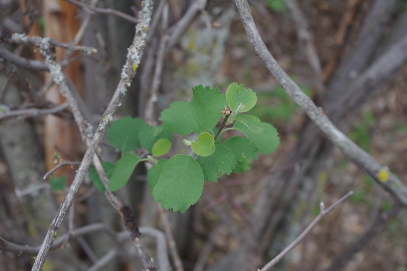
Once again, this is simply another shot of a different sucker to the left off the main trunk at the base. This small tree was always multitrunk and beautiful in appearance. It's just a shame the conditions lately have deteriorated so much that not only this plant, but many others are having a rough go of it.
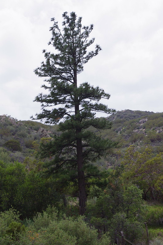
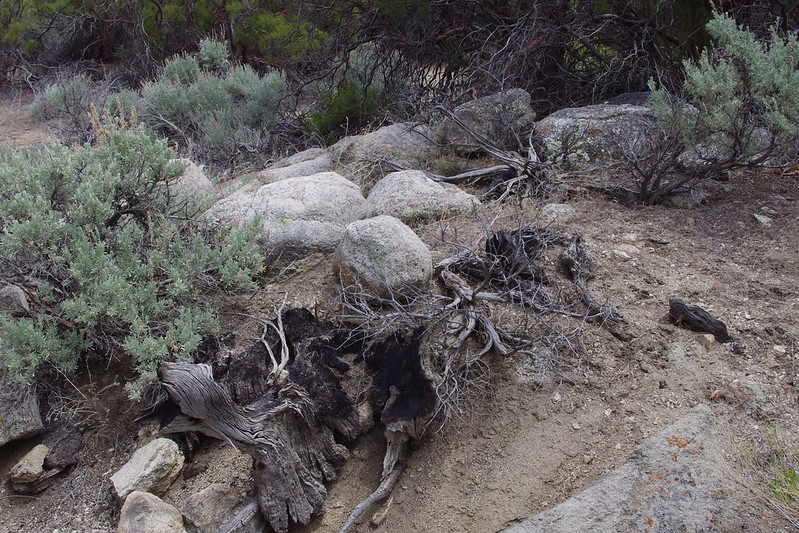
Now there was another plant anomaly which always gave me pause when I passed by it while regularly traveling on Hwy 74 when commuting to work in the Coachella Valley in the deserts below from my home in the high mountain valley of Anza California. This singular Jeffrey Pine (Pinus jeffreyi) is located on the very eastern border of Santa Rosa Indian Reservation along route Highway 74 in the San Jacinto Mountains. When I see such lone plant anomalies, I stop and take pause wondering where did the parent seed come from. Of course, perhaps someone planted it along the highway, but this was actually not the case. For whatever reason either the CalTrans or other individuals (perhaps Forest Service) have periodically cleared the chaparral from around this tree as the photo will indicate if you do a surrounding chaparral plant community comparison. One day with time on my hands I finally stopped and decided to investigate much deeper. Another reason is that I saw another pine further on down the dry wash or Arroyo in the direction of Palm Canyon watershed. That particular tree was very much struggling for it's life. It only had needles from the previous year's before growth along the whorls of it's branches. Most healthy Pines of any variety will have six or seven years growth of pine needles still clinging to the branch growth whorls from each previous year's growth cycle. This tree is now presently gone for good and actually fallen over as the photo below will reveal. It was associated with an Interior Live Oak (Quercus wislizenii) which still appears to be healthy. You can see into the Oak tree's interior main trunk which is visible because of the competitive growth with the Jeffrey Pine once on it's north side.
Photo Credit:Mine! Jeffrey Pine (Pinus jeffreyi)
This is looking west on Highway 74 with the pine to the left, and no doubt ignored and never given a second thought by passers by. On closer inspection if you drive by slowly, you'll see cut chaparral meant I guess as a fire break measure to protect this tree.
Photo Credit:Mine!
Here is a much closer shot of the Jeffrey Pine. The foliage on this particular tree has always been healthy and I have collect cones for seed from it in the past for germination.
Photo Credit:Mine!
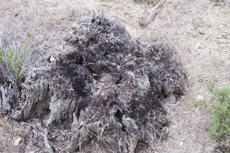
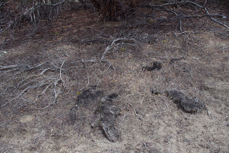
This is an area just east of the Jeffrey Pine along Hwy 74 looking northwards towards Palm Canyon which opens out into Palm Springs. These geologic features of granite boulder outcroppings divided by various elevations of steppes or dry bunch grass meadows (many are loaded with native bunch Grasses) are where most of the fire charred stumps are to be found. In the past I have found large charred stumps a couple feet in height in some of the granite outcrops, but most are within the flat steppes. There is a steppe below this one where I bushwacked and photographed the following Jeffrey Pinecharred stump anomalies for which you will find no mention anywhere in any historical literature.
Photo Credit:Mine!
This is the third steppe down from the roadway where I took the photo of the Steppe near the road above this one. This is where most of the stumps I've photographed are to be found. I had no more time to bushwhack and photograph others as my brother was waiting for me in the Jeep parked along the Hwy 74 where pullouts are few to be found. I was gone for almost an hour and had to turn back again. Still these stumps were both thrilling and sad again to see & imagine what once was.
Photo Credit: Mine!
This is the dead Jeffrey Pine carcass fallen away from it's former neighbour the Interior Live Oak (Quercus wislizensii). This tree was seen by me alive back in the very early 1980s before dying finally in the late 1980s and also is located in that meadow or dry steppe pictured above this photo. The next four photos will be a collection of those ancient almost disintegrated charred stumps which will eventually disappear completely in the future.
Photos Credits: Mine!
All these stumps were the easiest examples to find. Many others are deep within the old growthRedshank or Ribbonwood (Adenostoma sparsifolium) pictured in the photo which I must say in the second steppe meadow photograph above were giant old growth examples although the photograph may not reveal the true height of these Elfin Forest giants. Though these stumps have deteriorated quite a bit, they nevertheless reveal what once existed and was later destroyed by human carelessness with fire.
Here is a reference from my previous article or post which covered two studies in which the vegetation redistribution was debated by two competing Theorists for lack of better description of their behavior. Here is the link to my previous post on the subject of the fire and vegetation changes on Santa Rosa Mountain and a partial quote about the significance of two very major fires
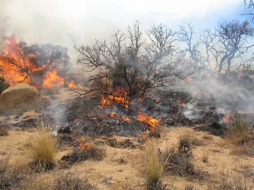
When I first arrived in Idyllwild, I inquired of the Control Burn Supervisor Steve Raybould and Wildlife BiologistTom Roberts about what fire deforested the entire north face of Thomas Mountain above Garner Valley. Back when I first arrived in those mountains in 1981, there were still many of the burnt snags and logs that were still visible everywhere on that north face. Presently when passing through the area on Hwy 74 last Sunday, most are gone or hidden by the Chaparral. Both Tom & Steve told me of two major fire events, one around the turn of the Century and another in the 1940s which later finished everything off. The fires came from the direction of Santa Rosa Mountains and they both said it was the Santa Rosa Indians who started them through carelessness. People often love to romanticize the Native Americans as almost being a part of Nature and being one with the land, but the fact is they are not animals, but real human beings just like anyone else with the same failings as other people. I really don't care if the people responsible for those fires were Purple with Green Stripes and Pink Poka dots. The major cause of change in this case was & has always been human and the consequences of these events resulted in certain name changes of specific geographic locations within Anza Valley and the surrounding countryside. Names like "Old forest Road"(where no forest actually exists) and even the name "Burnt Valley" itself truly leaves one to wonder about the why question. I'll deal with these in another future post I already have set aside as a draft. I just need more photos to verify causes of the change as indicated by clues. Anyway, historically the fires were 1922 and later 1947 and they burned big time from the Santa Rosa Mountains to Lake Hemet and through Burnt Valley and the southern face of Thomas Mountain. Whatever was left after the climate change back then was eliminated permanently after both those fires with any come back having great difficulty as I will show. Below is one part of a paragraph from my previous post link above referencing material from one of the researchers who looked for plant growth changes as a result of fires and for which I do agree.
They also followed the same fire history as referenced in the other study which indicates a huge major fire 91 years ago which would put that around 1922 and another major fire around1947. Sure enough you can check Cal-Forestry historical fire records and the early 1920s and late 1940s had major fires in the Santa Rosa Mtns. Here is a link to this website for fire records: Cal Dept of Forest & Fire
Further Reading on ancient Lake Cahuilla and it's potential for influencing a much wetter milder climate, see the other post from February 11, 2013. Also an associated article regarding San Joaquin Valley from it's Historic past.
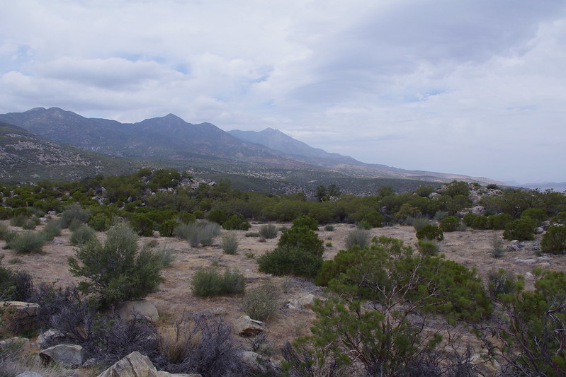
Looking down the throat of Deep Canyon towards Palm Desert and the rest of Coachella Valley below. A view of the landscape where Scientists found plants have shifted uphill for over 30 years. But was this shift in upwards movement an actual climate change phenomena from a once wetter period to the now present drier one ? Well surprise, it's another human component.There has always been some sort of speculation and controversy surrounding the San Jacinto Mountains, and especially the Santa Rosa part of those mountains, as to just how far down and extensive the forest areas once occurred at lower elevations. Some call it a fable and myth, others saying it was thousands of years ago when when the climate was wetter than today and it had a more vegetative state than at present. But the date is almost always pushed very far back.
photo: alltrails.com
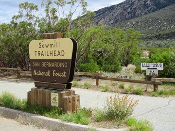
Recently I touched on this subject in a post on the Santa Rosa Mountains and the story behind the old Sawmill Trail and the man who helped build it Jay Dee McGaugh of Radec (Aguanga) California. To make a longer story shorter, Jay Dee McGaugh said that the road was built to harvest thousands of Jeffrey Pine trees some Forestry Official said were 'Bug Trees' and needed cleaning out. Dee McGaugh , who not only cattle ranched, but also had a heavy equipment business and who was contracted out in the old days for road building, said that the forest then extended much lower than you see it at present. Well, he certainly should have known he was after all, there and an on the spot eye witness. You also have to understand that this man had no political or environmental agenda for saying this, it was simply the facts as he related them to me when I first met him in 1983. As was common back then, no reforestation tree planting program was undertaken back in those days to replace what they had obliterated. That land was pretty much stripped bare and left to it's own regeneration processes for which even today you will still see along that road some stunted Jeffrey Pines which tried to make a comeback. Mostly now it is Desert Ceanothus (Ceanothus greggii)and Redshank chaparral. But I had found even evidence before that period (1930s logging venture?) where there was clear evidence of a one time existing large old growth forest Jeffrey Pine Trees whose stumps still exist much, much lower than even the present Highway 74 near Spring Crest which was at one time referred to or known as the old tourist stop called "Ribbonwood" named after the very abundant chaparral species around there called Redshank (Adenostoma spasifolium). The ONLY reason these stumps still existed in the late 1980s when I first discovered them on a hunch I had of an area once forested, is because they were charred solid by fire which allowed them to resist rot which would have rapidly disintegrated any tree remnants which would have otherwise been logged at such a lower easier accessible location. At least, these old Jeffrey Pine tree stump locations were pockets of woodland areas in among chaparral plant community, which of course today no longer exist.
Fast forward now to the present, and that's where a recent study was done around 2008 and a reprint of it in August of 2012 & the comparison to a further study by other researchers which does shed some fascinating light on the subject and gives a credible explanation for a different scenario of change in vegetation from tree forest to one presently now more dominated by a Chaparral Plant Community. I find both studies intriguing and exciting, though the early 2008 authors or group are at odds with each other 2012 Research Group in a bit of the usual intellectual spitting contest that science can be known for in these modern times. This should not surprise us as this is characteristic of most of our world's leadership. In this case it is mostly on the part of Anne Kelly and Mike Goulden against Keeley & Schwilk. In fact, in these studies I personally found both to have credible bits of gold as far as important findings, though they (researchers) may not have seen the other's point of view through the murkiness of resentment which clouds judgement. Well, moving on, here is a link to the older article in Live Science which also appeared as reprints in other online News. I'll explain what I saw in both Researcher's findings and my own personal experience from living in this area for almost 24 years.
First we have a debate between two studies. The first of the Studies saying plant movement uphill into higher elevations is caused only by climate change and it's the increase in this area's temperature and droughts that have caused the plants in the study to migrate uphill in elevation. Okay makes sense, since we find certain plants not doing so well in warmer temps and drought conditions. The first study was conducted in 2006/2007 by graduate student Anne Kelly and Mike Goulden both of the University of California Irvine. What they did was to retrace a 1977 vegetation survey that covered sites from sea level at the desert floor to high upper conifer forests at elevation 8,400 feet (2,560 meters). Now basically this Kelly & Goulden believed that climate change has caused plants to move further up the mountainside of Santa Rosa as climate has warmed. But as we all know, climate change is more than just warming, it's about extreme events of all types. They look at a couple of interesting phenomena and they looked at the 10 dominant native plant species that have appeared to have made the change higher up Santa Rosa Mountain. Now they say that Fire or even smog played no part in ecosystem changes, though they do acknowledge the historical Cal-Forestry Fire data. But they were wrong, Brush or Forest Fires are a major part in plant redistribution which ALSO has resulted in the localized climate change. I've already addressed this when I spoke of my experience in observing back in the 1980s the Cahuilla Mountain cloud formation anomalies during the monsoonal rain season each summer and how the phenomena stopped after the well known Diego Flats Fire in 1996 that I wrote about HERE! That entire localized situation changed completely after that 1996 fire on Cahuilla Mountain which is just west of the Santa Rosa Mountains. The old growth Trees and Chaparral were removed and the almost engineered looking cloud formation I described in my post almost immediately disappeared and never came back the next few summer monsoon seasons. Okay back to this study, there were some other problems I have with their view of smog pollution and/or fire smoke effects on vegetation which would influence Jeffrey Pine more than any other plants. Here is a quote from the study.
"Some montane regions in Southern California are exposed to high levels of ozone and nitrogen deposition, resulting in increased vegetation mortality. However, five considerations lead us to reject air pollution as the main cause of plant redistribution. First, the Deep Canyon Transect is comparatively distant from Los Angeles’ emission sources, and ozone-related conifer mortality has not been reported in the Santa Rosa Mountains"
Having lived and worked in and around these mountains between 1980 to 2003, I can attest to smog movement by extremely strong prevailing winds from Los Angeles through San Gorgornio Pass into the Coachella Valley for which a possible influence could indeed effect those mountains. I also remember a time when the region west of there in and around Temecula & Murrieta west of Anza Valley had mostly crystal clear days and baby blue skies in those early years, but that all changed to filthy air over time to the present with the building boom. Did they account for this ? No they did not, because they weren't present and were ignorant of these facts and probably didn't think to interview or attempt to ask these questions of locals which was a loss. No doubt such local residents would be considered not scientifically credible enough, which seems to fit the pattern of many research papers these days. Although attitudes are changing.
Now some other fascinating details in the paper are about rainfall average totals and one of the rainfall charts which shows the historical rainfall averages to the San Jacinto Mountains which were actually less in average between the years 1947-1976 to a increase in rainfall between 1977-2006. Although I have to say these data averages were taken from several reporting stations 75 kilometers away throughout Southern California, and certainly don't reflect the local conditions of these specific mountains. Again, I have to go back to local residents and my own personal experiences with rainfall anomalies in these and any other mountain ranges. Everything is not equal. Some regions have downpours and others get spit on, but they do acknowledge this in another similar paper HERE! I've often watched the TV News weather reports with irritation knowing how radically different each location can be. Clearly it's a tough call, but they should have done more homework locally with their own stations at differing location/elevations. Just too many variables to not get accurate specific readings and making assumptions and speculations on these. There was also more lower level snow in the early dates, than in the later. I thought this was interesting because it would be important in that water release by snow pack in those early dates would be gradual and percolate much more slowly, which would hydrate the plant community over a longer period, as opposed to rainfall which would mean immediate runoff and water quickly heading downstream for the Desert's Alluvial Fans or Bajadas Plains on the desert floor. There is no doubt that they missed some very important points here, but I think the climate change locally speaking was important never the less. Another extremely important event they make no mention of whatsoever is the historical heavy logging which happened back in the 1930s/40s. Clearly this would influence the upper regions where the absence of Jeffrey Pines & Oak allowed habitat inroads from other chaparral species which were always present as opposed to anything with climate and prove a more rapid removal and immediate relocation of plants as opposed to climate change over a long time. This would also influence local weather and other lack of cloud formation anomalies or mechanisms which would account for warmer temperatures.
Here again is the full paper of the study done by Anne Kelly & Jon Goulden.
The more recent study by Dylan Schwilk, of the Texas Tech University, and Jon Keeley, of the U.S. Geological survey and University of California Los Angeles, (which I agree with more) resurveyed the some of the same sites but rather focused on a single plant species instead, Desert Ceanothus (Ceanothus greggii). They found an interesting pattern of this particular shrub becoming less common at lower elevations and more common at higher elevations. This triggered conclusions about the movement of the chaparral plant which may have been due to the brush & forest fire history more than anything else. And yet, while they tended to dismiss or cast some doubt on local climate changes, I am more inclined to add it to the unusual plant rearrangement phenomena. I mean there is no argument about vegetation removal creating desertification patterns. What they did was to study plant ring growth history because these Desert Ceanothus plants are known to not sprout until after a fire. They also followed the same fire history as referenced in the other study which indicates a huge major fire 91 years ago which would put that around 1922 and another major fire around 1947. Sure enough you can check Cal-Forestry historical fire records and the early 1920s and late 1940s had major fires in the Santa Rosa Mtns. Here is a link to this website for fire records: Cal Dept of Forest & Fire In fact they have a map on their website with various colours representing different historical date time periods. I believe the later fire burned from Santa Rosa Mountains all along the north face of Thomas Mountain to Lake Hemet which obliterated that entire forest. Only a very few burnt snags remain on that Thomas Mountain in key areas, but this fire was very complete in it's destruction of the ecosystem. Once again, it had a human cause component. Forestry folks always said it was the local Santa Rosa Indians who started that fire, but who knows. Either way the cause was human. Interestingly, they also do not make mentioned of any of the logging up on the north face of the Santa Rosa Mountains along the switched back Sawmill Road trail. Clearly this would have made a difference in their Jeffrey Pine study. There also is no mention of the trees and woodlands around Spring Crest and the Santa Rosa Reservation on both sides of Hwy 74 which would also have been important, even if the trees were in small woodland pockets in among the chaparral which would have been common. Here is the link to their fire hypothesis study.
This is a pity, Kelly/Goulden were clearly irritated in their rebuttal of the Keeley/Schwilk study for which I most agree with BTW. It is logical and can be verified by not only official fire history, but also eyewitness account by older ones living at the time, but now presently gone. There is also the mechanism factor of plant (trees/shrubs) vegetation removed and if not replaced, causing a change in weather or climate. Vegetation facilitates rainfall, especially during monsoonal moisture summer seasons. The second fire wiped out what re-establishment taking place after that first fire and was coming back to not only the Santa Rosa Mountains, but Thomas Mountain and parts of Eastern Anza area of Burnt Valley and Table Mountain. Forest trees need ample time to mature and produce more seed. There was never enough time lapsed between fires. There are no longer any viable heavy forest cover there anymore, though the evidence is still in existence and I'll write a future post with photos on that later. There are other regions of the planet that also express similar plant movement in elevation have been studied, as this one in the video below around Madagascar. Like the San Jacinto Mountains which have clear distinct life zones which start at below Sea Level to high Alpine Elevations, many of these typical mountains have a change in temperature every few hundred or thousand feet, depending on the circumstance. Micro-climates with both plants and animal species are common. But on average cooler temps mean different life zones. Incredibly, if you take all of these 1000s human caused localized plant destruction and plant community pattern changes and combine them all together around the global, it is clear these have effected the macro-climate patterns around the Earth which is why we have Climate Change, despite what the political debates want to argue.
Here are some interesting facts about the plants studied. Table 1. from the first study by Anne Kelly & Mike Goulden where 10 plants were studied. The second study by Dylan Schwilk & Jon Keeley followed on Desert Ceanothus. Change in cover-weighted mean elevation of ten most widely distributed species in the Deep Canyon Transect Species
693 meters down to 643 meters in elevation = -50 decrease in elevation.
Illustration Credit: University of Arizona
Dominant plant species along an elevation gradient shifted synchronously with one another over a 30-year span that has a concurrent temperature increase, based on a new study by Kelly and Goulden (13). The ranges of the plant species' distributions remained the same, resulting in an overall "leaning" of the vegetation gradient toward higher elevation. At the very least, this clearly illustrates the Jeffrey Pine forest retreat over the historical early time period to the present day.
Another one of the more interesting anomalies in that plant list was the fact that the Desert Agave actually dropped in a lower habitat elevation by 50 meters (164 feet). No mention was ever made or explanation of this strange fact was given. There was a massive fire which hit the entire Pinyon Flats area in the 1990s, but I doubt they never even took that into account. For me the historical forest line in elevation has an intense fascination. I've always hypothesized myself that the Ancient Lake Cahuilla (present smaller Salton Sea) had more than one means of water source than the Colorado River. In the early 1980s when we had heavy yearly rainfall amounts on record between 1980s and 1986, the Deep Canyon Horsethief Creek, Whitewater River, Taquitz & Andreas Canyon Creeks, Palm Canyon Creeks among others had tremendous amounts of water pouring down through them all the way to the Salton Sea and in some cases most of the year. Maybe some valley resident peoples remember all the road and golf course closures back then ? Much of that water ran yearly down those normally dry washes. If in ancient times those forest levels were far lower and rainfall far more plentiful, then these tributaries would have contributed to Lake Cahuilla's water level maintenance. There is evidence for this as well. This Spring I'll photograph some of the old charred Jeffrey Pine stumps I found on both sides well off of Highway 74 (Palms to Pines Scenic Route) which is nothing more than Chaparral Plant Community and I'll post them on a separate link and attach this page to them. What is both interesting and sad with both these studies is that both Research Groups are correct in Fire destruction and Climate Change and but in that very order. But clearly these imperfect human 'Egos' got in the way as a result of this incessant obsession with fame, glitter and glory which can be infectious to many in Science today. Clearly I find Keeley's and Schwilk's study more compelling. Can you imagine what they could accomplish in working and cooperating together as opposed to all this fighting ? It's too bad because many different Research Groups today miss out on a lot of important findings which could lead to rebuilding these ecosystems. While I like the Keeley/Schwilk Study, I was disappointed a bit on the lack of mention of any off the logging operation which harvested large numbers of Jeffrey Pines from Santa Rosa Mountain which also could have also effected climate, though on a localized level, or greater if adding the fire component. - Stay tuned for update!
~~~~~~~~~~~~~~~~~~~~~~~~~~~~~~~~~~
Update: This is an update with regards the subject matter within this post. I have recently documented some out of place plant anomalies I first discovered back in 1984. They are now photo documented and reveal an older forest location of Jeffrey Pine at the foot of Santa Rosa Mountains where no such pines exist today. This is a much lower elevation than even Hwy State Route 74 between Santa Rosa Indian Reservation and the planned housing Community of Spring Crest. This location is specifically explained and easy for anyone to document. Caution, always be careful here - Enjoy