My first impression when I first arrived in Anza was, "What am I getting myself into ?" Anyone who's been to the local Circle-K in town after sundown knows what I'm talking about. My attitude was better than Ken Dawson, who I wrote about here , back in May 2013. Ken told me when he and Linda first came to Anza to view this property in Terwilliger, he told me this was his impression when first driving through the town of Anza, "Man if Anza looks like this, Terwilliger must be a bitch." Well, that was just the way "tell it like it is Ken Dawson", expressed himself. He really didn't mean any harm, mostly it was a joke, but Still!
 |
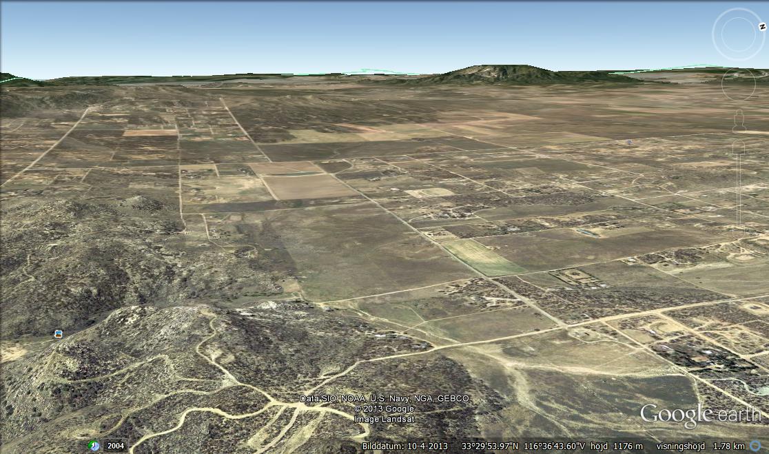
| Google Earth: San Carlos Pass & Cary Ranch |
When I concluded my first post about the Juan Bautista de Anza expedition from central Arizona to Coyote Canyon, I left with this scene on the right of the what Jaun Bautist de Anza named the San Carlos Pass and I'll get to this area in a moment. But there are some interesting things to make note of as far as weather and climate interest. Both Anza and Pedro Font wrote in their dairy or journals of the horrible winter weather of pouring rain and intermittent sleet and snow storms they endured from Borrego Valley up through the Lower, Middle and Upper Willows of Coyote Creek turning west and moving through Nance Canyon to the San Carlos Pass. Interesting fact, when I lived in Terwilliger, we use to call the area the Banana Belt, given that temps here were milder than surrounding areas and rain more intense to the north and the south of it's location. Even during normal years these areas do not receive that type of rainfall and/or moisture content. It is interesting that once they reach the wider valley of Nance Canyon, Anza reveals that the area was fed by various sources of running water. All very true, there are several major tributaries which converge on this valley, all of which have evidence of this wealth of water by the presence of large Cottonwoods and California Sycamore Trees which are permanent fixtures in the converging Arroyos. There are other natural anomalies or more specifically plant life features the Anza Expedition encountered up at the top of the mountain pass called Puerto San Carlos (Cary Ranch) which brought them into the Terwilliger and Anza Valleys. Below here is a historical photograph from the Hamilton Museum which doesn't put a date on it, but given another photo published next to it which is said to be circa 1930 at the Park Valley Ranch (Lake Riverside Estates) below Cahuilla Mountain, it would be easy to assume it is around or close to the same time period. Especially as you can view the lack of any real development. This view above here is on top of the giant boulder strewn hill overlooking the San Carlos Pass and the Ranch looking westward towards the entire wild Terwilliger Valley with Cahuilla Mountain in the far distant background.
Pity there weren't any modern cameras back then. I'd really love to see the colours and deeper clarity and contrast which would help in identifying plant cover even in the distance. But at least, an observant individual can see the much denser plant cover than at present. I've actually stood on this exact spot where this photo is being shot back in the very early 1980s. The land development company High Country Ranches was developing a massive amount of land behind this hill and to the north against the southern face of Table Mountain which I believe were mostly 20 acre parcels in the beginning. They actually developed this very large boulder strewn hilltop with a few building pads and lots while I lived at Dawson's place in Terwilliger. Before anything was sold, I drove up there with my four wheel drive Toyota and walked around. Something I always wanted to see were the caves and petroglyphs around and within those giant boulders. It was mentioned in many accounts that this is where Anza met some of his first Cahuilla Natives. Sure enough, most all of the caves have soot and ash stains on their ceilings where I imagine campfires were lit for cooking and just general warmth in wintertime. Some people to first explore these caves found pottery shards and whole or partial ollas. I only found pottery shards here. But that view overlooking the ranch to the west is awesome. On an interesting note, the Hamilton Museum website has a photo looking down into Nance Canyon from the top of this same hill, but while it is black and white, it is by no means an old photograph because when I first visited, none of those roads in the background existed. The only road was the one at the bottom going from right to left in the photo and there would have been only two main homes and residents down there. The large cleared land with house and Cottonwood trees and one house across the creek from that. The road at that time was hideous and no one but winter trekking Jeep clubs ever ventured down there. The guy in the large house with the clearing ran me and a friend out of there with his shotgun. Lots of Independent Survivalist residents back then. (Nance Canyon) . Now look at this present day Google Earth map I've tried to capture close to the same angle without too much distortion.
 |
| Google Earth |
It really was a fun challenge to go just so far without much distortion to get almost the same exact camera angle as that original photo which I believe was probably taken some time in the 1930s. Note the lack of those large Oak trees as seen in the 1930s photograph. In fact, do you notice the general lack of large old growth of any type of vegetation when you compare both photos ? Things have changed dramatically. You can still see the barn in the picture, but many of the larger Live Oak trees are just gone. In fact I'm not sure if there are any oaks other than scrub oak now. The Cahuilla living in this area's village would have been very dependent on such a valuable food resource and I don't doubt that they were intelligent enough to replant and reseed many of these plants as a food resource near their food preparation areas where the metate were located. The entire length of this valley drains this direction all the way from Burnt Valley via Hamilton Creek and out this pass below. Mostly now, there is never enough rainfall for that to even remotely happen. Take note of where the barn is and cleared land. Also take note of the boulders to the left of that barn and another clearing. Violet Cary told me that when they first moved there they planted a large orchard of peach, plum and apricot trees. She said the water table back then was so very high and the sedge grasses even grew up the hillside there. They never had to irrigate until the late 1960s when Agri-Empire moved in and farmed potatoes which require a fair amount of water and lowering the water table by means of their industrial sized irrigation well head pumps. She hated Jim Minor and Agri-Empire. Never had a nice word about him each time I met her. But back then there were several of those people who were at odds with what they believed was the Evil-Empire. Hmmm, Mr Wheeler who lived on Cahuilla Mountain comes to mind. Take a look at the next photo I created from Google Earth which gives a greater view of the area in question above. You'll see the High Country Ranch lot development at the lower right where I parked my truck and explored and the actual San Carlos Pass which the Anza Expedition came through.
Eastern end of Terwilliger Valley and the San Carlos Pass
~~~~~~~~~~~~~~~~~~~~~~~~~~~~~
Diary of Juan Bautista de Anza - Second Expedition:
Tuesday, December 26. 1775 --
Today having dawned fair, at the regular hour the sun came out bright. For this reason and because the mother was better and had the pluck to march, we prepared to break camp, and at a quarter to nine set forth, ascending the valley which has been mentioned, going west-northwest. Having traveled along the valley for about three-quarters of a league, at a place where it narrowed greatly we left it at our left and immediately climbed a small ridge. This was followed by two other smaller ones, by which we arrived at the pass or opening of San Carlos , having traveled in all only about two and a half leagues in four hours, because of the stops which it was necessary to make. Here we halted for the night because it has been raining ever since nine o'clock, although very lightly, since this rain, if it should become harder, might injure the woman who was delivered night before last, and since the march although short has been for the most part up and down. With this march the sierra or cordillera which runs to and ends at Baja California is now overcome or passed. Rain continued until half past four in the afternoon. After it began to get dark a heavy, distant thunder was heard, and this was followed by an earthquake which lasted four minutes. -- 39. From Tubac to the Puerto de San Carlos, 163 leagues.
~~~~~~~~~~~~~~~~~~~~~~~~~~~~
Diary of Pedro Font:
December 26. 1775 --
We set out from the dry gully at a quarter past nine in the morning, and, about two in the afternoon, halted in a bottom near the rocks that form the pass of the Sierra Madre de California, called the Puerto de San Carlos, having travelled some three long leagues to the north-northwest, and climbed the slope as far as the summit, a distance that must be about one league. At about five in the afternoon we felt a shake, with phenomena of earthquake, which lasted but a very short time and was accompanied by an instantaneous and loud noise.
Below here are the footnotes from the Translation of the Dairies into English from Spanish which were published back in 1930. The descriptions given in the above from Anza and Font are observations of the same event on the same day and written in their respective journals and a interpretation below of both of these and the area in question along with the 1930s photograph of the old Fred Clark (now Cary) Ranch posted below.
ANZA'S CALIFORNIA EXPEDITIONS VOLUME III
THE SAN FRANCISCO COLONY , DIARIES OF ANZA, FONT, AND EIXARCH, AND NARRATIVES BY PALOU AND MORAGA
TRANSLATED FROM THE ORIGINAL SPANISH MANUSCRIPTS AND EDITED BY HERBERT EUGENE BOLTON PROFESSOR OF AMERICAN HISTORY AND DIRECTOR OF THE BANCROFT LIBRARY UNIVERSITY OF CALIFORNIA UNIVERSITY OF CALIFORNIA PRESS BERKELEY, CALIFORNIA 1930
Archive.org: Anza's California Expedition
An Archive of Anza's Journal and Footnote Commentary
1. Puerto de San Carlos was the pass at Fred Clark 's corral, at the east end of Cahuilla Valley. Above the Upper Willows some three or four miles the canyon forks, with Horse Canyon on the right (ascending), Nance Canyon in the middle, and the main canyon (Tule) at the left. Passing the mouth of Horse Canyon, Anza climbed the ridge between Nance and Tule and camped at the fine springs in the flat just before reaching Fred Clark 's corral. The flat is in Nance Canyon where it swings around to the trail again. Anza gives the distance as two and one-half leagues, and Font as three leagues, which is more nearly correct. Font's description of the route is excellent: The road follows the principal arroyo of the dry canyon, which gets much narrower until the foot of the ridge is reached, which now has some rather bad spots. The ridge is divided into two stretches; the first is rather bad and long, the second less so, and between the two there is a fairly level stretch. From the highest point one descends a rather narrow, dry arroyo, and on reaching some large round rocks one descends a gentle and short slope to the flat where camp was made. The two ridges and the arroyo are clearly recognized by one following the trail today, and the large round rocks are still plainly to be seen. A superb diarist was Font.
 |
| Photo image: Hamilton Museum (Fred Clark Ranch) |
This view appears to be looking north towards Thomas Mountain with Mount San Jacinto in the background. The foreground vegetation is the common Silver Sagebrush (Artemisia cana) which is everywhere up in those high elevation valleys. Now I want to mention that beyond these plants and the willows in the foreground, no doubt there were massive meadows of various Sedges, as the water table would have been extremely high and much closer to the surface back then on all these valley floors. When I first visited here in the middle of the 1978-1984 heavy El Nino climate wet period which seemed to almost mirror the climate pattern Anza and Font wrote about, the Cary Ranch as I stood there getting a grand tour around the place was loaded with sedge meadows, some large patches even extending north out into the large grassy plain which you can see to the left of the Barn in the above older and newer photographs of the ranch. When Anza and Font speak of the Trek from San Carlos Pass to the area of Tripp Flats having great travel difficulty because the extremely heavy moisture content which made the ground very miry, and I can certainly vouch for that. In this photo here in this Link , I was once driving out across this plain to visit an elderly native Cahuilla and his wife. This was around 1981 on a clear sunny day and the road looked clean, fine and dry with two dirt tracks with sedge grasses on either side and in the middle. Just following the worn tire tracks I noticed that I started losing power to the vehicle and couldn't figure out what was wrong. It became worse until suddenly I stopped and couldn't go any where further. I got out and noticed that the vehicle had sunk up to the frame in that muck. This soil here is extremely fine and miry as Anza described. The old Cahuilla gentleman walked out across the Prairie with what seemed 20+ dogs and told me they never drive anywhere in Wintertime. Only a Farm Caterpillar creating the new potato field north of that yellow Pin point I put on the Google map could pull me back out to the dry dirt road towards lower Bautista dirt Road.
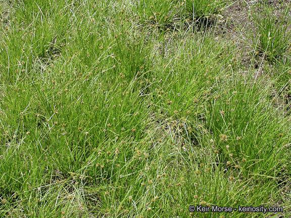 |
| Calphotos/Berkeley - Sedge Grasses |
When I first met and spoke to Violet, Art Carry even had cattle grazing in the lower lush green sedge meadows which were dense and heavily covering there along those willows going back south to the left hand side of the picture heading back down towards Nance Canyon. The newer Satellite photos indicate none of these plants presently exist there. You can pull up Google Earth and view this area yourself. That's really sad and terribly revealing about the dramatic way water has been heavily used and how the climate has change radically. It's also sad because I have seen this with my own eyes as an eye witness to what it was once like and now it's simply gone. There is no reason whatsoever to believe that this far eastern stretch of Terwilliger Valley, all the way stretching westward to Lake Riverside Estates wasn't all sedge meadows at one time exactly the way western Garner Valley is today and there are a number of clues why I believe this from the observational notations given by both Font and Anza in both of their dairies. I'll point some of these clues out in the photograph below and associate them with a few facts of today. On the trek from San Carlos Pass to an area called Cañada de San Patricio, known locally today as Tripp Flats which is an area described as the headwaters of the river canyon we now call Bautista Canyon which leads down to Hemet California below. I am not going to dwell much on this location in this post as I'll take it up next time in Part III. I am mainly concerned with the center of Anza Valley itself and the evidence for a far richer vegetative environment that once existed than it does at present. Many notes jotted down by both Anza and Font in the dairies give some interesting clues which I find have never been explored before nor thoroughly thought through in anyone else's writings.
 |
| image: Mango Traveller |
Hurkey Creek spilling out onto the Garner Valley floor near Lake Hemet. Terwilliger Valley through lower Anza Valley to Cahuilla Mountain may well have looked very much like this scene here when the Anza Expedition passed through. Through an entire day's time, they trekked from San Carlos Pass to Trip Flats and complaining about the difficulty of traveling over terribly wet miry ground and footing. This would indicate an extreme wealth of surface waters for which sedges and other water loving plants like rushes would thrive.
Below here, I'm going to quote Anza's first visit in 1774 with his first hand observations and the relevant material as far as natural history perspective. Then I'll quote Pedro Font's very much expanded dairy the winter trek after (1775) and his impression of the natural world's landscape. As the 1930s, as the translator of the Anza Expedition revealed, Font was a much more superb Dairist with his greater eye for detail. This is actually one of the things that I really appreciate most. When you have a written record of the same event by different individuals, you can view a more complete accurate overall view of the expedition, but with personal details that caught the eye of each individual who was awe struck by different features or aspects of the trek. The different notations of some physical aspect along the trail don't conflict, but rather compliment one another. Well, if that makes any sense. In both cases, the writings of both I can appreciate more fully than most because of having lived there for over 20+ years and having a keen interest (okay obsession) with the area they wrote about and the natural world which at one time existed, but is no longer existing in today's unfortunate reality. People should also note that this is the same story with most locations on Earth.
~~~~~~~~~~~~~~~~~~~~~~~~~~~~
~Juan Bautista de Anza, 1774 journal entry describing the first scenes of the trek through San Carlos Pass.
Tuesday, March 15, 1774.–
Two hours before daybreak we set forth up the arroyo, which in general runs north-northwest, dividing the large mountain chain through which it flows. [Footnote 108] The floor of the valley is very even and of considerable width for four leagues, where in various places running water is found. Two more leagues were traveled where the valley is narrower, and then, leaving it at the left, we climbed a ridge [Footnote 109] which did not cause the animals the greatest fatigue, and at whose crest we camped for the night in a place with good pasturage and water.–From Tubac to the Puerto Real de San Carlos, 227 leagues.
Right here there is a pass which I named the Royal Pass of San Carlos. From it are seen most beautiful green and flower-strewn prairies, and snow-covered mountains with pines, oaks, and other trees which grow in cold countries. Likewise here the waters divide, some flowing this way toward the Gulf and others toward the Philippine Ocean. Moreover, it is now proved that the sierra in which we are traveling connects with the sierras of Lower California. In the course of the journey made today we have seen an improvement in the country in every way, and have concluded from its moisture that it may be suitable for seasonal crops and the planting of fruit trees, and that there are pastures sufficient for maintaining cattle.
~~~~~~~~~~~~~~~~~~~~~~~~~~~~~~~~
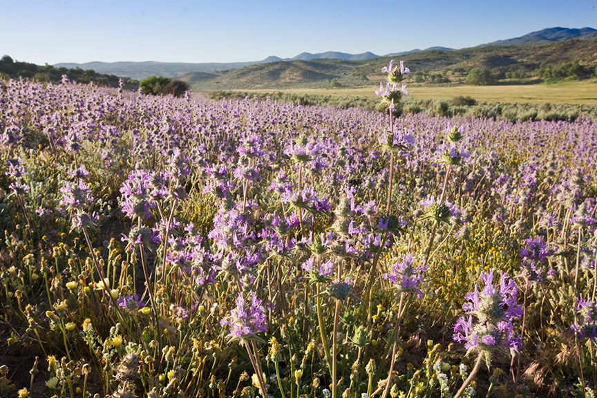
There are a couple of important points here about Anza's first trip through the Spring of 1774. Notice the area coloured in orange above. Indeed, in times of heavy rainfall when I lived there, this area in the Spring is rich in heavy greenery, which Anza and Font both noted would be perfect for pasturage for Cattle industry. This area through Terwilliger Valley towards Anza Valley is also one of the richest wildflower areas in all of Riverside County's high mountain valley regions. Anyone who has actual first hand experience living there for a few decades would also recognize this incredibly beautiful feature that Anza actually took the time to note down. Indeed the higher surrounding hills of the prairie floor are rich in Gold Fields and Owl's Clover, along with numerous other annuals like Chia as the photo below of Cahuilla Reservation reveal. Here is a wildflower picture link to the Goldfield Wildflowers at Carrizo Plain by Simon Sun. It is illustrative of what much of Anza and Terwilliger Valleys were once like. Seriously, how could Anza and Font have passed through here and not mention a word about such beauty ? I'll have more pics next time of the famous Gold Fields down in the Hemet/San Jacinto Valley which can actually be blinding in full sun as they can so thoroughly blanket or carpet an immense are or region. Most of these areas in Hemet Valley are long gone and developed over.
I'll have more pics later, but please book mark and read Deborah small's extremely interesting blog on Ethnobotany, much of which deals with the Anza areas. Now take another look at this next clue which I highlighted in green from Anza's 1774 journal account.
"Likewise here the waters divide, some flowing this way toward the Gulf and others toward the Philippine Ocean."
For me this is very intriguing, as he speaks of the separation of the natural hydrology of the landscape up there in Anza. Anza sped through here rather quickly on his first and second trips. Mostly about a days walk. There would not have been much time to determine and figure out which direction waters moved on the surface especially if the climate and weather circumstance were as they exist today. The very idea that surface water was running this far down from Thomas Mountain and heading either to the Pacific Ocean (he calls Philippine Ocean) and the Gulf (referring to Sea of Cortez) is a testament to the great wealth of surface water existing back then which no longer exists today. There are only two large water courses which would have come this far, the first being Hamilton Creek and the second Cahuilla Creek. Both actually do split off exactly as he describes if they were actually running with water. Hamilton Creek is the hydrological feature which has always filled up that shallow lake depression while I lived up there and which Anza described. Here is a map below from Google Earth which illustrates the separation of the stream flows as he would have seen them first hand.
 |
| Google Earth |
This is a similar but much closer up view of the link I gave above about my Car mucking experience. Cahuilla Creek comes directly out of Thomas Mountain with it's head waters at Old forest Road. It crosses the Highway 371 near the old Kellogg Ranch, but looks more like a giant badly eroded agricultural irrigation runoff ditch which is in fact what it is most of the time anyway. On the far right in the dry looking area, this is where Anza's mystical Laguna Del Principe was once located. This area is almost totally destroyed when I last viewed it this past Spring 2013. The Cahuilla Indian Reservation back when I first came to Anza, had never ever really developed their land for anything other than range cattle. That has all changed now. Agri-Empire has diverted and channel much of the lower Hamilton Creek drainage to flow towards the west, but during heavy rains or flashfloods, some still makes it to the east towards the lake bed. Take a look below at how it appears today from the highway, though I highly doubt that most residents up there know exactly what this old stream bed actually is along highway 371 just west of Anza. Also take note of Agri-Empire's redirecting Hamilton flow towards the west, with only a slight veering to the left.
 |
Google Earth.
Cahuilla Creek draining down from off Thomas Mountain. Most modern maps won't even reference these facts any longer. This overpass had at one time signage listing it as Cahuilla Creek but they are now totally removed. Whatever. |
It's remarkable when you sit back and ponder the reasons for both of these creeks running heavily all the way down the the valley bottom. Both creek beds have run at times before when I lived there, but only during times of Monsoonal flash flooding, although both did trickle a little during the heavy 5 year El Nino event in the last couple of years, with Hamilton Creek even flowing with enough water to fill that mystical disappearing and reappearing lake which was once more of a permanent landmark than today. Hamilton Creek as well has the same story. But if you think back to a time as where no one had as yet sunk any wells or redirected any water and where the vegetation system was a much more heavily forested cover of not only pine, but of Live Oaks, these stream banks would have been heavily wooded with riparian species and their meandering course more foundationally established as to facilitate the water's easier surface movement over greater and farther distances than exist today, which is for the most part, totally bone dry. Once again, the water table everywhere would have been much closer to the surface for such an ecosystem to have once existed.
~~~~~~~~~~~~~~~~~~~~~~~~~~~~~~
Wednesday, March 16.–
Because it rained and snowed, like the night before, we were not able to take up the march during the forenoon. But at two in the afternoon we set forth, immediately climbing some small hills, where a fair-sized vein of silver ore was found. [Footnote 111] From these hills we continued west for a distance of three leagues over good terrain, halting for the night, because it threatened to rain, on the banks of a large and pretty lake, to which we gave the name of El Príncipe. It is surrounded by flower-strewn and pleasant valleys and by several snow-covered mountains, by which it is filled with water. In the hills nearby were found several springs of very agreeable water, independent of the lake.–From Tubac to the Laguna del Príncipe, 230 leagues.
I previously wrote separately about Hamilton Creek and the evidence for Violet Cary's forceful insistence that the eastern and northern portions of Anza Valley being heavily forested with the predominant tree being that of giant oak trees. You can follow that account Here . Hamilton Creek with a large drainage area of almost all of the top of Table Mountain which certainly been heavily forested and the entire Burnt Valley along with other contributing tributaries joining further on down from Thomas Mountain would have kept that mysterious lake rather more permanent with a southeasterly outflow heading towards San Carlos Pass, which in turn would have kept that surface miry as noted in the dairies. And Cahuilla Creek again, bone dry today, but more permanent surface flow over 300+ years ago draining from much of the western face of Thomas Mountain through OLD FOREST Road canyon area, just simply sheds more light on what the area once looked like in history. The bottom line here is this, we're not talking 1000s of years ago as is popular to story tell, we're talking a little over a couple of hundred years ago. It may take 1000s of years for a system to develop and mature into a sustainable ecosystem, but it's only taken 150 years of supposedly greater scientific enlightenment and technological innovative development to destroy it all and send everything into the Cesspit. Clearly, something is radically wrong with the understanding of many of these areas. This should start ringing Climate Change bells inside some important Somebodies brains, but will they listen.
~~~~~~~~~~~~~~~~~~~~~~~~~~~~~~~~
Wednesday March 16 -
From these hills we continued west for a distance of three leagues over good terrain, halting for the night, because it threatened to rain, on the banks of a large and pretty lake, to which we gave the name of El Príncipe. It is surrounded by flower-strewn and pleasant valleys and by several snow-covered mountains, by which it is filled with water. In the hills nearby were found several springs of very agreeable water, independent of the lake.–From Tubac to the Laguna del Príncipe, 230 leagues.
I can only imagine Anza being so impressed about the amount of greater surface water everywhere independent of the large Lake between Terwilliger and Anza Valley. One of these great surface water resource areas if he sent scouts to investigate, would have been up by the old Stanley Swanson Tree Farm where I once resided for a time. This not only part of a western branch of the greater Hamilton Creek drainage flow, where a wealth of water near has always been nearer the surface, but during the time of the El Nino event and for several years afterwards, all wells on that property which had old windmill towers bubbled to the surface and overflowed from all the well heads. Sedges and Rushes were in large spread on the lower acreage, and they were all the way to the present Diner 371, or the Old Chaparral Restaurant. So the potential for massive amounts of surface water flow would have been huge, especially in supporting a much greater forested ecosystem.
 |
| Google Earth |
Well, many residents will recognize this location. This is where in 1982 a massive wall of water down Highway 371 with 6 to 8 foot high rapids from shoulder to shoulder blitzed all the way down Kirby Road to this point during an hour long Monsoonal Thunderstorm event. The Nazarine/Lutheran Church is at the upper left with Hill Street jct above that. Where the barn, other outbuildings and the Mobile Home are moving left towards that Church building are the remnants of an extremely large Cahuilla Village, but not many people know of this. There are several large flat granite bedrock areas, which may be covered over with soil fill (Stan never wanted anyone to know about them for fear of being forced to do an archaeological study) where huge Metate Grinding holes still exist. The area no doubt would have been far more wooded at the time with large oak trees which would have provided one of their main staple foods, acorns.
 |
| Google Earth |
This is the entrance that most people up there drive past. To the left here I believe is the antique shop owned by the gal who bought my old place. It's actually a separate parcel for which the owner would never sell out to Stanley. On the right as you drive in is the ancient village site right about where you see the small Coulter Pines and to the right of them. Like most Native American pantries, Prickly Pear Cactus and Mexican Elderberry are present here as well, or at least they were when I was there. Take a look at the small independent Metate grinding stones above. I actually found one of these and it's hand grinder stone at this large location. I had since moved and had my own place. I created a garden up on table mountain, but the soil there was mostly coarse decomposed granite and I wanted bottomland soils. I asked Stanley, who lived in Orange County if I could take some of the black (no doubt Biochar) soils from around the large granite metate areas which food preparation and campfires no doubt happened for countless generations. Beautiful soil, but there was this one large rock that my shovel kept hitting, so I dug and pried it loose just to get the thing out of the way so that the soil was easier to shovel and load into my pickup truck and the result was almost identical to the metate you see there in the middle, but it was upside down looking like just any other rock. What a pleasant surprise this was. I almost forgot about the reason I was there. I also found many black beads with holes drilled through them for a necklace. I still don't know how they did such things. Underneath was the hand held grinding stone (called manos) looking very much like the lighter coloured one in the photo above, but made totally of bright white quartz. It was perfectly shaped like a white bar of Ivory soap, but only much bigger. I always wondered how much time it took for those natives to make such an incredible masterpieces. Shows what a human can do with lots of time on their hands and none of the modern day distraction.
~~~~~~~~~~~~~~~~~~~~~~~~~~~~~
 |
| image: Deborah Small |
Below here is the expanded more detailed parts of Fray Pedro Font's Dairy of the 1775 Expedition as he observes drastic changes in the landscape coming up through the pass of San Carlos. I'm only quoting the relevant passages as these relate to the Natural World seen then first hand. He used a Spanish word, "Hediondilla" , which refers to the common desert Creosote Bush.
~~~~~~~~~~~~~~~~~~~~~~~~~~~~~
Tuesday December 26 -
A little before we entered the narrow part of the canyon a fine sleet began to fall, and lasted until after we had halted. The day and the night continued very wet and cold, but the mother recently delivered had the spirit to continue the journey. The hediondilla, shrub of evil augury, for it can live only in such bad country, which is appropriate to it, lasted to the top of the ridge. Then at once I noted the change in the landscape, for now we saw some scrub live oaks and other small trees; and they said that in the sierra in this vicinity there were pines with pine nuts, though I did not see any.
This place has a spring of water and a small arroyo nearby, with plentiful and good grass; and the sierra hereabout appears to be very fertile and moist, quite in contrast with the former, which appeared to be rather mountains of boulders and rocks than a sierra. In this flat we found an abandoned Indian village, [Footnote 163] and from the signs it was evident that as soon as they sensed our coming they left their huts or warrens and fled, judging from their fresh tracks. Being so savage and wild, when they saw the cattle which went ahead, God knows what they thought they were. And so we were not able to see a single Indian. It must have been about five in the afternoon when we felt a tremor of very short duration that appeared to be an earthquake, accompanied by a short, sharp rumbling. After a short time it was repeated very distinctly.
Pedro Font speaks of the abrupt change in landscape as the trek through Nance Canyon and Through San Carlos Pass where the native peoples abandoned their village at the fright of seeing cattle which they had never seen before. He also speaks about the areas richness in water which makes me wonder about old Carl Long's 200 acre parcel which has an Artesian Spring to this day which flows from rocks and where he kept those last wild horses he wrote about. The location for Carl's Ranch and Artesian spring is very near to that San Carlos Pass boulder strewn area described in the journals. Well, who really knows for sure if these are a part of that description. Still, it is interesting.
Wednesday December 27
Here the country is better than the foregoing, for after leaving the Pass of San Carlos this country completely changes its aspect, in contrast with that left behind on the other side. From a height near the place whence we set out, formed by large stones, rocks, and boulders, through which the road runs and which form the Pass of San Carlos, as if the scenery of the theater were changed, one beholds the Sierra Madre de California now totally different —green and leafy, with good grass and trees, in the distance looking toward the South Sea, whereas in the distance looking toward the California Sea it is dry, unfruitful and arid, as I have said
As soon as we reached the top of the rocky pass of San Carlos we entered level and good country, from which one sees to the north-northwest and northwest the same Sierra Madre, very high and white with snow; and this Sierra Nevada continues beyond the mission of San Gabriel. After going a league we entered a valley, which the last time they called Valley del Príncipe, [Terwilliger] formed on the right by the Sierra Nevada which I have mentioned, with others, and on the left by another spur of mountains, very high and full of pines, which appears to run toward San Diego. All the valley has plentiful and good grass, with shrubs and fragrant herbs.
After leaving this valley we entered a growth of low brush and then we came to the canyon, which is very narrow and is formed by the same hills and branches of the Sierra Madre. Near the camp site we found three small huts of Indians with many shucks of acorns, which constitute their food, but we did not see a single Indian. In the canyon we saw many pretty and fragrant plants, and at the camp site there were many rose bushes, the first ones which I have seen in those lands. Their roses are small and have only five petals, but they are very fragrant, although at this season they were withered, and they had only the red seed pods. I ate some of them and they had a rather agreeable taste. There are also live oaks and other trees. Today the weather was fairly good.
~~~~~~~~~~~~~~~~~~~~~~~~~~~~~~~~
 |
| Comb's Peak south of Terwilliger (2003 Coyote Fire) |
As the 1930s translator of the dairies stated, Font had a much more detailed account of the area's natural features. He describes the mountain on both sides as being full of pines and oaks. The Bucksnort Mountains and Beauty Mountains would have been on the left as he describes these heavily wooded areas as running towards San Diego and then what calls the Sierra Nevada to the north which would have been Thomas Mountain and the Santa Rosa Mountains to the north and East. There is no doubt in my mind that this area was more heavily forested in the mountains and with numerous pockets of woodlands on the valley floors. The richness described of water sources like springs and streams independent of the main bodies of water would certainly have fed just such a rich ecosystem. Certainly a far cry from the present sorry condition one would physically find this place if they visited today. For the most part, the Bucksnort Moutains to the south of Terwilliger have no more forest to speak of. What remnants that were left were almost completely destroyed by that 2003 Coyote Fire which took almost everything to the edge of the Lost Valley Scout Camp. There is so much more to say, but so little attention span from most readers. Most want nothing but photos followed by short quips, so they can move on the the next bit of local or world News. Still there is so much more to say. But my Spring 2013 trip over there was extremely disappointing.
Driving down Terwilliger Road, I notice that the land on the eastern side of the Cahuilla Indian Reservation where traditionally the largest untouched chaparral and Scrub Oak woodlands once existed are almost completely destroyed and removed for apparent industrial agricultural purposes. It needs pointing out that this was one of the exact areas summer monsoon clouds developed over and much of the first seasons rainfall took place. I'm sure this has even changed now. I remember approaching some of the more militant activists on that side (I won't say who) of the Rez about possibly volunteering to put together a project on the reservation like we had done at Ken Dawson's place . Absolutely and totally not interested, even if I paid for the trees myself. I got an ear full of Indian Activism and a story line about it's all the white man's fault and the government should be the one to put things back the way they were, not us. Whatever! You know, I'm as much or more sympathetic as the next person about what was done to the Native North Americans, maybe even outraged, but at some point numerous generations later (irrespective of whatever past ancient culture got the shaft on Earth), you get over it and move on and make the improvements yourself. These folks have the best land up there and unfortunately it's becoming ruined physically just like the surrounding properties. In the long run as I've stated in previous posts, there is really no differences in ALL human beings once you remove the cloak of costume and cultural customs. Underneath everyone is equal to everyone else and this is sadly evident in the way the land has been mismanaged up there in Anza and Terwilliger.
In the third part, I'll write about the landscape between Tripp Flats all the way down to Mystic Lake near Moreno Valley. That will be as far as I can go with regards knowledge and personal experience of these areas which Anza and his Expedition traveled through. I'll also post another article on Hamilton Creek Canyon which I've found interesting, but didn't have the time to document. The creek bed use to be much higher in elevation than at present and there is a wealth of physical evidence to bare this out. Keep also in mind that the main message here is not so much about the people past or present, as it was the natural world that once exist but no longer does and what humans can learn from how ecosystems were once put together and constructed. All the genetic information within all living things is still buried deep within every living thing. How they work, function and cooperate together still exists if only humans will unlock the secrets and put things back the way they once functioned. Although human interference has disrupted and perhaps caused the genetic informational content within all these living things to express themselves less efficiently, these can nevertheless be put back together like a well oiled machine. The main hindrance to all of this of course is human behavior and that is something science and technological innovation has no answer for. Humans have to want the change.
~~~~~~~~~~~~~~~~~~~~~~~~~~~~~~~
Further Reading References:
(Part 1) Juan Bautista de Anza's Journal sheds light on a past Extinct Ecosystem
http://en.wikipedia.org/wiki/Juan_Bautista_de_Anza_National_Historic_Trail
http://www.anzahistorictrail.org/visit/explorer?x=-115.8398&y=32.8224&z=10&base=bingstreets&layers=anza_rec_trail%2Canza_histtrl%2Canza_campsites
http://www.solideas.com/DeAnza/TrailGuide/Riverside/
http://archive.org - DIARIES OF ANZA, FONT, AND EIXARCH, AND NARRATIVES BY PALOU AND MORAGA TRANSLATED FROM THE ORIGINAL SPANISH MANUSCRIPTS AND EDITED
http://anza.uoregon.edu/archives.html
http://deborahsmall.wordpress.com/


.JPG)