Thursday, August 22, 2013

How human dams destabilize river food webs & Beaver Dams stabilize them

Department of the Interior - Bureau of Reclamation


Glen Canyon Dam - Lake Powell Arizona
A few days ago there was an article about research work which has been done revealing the destructive nature of the historic Human Dam building projects over the past 20th Century. The large poster child for this subject of course was the Grand Canyon, so I found it worth a re-post in some of it's parts, plus other issues regarding fresh water problems for the Western USA. Humans tend to want to do everything on a Grand Industrial Scale. The claim is made be human leadership that, "Well, we're simply replicating what Nature does out in the wild". Well, not quite. Nature generally can be found to build systems on thousands of small scale systems and in turn collectively entire ecosystems benefit for free. Humans do things on Grandiose Scales under the guise of "We just want to serve our fellow man", but where only a handful of individuals actually profit, and generally in terms of monetary worth and financial gain. Out in Nature, when there is an imbalance and one species of whatever organism takes completely over, the entire system suffers and eventually collapses the whole. Maybe humans should pay more to Nature's often humble small scale collective systems which when working together instead of against, benefits the whole. Industrial Scale Dams, Industrial Agriculture, etc are killing this planet. Here's the article from the Cary Institute of Ecosystem Studies

Credit: Emma Rosi-Marshall

Humpback chub are a federally-protected endangered species

The research team investigated food webs in the Grand Canyon Reach of the Colorado River. Study sites were distributed along a 240-mile stretch downstream of Glen Canyon Dam, which was completed in 1963 for water delivery and hydroelectric power needs. During the three-year study, samples of over 3,600 animal diets and 4,200 invertebrate populations were collected and processed. Among the team's findings: following an experimental flood, sites near the dam had the most dramatic changes in the structure and function of their food webs.
Dams destabilize river food webs: Lessons from the Grand Canyon Tuesday, August 20, 2013

Drs. Wyatt Cross and Emma Rosi-Marshall
 seining for fishes in the Grand Canyon

(Millbrook, N.Y.) Managing fish in human-altered rivers is a challenge because their food webs are sensitive to environmental disturbance. So reports a new study in the journal Ecological Monographs, based on an exhaustive three-year analysis of the Colorado River in Glen and Grand Canyons.
Food webs are used to map feeding relationships. By describing the structure of these webs, scientists can predict how plants and animals living in an ecosystem will respond to change. Coauthor Dr. Emma Rosi-Marshall, an aquatic ecologist at the Cary Institute of Ecosystem Studies, comments, "Given the degraded state of the world's rivers, insight into food webs is essential to conserving endangered animals, improving water quality, and managing productive fisheries."
The project – which relied on a team of more than 10 researchers from the Cary Institute of Ecosystem Studies, Montana State University, Idaho State University, University of Wyoming, U.S. Geological Survey, and Loyola University of Chicago – assessed six sites on the Colorado River, many so remote they required two-week boat trips through the canyon.
Lead author Dr. Wyatt Cross of Montana State University comments, "Glen Canyon Dam has transformed the ecology of the Colorado River. Immediately downstream, cold, low-sediment waters have favored exotic plants and animals that haven't co-evolved with native species. We now see reduced biodiversity and novel species interactions that have led to the instability of these river food webs."
My interruption here: 
Take a long look below at this peculiar looking fish which is actually a Colorado River native. This is a fish called the Humpback Chub which are a federally-protected endangered species. This is one of the fish whose skeletal remains have been found in and around the old Cahuilla Indian fish Traps along the ancient sea level line of Ancient Lake Cahuilla locted in the Coachella Valley. The ancient lake water was not like that of the present Salton Sea, but if not totally fresh, was at least brackish water where this and other Colorado Natives once thrived.


Near Glen Canyon Dam, the researchers found food webs dominated by invasive New Zealand mud snails and non-native rainbow trout, with large mismatches in the food web and only a small percentage of available invertebrates eaten by fish. In contrast, downstream food webs had more native fish species, and a less productive invertebrate fauna that was efficiently consumed by fish, including a federally-listed endangered species, the Humpback Chub.
In March of 2008, the Department of Interior conducted an experiment that simulated pre-dam flood conditions, providing an opportunity to see how high flows affected food webs with very different characteristics. Rosi-Marshall explains, "Food web stability increased with distance from Glen Canyon Dam, with downstream sites near tributaries proving the most resistant. At these locations, the flood didn't cause major changes in the structure of food webs or the productivity of species." 
It was a different picture for sites near the dam. As co-author Dr. Colden Baxter, an aquatic ecologist with Idaho State University, notes, "These energy inefficient, simplified food webs experienced a major restructuring following the experimental flood." New Zealand mudsnails were drastically reduced. And changes in algal communities led to a rise in midges and blackflies – favored foods of trout – resulting in a near tripling of non-native rainbow trout numbers.
Rainbow trout, introduced below Glen Canyon Dam in the 1960s, support a valued recreational fishery. But when trout density increases upstream, and fish move downstream into Grand Canyon, they can compete with native fishes for limited food resources, sometimes preying upon juveniles.

Image: Bob D. burdick

Biological Technician, Rick Smaniotto holds a 17 pound female Colorado Pikeminnow (formerly known as Colorado Squawfish). The Colorado Pikeminnow was once found throughout the Colorado drainage basin, in which it occurred in Arizona, California, Colorado, Nevada, New Mexico,Utah, and Wyoming, as well as in Mexico. Damming and habitat alterations have confined this fish to the upper Colorado drainage; currently, remnant populations are known from the Green River, Gunnison River, White River, San Juan River, and Yampa River. There are  historical account records for catch size of these fish as being up to 6 ft (1.8 m) long and weighing over 100 pounds (45 kg). Arizona Historian Marshall Trimble referred to this reference in his description of their once historical presence in the San Pedro River in southern Arizona. More on this later. The Colorado pikeminnow was in the early days called "white salmon" and "Colorado salmon" by ealy settlers and also valued as a food and sport fish by both Indians and early pioneers.

Back to the Article on Grand Canyon Dams
"Understanding how and why high flows affect trout numbers is valuable information that decision makers can use to help manage and protect river resources," remarks Dr. Theodore Kennedy, project coordinator and a coauthor of the study with the U.S. Geological Survey's Grand Canyon Monitoring and Research Center.
Dr. Robert Hall, an ecologist at the University of Wyoming, notes, "While downstream food webs proved to be more stable in our study, they are clearly a shadow of pre-dam conditions. Four large native fishes have already been lost from the Grand Canyon reach of the Colorado River. And invertebrates that were once an important part of the food web, such as mayflies and net-spinning caddisflies, are conspicuously absent. "
Today, many ecosystems are like the Colorado River: an amalgam of native and non-native species living in human-altered habitat. The study's authors demonstrated that large-scale modifications, like dams, can have far-reaching effects on how energy flows through food webs, altering their stability and leading to less resilient ecosystems.
(Source)
With all that in mind, there are of course the original dam building  engineers long before mankind was ever appeared on the Earth. Beavers! They have had the past misfortune of being trapped out for their fur and the consequences were soon felt as a result of their absence from Nature. Even with their re-introductions in many areas, there has still been some controversy as to presence and benefits coming from Cattle Ranchers. I actually believe cattle ranchers don't like any other animal than cattle. Prairie Dogs, Wolves, Coyotes, competing Bison, *cough-cough* - Sheep, etc. Did I miss any ? But seriously, why Beavers ? In a recent article from oregonlive.com

(RICHARD COCKLE/THE OREGONIAN)
John Day ex-logger and ex-rancher, Loren Stout, inspects a beaver dam along Deer Creek in Grant County. The Oregon Department of Fish and Wildlife opened up at least one beaver dam along this busy tributary of the John Day River System last spring to enable migrating steelhead to pass. Biologists say beaver dams benefit fish, but low water made it impossible for steelhead to get past some dams. Stout claims he freed two 29-inch steelhead that became caught in a dam.
The controversy here with the Cattlemen mostly was about the effects beaver were having on their Salmon run population in streams running through their land. Never mind that the beaver in reality benefit the landscape with better grazing forage extending a large distance from the creek to nourish the grasses and other plants cattle eat. In their total ignorance, they just didn't like what they thought the beaver were doing to their Salmon. Back in the middle 1990s, I had a conversation with the Garner Valley Ranch Forman, Robert Houdeshell, who was from up north around the eastern Washington State area and now in Idaho if I remember properly, about studies being done on the benficial effects of beaver being reintroduced into Ranchlands. I don't remember the exact publication he showed me now, but the gist of it mentioned the benefits of a beaver dam's ability of slowing water way down and backing the water way up and spreading over a greater landscape behind it. It explained how the beaver's dung along with that of  visiting waterfowl like Ducks and Geese have the effect of sealing the beaver pond's bottom, where instead of allowing the water to percolate deep down into the soil and under the dam headed only to make it's way down stream anyway, it actually forces the water to saturate the landscape in a sideways horizontal movement which benefits large riparian woodlands and meadows many many meters away from the main body of water course where cattle and other wildlife graze. The website,   did their own critique of the article here: http://www.martinezbeavers.org , and you may click on that link and read. But I'll do my own take on the Cattlemen's talking points against the beaver and what I know of Trout survival in some San Jacinto Mountain locations which would seem impossible to the experts. First some of the talking points in The Oregonian article:
"We got reports from two or three members of the public that there were Steelhead stacked up below this beaver dam," explained ODFW biologist Jeff Neal of John Day. He blamed a disappointing winter snowpack and undersized springtime flows for making it impossible for threatened Steelhead Trout to get past the dam. The spring dam removal highlighted the complex and sometimes controversial role that beavers play in the lives of fish.
So the argument is, the beaver dams create barriers for migrating Steelheads especially during low flows. But some logical conclusions and observations made by the Biologists, are something anyone with any sense of education would understand about the ability of Steelhead to survive, migrate or whatever they choose to do. 
Biologist Chris Jordan of the National Marine Fisheries Service, says a beaver dam like the one Stout pointed out on Deer Creek might pose problems for fish in late summer's low water. But steelhead aren't migrating on these streams in August.  "Steelhead are amazing jumpers," says Jordan, who believes beaver and their dams improve aquatic habitat for fish.  Migrating fish usually "can get around them or through them or over them," says Jimmy Taylor,a wildlife biologist with the U.S. Department of Agriculture's National Wildlife Research Center at Oregon State University.
Those are all logical conclusions and things most people also understand. They are amazing jumpers, they don't migrate in August, etc. Would a small beaver dam be an issue to such fish that are known for scaling waterfalls and swifter rapids ? But the other question is, were these dam removals actually necessary as insisted upon by the cattlemen ? Take a look at some of the excuses given for Steelhead Trout being bottled up behind a Beaver's Dam. 
But ranchers like Stout and Stangle argue that summertime water in the pools behind dams turns warm under the sun's heat, which they say can't be good for Steelhead.  "The holy grail of the Steelhead is the temperature of the water," said Stangel, adding that, "beaver aggravate that problem by gnawing down trees, alder and underbrush that otherwise would provide cooling shade."

Foster Lake Idyllwild Calfornia Postcard
Here is what I know about Trout survival up in the San Jacinto Mountains. I'm talking about both Rainbow and German Brown Trout [which locals called the native, but not so, the name is probably a give away] which in many areas have naturalized. Just north of Idyllwild & before you come to Pine Cove on Hwy 243, there is a turn off to the Idyllwild Water District's water holding reservoir called Foster Lake which in the past was used by the public for picknicking, fishing and other recreational activities. Today, I believe it's closed.

Foster Lake photo above during the 2007 drought

Foster Lake August 1, 2013
In the early days of my living there, there was always plenty of water filled to the brim and often flowing over the spillway. The White Water Trout Hatchery regularly came up and release hatchery Trout at Lake Foster and other surrounding well hydrated watering holes for tourist fishing. During the entire time I was living there and right through the 1980s to 90s, there was always water, but not always enough to spill over the Dam's spillway down into what is called Lilly Creek. This creek flows down into Idyllwild Park where many may have visited the Nature Center there. This Park is rich in beautiful plant life as a result of traditionally being well hydrated from the Lilly Creek drainage up above. Now while that stream hasn't always flowed, it does have a few small deep pools which are well hidden to most people. It was at this creek location below the spillway at Foster Lake where we had friends purchase property and build a home on Foster Lake Rd above Hwy 243. One day another elderly friend came to visit this house and took my friend's son down to that creek which did have some flow to it, but not much. There were about 4 or 5 of these small but deep pools in boulders which always retained water. Now, this tiny Creek was never ever stocked with Trout. But we found trout there and each pool had a single trout which were huge, indicating that even if they had been hatchery trout released at Foster Lake, they had lived there for some years. No hatchery Trout are ever release at this size. They no doubt were trapped in these pools after being washed down the spillway at higher than normal flows during that El Nino period '78-83'. The point here is, they thrived and so would Steelhead behind a Beaver Dam thrive for a few months waiting for heavy flows.

California @ AARoads

San Jacinto Main River Canyon
Another example are the German Brown Trout living in the high country of Mount Jacinto State Park at high elevation. Not only me, but also Steve Raybould of the U.S. forest Service has seen these trout survive the end of the summer dry period where man streams had shrank down to no more than a long slender mud hole with warm cloudy water and the trout were still thriving. Another example is the always steady dependable deep pools in South fork Canyon of the San Jacinto River and up Strawberry Creek between north of Hwy 74 & Idyllwild's Grotto region. Deep pools which are spring or cieniga fed are always dependable water holes utilized by the naturalized trout as weigh stations until the winter and spring floods come through each season and as far as I know it has always been that way. I use to going down to the main boulder strewn canyon of the main channel of the San Jacinto River and German Browns could always be caught if you knew where to look in otherwise dry river rock cobblestone. Again, the point is, these trout survived much tougher conditions in a hot and often drier climate and geography, than some low flowing creek and Beaver Dam as the one referenced up in the State of Oregon. Now let's focus back on the Colorado River drainage and other tributaries which one had countless Beaver Dams.

US Bureau of Reclamation


There is actually an older article from 1994 in the Tucson Citizen which highlights beaver reintroduction planning as part of the San Pedro River Restoration project which in many many ways has been a success. The Sonoran Beavers who built the Dams along the  still in existence water courses through the arid Arizona southwest historically kept water within the riparian system which allowed even the large Colorado Pikeminnow (Squawfish) to be able to exist and be reported on by early settlers. This fish for the moment I don't believe is there, but no doubt be reintroduced. This is the river Marshall Trimble referenced as having large Colorado Squawfish which were between 3 and 5 foot long. Some parts of this once meandering back and forth river valley were channeled to allow settlement and farming on both side of the river. With the reintroduction of the native Sonoran Beaver once again creating a mosaic of river dams and backwater lakes, this river could once again create it's much more slowed down meandering back and forth structure which is what makes for prime wildlife habitat. Here are some pertinent quotes from that Tucson newspaper on the areas history of wildlife habitat of the San Pedro River Preserve:
Damaged San Pedro River healing again (1994)
"After the beavers are established, state and federal wildlife experts and public fans of this area hope larger birds of prey, native fish and maybe someday, just maybe, wolves will live here again."
SIDEBAR: Beaver return called benefit to river system 
 The “keystone’ species to the San Pedro River’s future is the beaver, says Arizona Game and Fish wildlife biologist Rick Gerhart.   
Beavers once thrived along the river, but were trapped out in the mid- and late 1800s during the country’s obsession with making hats and coats out of the giant rodent’s pelt. 
 By building dams, beaver slow the flow of the river, allowing what water there is in the desert to spread out, sink in and form habitat for other animals and plants. 
 “It modifies the habitat to benefit other species,’ says Gerhart. “(Beaver) dams allow much wider perimeter of the stream. It spreads the wetted area, three to five times wider and wetter. Water seeps out gradually during dry periods. Perennial stream flow had been found to return when there are beaver.’ 
 So wildlife experts are preparing to give Mother Nature another nudge. 
 Gerhart said, "beavers also create pools behind their dams that are perfect for some of Arizona’s threatened and endangered fish." 
If all goes as planned, maybe as soon as next year, a few beaver – North America’s largest rodent (up to 4 feet long and 60 pounds) – will be reintroduced into the San Pedro."
Here is a 2012 Update on the Beavers along the San Pedro River
Reintroduced beavers branching out in San Pedro

Here's a great video of the reintroduction to the of the Sonoran Beavers to the San Pedro River system (2009):
Reintroduction of the Beaver to the San Pedro River of Southeastern Arizona

Here is a great video on the Oregon Beaver Reintroduction Programs:  Oregon Field Guide: "Beaver Assisted Restoration"
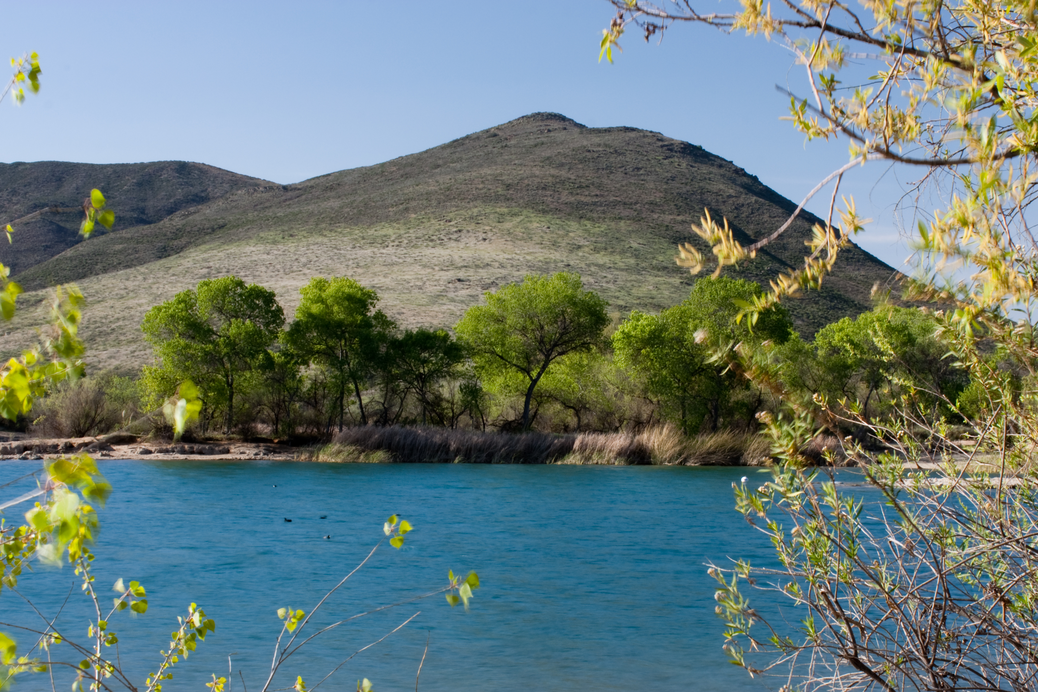


Lake Skinner, Riverside County California

Future post on Lake Skinner and the Temecula Beavers

Further Reading references:
Bureau of Reclamation Forecasts Lower Water Release from Lake Powell to Lake Mead for 2014
(Very Kool Link) "Colorado River Map Zoomifier" Endangered fish program working to right wrongs of the past Grant County, Oregon: "Beavers, fish and cows: Beavers, Salmon and Cattle: Restless co-existence"
http://www.martinezbeavers.org - "Worth A Dam"


Tuesday, August 20, 2013

Our Earth: Looking at Past Relic Ecosystems While Meditating & Pondering on Future Rebuilding

It's really sad that the today's News Reports as a general rule, are mostly negative regarding our home, the Earth. Of course, if I'm not careful, I can get caught up in the same cycle of negativity spinning out of control. While I do report on many negative things as far as photos I've taken recently, there are also some positive ways of meditating on them. For example, these few photos I took below. 
Photo:Mine
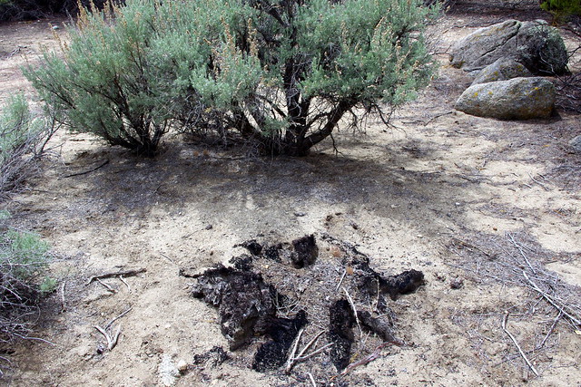
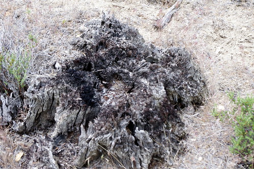
These all are stumps for which fire destroyed in the early part of the turn into the 20th Century up in the Santa Rosa Mountains above the city of Palm Springs, California USA. These were all Jeffrey Pines and while there are no longer any living trees here, they do reveal a time of climate era when circumstances were more favourable to their liking. The area is at an elevation of  between 4,200-4,400 feet and on the desert side of the mountains below highway 74 above the upper Palm Canyon. For those truly interested, I wrote and documented these old plant relics here: 
Plant Forensics for Determining a Climate's Ancient Past

Photo: Mine
It's actually incredible when you ponder it. Because the present day forest treeline is somewhere closer to between 5,500' to 6,000', depending where you are on the mountain. The two photos of stumps I are a large group of relics I discovered way back in the early 1980s, for which a couple of small Jeffrey Pine still existed. They are all now gone with the exception of one singular large example next to the shoulder of Route 74 in the Santa Rosa Mountains. Still, questions just keep nagging, what was it that allowed such an ecosystem to once thrive here ? While such discoveries, observation, and documenting are all fine, there are very little in the way of solutions offered for bringing such an incredible viable system back to life again.

Photo: Mine

Utah Serviceberry
Amelanchier utahensis
I also previously wrote about the single specimen of Utah Service Berry found in Burnt Valley east of Anza CA, but since my post on that, I have recently learned of three examples located within the Deep Canyon Transect drainage area. This info comes from the     Philip Boyd Deep Canyon Research Center.  This is fascinating and actually makes sense, since I've always found a similarity to San Rosa Mountain habitat and that of Table Mountain, east of Anza. Clearly there were in the past a deeper & richer plant community connection between the two geographic locations than at present. But again, while the research has been interesting regarding plant movements up into higher elevations on the Santa Rosa Mountains for which Anne Kelly & her colleague wrote about, it only Jon Keeley and his colleague Dylan Schwilk who offered any viable background information on the reasons for the localized climate shift or change. It's certainly popular today to look for clues for which may be attributing proof of Climate Change  as being a real phenomena, but it's those mechanical causes that are one of those things most lacking in the research. The idea being, if you know, understand and can easily communicate to others what caused the change, then utilizing some reverse engineering techniques, one should be able to provide viable solutions to an area's localized recovery. Most often, in all the research, this is the one thing I find disappointingly missing. I'm not sure if it's something they never consider[as a result of strict research focus], understand [may be totally far removed from their field (which isn't an excuse)] or perhaps more motivated by ideological and political concerns which the latter appears to be the most influential. I say political, because these ridiculous debates are mere arguments between competing ideologues seeking more power and influencing over policy establishment [for whatever justification], who also never actually offer viable solutions other than talking over the heads of the average world citizen who has no clue as to Carbon Credits, growing economies, etc. Lack of knowledge and understanding by this World's failed leadership however are also reflected in the average private property owner whose own tiny minuscule universe of imagined self-sovereignty we call a 2.5 to 100 acre parcel, is also often a bad example of bad land management. Even still, bad leadership in Government is no excuse for a private land owner not to get a proper ecological perspective with regards their own land. The fact is, you'd think pride of ownership [American Dream ?] should be a motivating factor for someone who claims to have left the rat race of City Life, and creating an ecological showpiece example for everyone else to see. But often times the condition of their land is not a reflection of their original motivational desire. I also find that even many within several of the popular new age  Permaculture Cult communities fail at this. Be warned, not all Communal Gurus really know what they are preaching about. 


Google Earth

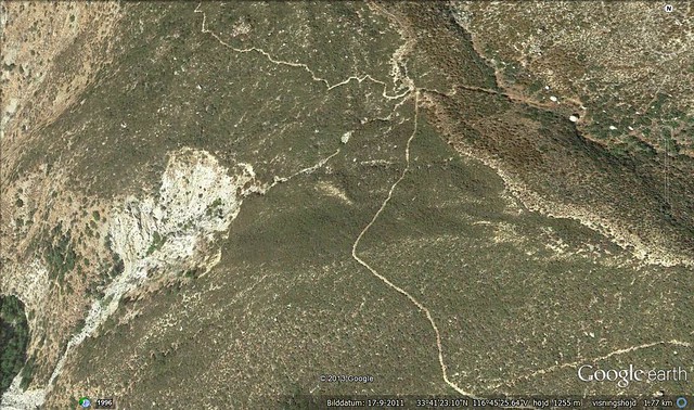
Location where ancient forest relics of the Jeffrey Pine stump field which amazingly still exists, though deteriorating more rapidly now. At the time of my discovery, I wondered why they were no longer thriving there. In 1982, we were still at a point of rainfall abundance during the heavy El Nino event periods of 1978-1983. Even then, pine seedling germination and establishment were at an increased high rate of success. Periods of less rainfall [mini-drought cycling] were never a past historical problem for such an ecosystem because of their defense mechanisms through rooting infrastructure and mycorrhizal networked associations within a mutualism of the plant community cooperative which ensures the health of all associated within the system. I believe that the continued land misuse and abuse by not only the increase in wildfire events, and public land mismanagement by those responsible, but even a far greater threat has been coming from small land owners who through ignorance have a total disregard when it comes to  managing their own properties as Google Earth historical images clearly demonstrate.


Credit: Richard Brusca
Aside from the lack of viable options or suggestions at the conclusions of most research papers which are strictly focused on evidence that things are getting bad, which in itself everyone already feels, one has to wonder if such studies were thoroughly done properly in the first place. One has to question, 'were they really so narrowly focused, like so much tunnel vision, that they failed to observe other clues around them which would have given further insight and understanding' ? For example, another study over in Arizona was recently released this month on August 14th, 2013, by the University of Arizona where several target species where followed. Focusing on just one of these, Alligator Juniper, where it has been noted that the tree has made a dramatic movement up in elevation and died off at lower elevations.  There are a couple of paragraphs which almost mirror the observation of the upwards movement of the Santa Rosa Mountain Jeffrey Pines from that historic 4,000 feet elevation to almost 6,000 elevation. Take a close look at this one paragraph.
"For example, in 1963 Whittaker and Niering recorded alligator juniper as a component of upland desert and grassland communities in the Catalina Mountains, beginning at an elevation of just 3,500 feet. Today, one has to drive to the 5,000-foot elevation marker on the Catalina Highway to see the first live alligator juniper trees in upland habitats."
Wow, sounds so familiar doesn't it ? Interesting how these same identical natural themes are occurring as one large massive western North American continental event as opposed to some restricted localized phenomena. I remember another time of unusual unnatural occurrence between the years of 1988-1990 throughout the southwest, but I wonder if anyone else remembers ? In the San Jacinto Mountains, both Jeffrey and Coulter Pines were dying off in large numbers. But this was also happening on the eastern side of the Palomar Mountain chain were almost every Coulter Pine died off. This was also repeated over at Prescott Arizona where as far as the eye could see when you came to the top of Iron Springs grade from Skull Valley, there were literally thousands of dead and dying Ponderosa Pines.  Now, while this observation was all certainly very interesting and informative, does anyone else read any thing else beyond, "here is proof positive evidence of global warming or climate change" ? Yes it's all very interesting & important, but are there any viable solutions for reversing this trend ? If so what are they ? Do we need more diversity of scientific expertise from a variety of fields which allow the research to view from every angle ? Take a look at what they believed was the thoroughness of their study because of all the varying team member participants from other fields of Science.
 (Source: Dramatic response to climate change in the Southwest)
"The scientists in this multidisciplinary group gathered the data during fieldwork in 2011, and included UA postdoctoral fellows and professors from several programs, including the UA departments of entomology and ecology and evolutionary biology, the Center for Insect Science and the Institute for the Environment, as well as botanists from the Arizona-Sonora Desert Museum."  


But was this diverse collaboration of researchers enough ? One thing I would ask, where were the mycologists ? The Soil Scientists [Pedologist] ? The Chemists for testing water from Rainfall ? ETC! Here's what I'm leading to. In my present profession, I collect data and research from the British Isles of General Practice Doctors, Specialized Medicine, Pharmacists, Professors, etc. All data and research collection is sent back to Pharmaceutical Companies for evaluation. Incredibly, I find only mere handfuls of Doctors actually are up to scratch on the actual science and adverse reactions of the drugs they prescribe patients. Scary. One Doc I interviewed apparently uses Dice Theory when it comes to prescription recommendations. If one drug doesn't work, then oh well, let's see what this next one does. No real depth of thought goes into what motivates him. A Good Doctor knows and understands his profession. He/She doesn't merely look at the outer surface of what the mere eye observes, but goes deeper into the human system looking for a cause to outward appearing symptoms. This is what we would expect and want from any competent Doctor we'd entrust with our personal heath. If this Doctor had exhausted all his personal expertise into the matter with no result and was still unsure, then his next responsible move would be to call in a specialist. If this is what we would expect of a Physician, then what about the health of our planet ?

Here's where I'm going with this. For almost two decades I've noticed something unusual when planting nursery grown plants in the wild and inoculating with a healthy bio-diverse mix of fungal species. Not only have I noticed the normal productive growth of  the target plant inoculated, but also that of the surrounding wild Chaparral Shrubs. Now, I've taken some flack and criticism by supposed experts who tell me that inoculation is NOT required (particularly in wild settings) simply existing because the spores are everywhere in the air. And yet if true, then why the poor condition of wild plants in these modern times ? This past trip I noticed an increase in poor chaparral health and I'm talking plants in locations seemingly far removed from human influence. Especially Scrub Oaks will actually prosper more. At my brothers place in Ranchita CA, I planted several Foothill Pines within the Chaparral on a hill. Not only have the Pines prospered with the mycorrhizal inoculum, but also the Scrub Oaks. I also noticed this on my own former property in Anza. There were two specific incidents where Scrub Oaks which looked as though they were struggling, suddenly come to life by their association with the pines planted and the interconnections made through the effects of the predominant PT Mycorrhizae as later Truffle formation revealed. So again, one wonders, what's going on ? Is the micro-biological world really all that healthy in the wildlands as some blindly insist ? Is this also not another area that should be explored for it's possible decline which would clearly effect what we do observe and see above the ground ? This is where other specialists on board could evaluate and report any below ground hidden abnormalities which would explain the above ground decline among other factors.


Photo: Mine

This was taken on my old place back in 2011. I was actually looking for an example to show of a once stunted struggling Scrub Oak and the turnaround made as a result of inoculation. The Oak  which was wedged in between three Coulter & Jeffrey Pines was removed as it was considered worthless. Modern Property owners have been trained by the US Forest Service that any healthy forest should reflect Garner Valley to the north of this location. Stately long tall pines with a sterile understory is the name of the game. As you can see here, the property was also stripped of it's old growth Chaparral which was in a beautiful pristine condition. Any underground networks have now been destroyed which allows for intrusion by non-native annual plants. 


image: Robert L. Anderson (forestryimages.org)

PT Mycorrhizae Truffle on Pine Seedlings
There is also another story to the above photo. On the opposite side of this now dead Manzanita skeleton, there was once a granite boulder outcropping with another small scrub oak on the back side. In front of that Scrub Oak and inside the rocks was a small Parry Pinyon which I first discovered the day we took possession of the property in the summer of 1985. It was at the time a mere 6 inches high. For the length of  the 15 years I lived there until the year 2000, it remained such, with some years no growth and others a mere quarter if an inch in top growth. In the year 2000, I thought, what the heck, so I heavily and completely inoculated around the rocks starting at the small plant's trunk & root base. That summer after Monsoon rains, truffles of Pisolithus tinctorius Mycorrhizae actually formed under the Scrub Oak down on the lower backside of the rocks, but no noticeable or remarkable difference in the foliage, which I have explained before. At least with the truffle formation below the rocks near the Scrub Oak where I had NOT inoculated, I at least knew the symbiotic attachment had anyway succeeded. But the following Springtime was a much different story. That Parry Pinyon put on 8 inches of new vigorous growth [compared to the prior 15 years of nothing] and the Scrub Oak likewise displayed much larger leaf size development and a brighter green than at anytime in the whole 15 plus years of living there. One and a half years later I sold out. My trip in 2011,  I was hoping to photograph this exciting change over of this Pinyon and Scrub Oak. You can imagine my shock when everything had been removed and bulldozed smooth. I'm kool with that in the sense that the property is no longer mine, nor any of my business for that matter. Still, it is a reflection of what people have been indoctrinated into understanding about land Management from the leadership in charge which is supposed to  know better. Still, I puzzle about this thought or notion of the wildlands are microbe okay when it comes to the underground microbiology. Note the interesting explanation of how mycorrhizae can be lost from the soil below from the reference from the MycoApply's website:
Mycorrhizal Applications Inc: Don't Soils already contain mycorrhizal fungi ? 
"Undisturbed soils are full of beneficial soil organisms including mycorrhizal fungi. Research indicates, however, many common practices can degrade the mycorrhiza-forming potential of soil. Tillage, fertilization, removal of topsoil, erosion, site preparation, road and home construction, fumigation, invasion of non-native plants, and leaving soils bare are some of the activities that can reduce or eliminate these beneficial soil fungi. Reintroducing mycorrhizal fungi in areas where they have been depleted can dramatically improve plant establishment and growth."
"Many routine nursery practices, such as fumigation and dousing with high levels of water and nutrients, produce non-mycorrhizal plants. When high levels of fertilizer and water are provided for non-mycorrhizal plants, they can thrive in this artificial growing media, but they are ill prepared to survive the eventual outplanted condition." 


While it all makes sense on what it takes to destroy a system of it's soil microbes, are there still other things going wrong out in the wild right now that we need to know about ? Are there other explanations other than fire, drought and general climate change being blamed for ecosystem decline ?

image: MycoApply

So is the Fungi present, or is it not ?
The Climate Change Research for evidence at this point in time is mostly a given. No amount of more research is really going to convince opposing ideologues about any urgency of the matter. There should be more effort made into what it should take for rebuilding these various ecosystems. Mycologists and soil scientists should also be utilized to find what else is missing within any of these declining ecosystems besides the obvious above ground components which are now missing. It's also a safe bet that if host specific plants are missing above ground, that their symbiotic below ground infrastructure connection partners are also absent and no longer viable. I have a post in draft which deals with some of the possible pollution elements which while mere heavy metal traces, can most certainly build up and accumulate over decades and possibly be contributing to some of these declines. Certainly aluminum poisoning can cause many plants to disassociate from mycorrhizal partners and to lessen their water and nutrient uptake as a defensive measure so as not to contaminate within it's organism. Unfortunately, if the toxicity persists, this defense measures will eventually kill the plant. This is why experts in fields of things not seen to everyone should be in association with experts who study the things seen. That way we get a more complete picture of things, but will anyone listen and read ? Scientists are generally not known for being the great communicators. Most of their work and communication is within their own inner circle, something that the present leadership is going to have to change if they want a shot at climate reversal by means of ecosystem rebuilding which demands every human be on board. It won't be a matter of Marshall Law to force everyone to do the right thing. You have to reach the average person's heart in order to motivate them. Again, all the intellect speak in the world won't accomplish this. Common sense language, illustrations and communication skills are required to make the subject interesting. You have to remember you are competing with devices other elements of scientific research and innovation have created to help the average human being escape the misery of  a modern world which lacks purpose other than acquiring more and more material goods. 


Further References:

Warming climate pushes plants up the mountain


Response of Mycorrhizal Diversity to Current Climatic Changes


The role of mycorrhizas in forest soil stability with climate change


http://terreweb.ubc.ca/

Mission Statement of Terreweb
The goal of TerreWEB is to create an enriched, innovative, collaborative graduate training environment that addresses key scientific gaps in understanding the impacts of global change on terrestrial ecosystems and developing strategies for mitigation and adaptation, and evaluating the factors underlying global change communication deficits, developing novel communication strategies for addressing these deficits, and measuring the efficacy of those strategies."
U.S. Forest Service: "Biodiversity of Mycorrhizal Fungi in Southern California"


CALIFORNIA CHAPARRAL INSTITUTE

http://www.mycorrhizae.com/


Wednesday, August 14, 2013

Anyone Really into Using Google Earth ?


Well, I'm learning more and more. Just learning all their tools and other feature has been fun. Take a look at the 'Going back in Time' image feature where you can go back a couple decades. Definitely has been useful to researchers watching the downwards spiral of the Natural World. Check out the link below here where some amazing uses for this imaging through time are exposing the ecological disintegration of some of earth's resources.
Business Insider: "How to Go Back in Time on Google Earth on a Desktop"
Speed of Creativity
Here are some photos and images I've played around with. For example, yesterday I wrote about the documentary by CNN on Medical Cannabis. Having lived in Anza where Pot Farms were once common and two of my neighbours arrested for growing Pot for Profit, one of whom lost his entire 10 acre homestead which by Law had to be forfeited to the State, I remembered some remote Pot Farms I stumbled upon in my bushwhacking days. One most notable was found along Strawberry Creek below Idyllwild California and physical effects still visible through Google Earth. Take a look.

Google Earth
This is a Satellite view of Strawberry Creek with Route 74 at the bottom and the very west end of the Idyllwild Community at the top. Access is more difficult now, but the Pot Farm scars are still visible if you know where to look along the east side [righthand side] of Strawberry Creek.
Google Earth
Incredible isn't it ? Human created scars out in the middle of virtually wilderness. Of course this isn't the only scar on Earth as seen from Satellite in this region. Below Is another shot of the other side of the San Jacinto River which illustrates the damage cause by original Hwy Route 74 paving project and Creek diversion scheme gone terribly wrong. Well, at least from an entire environmental view and Ecological perspective. See image below.
Google Earth
This large abnormal scar along the eastern side of the South Fork of the San Jacinto River Canyon was created when a deliberate diversion was made to run the Baldy Mountain Creek due west instead of it natural and historical meandering towards the north. This no doubt saved the State Road department some $$$ by not having to build a bridge over the section for which the road crossed over this Creekbed. In old photos, this was originally a horse and wagon dirt road. No doubt washouts were a major issue which influenced this irresponsible decision. I previously wrote two post on this place with a preview (Here) and the main subject's article (Here).

Google Earth
Hamilton Creek Alluvial Floodplain in eastern Anza Valley in California. On August second I posted an article on my experiences on my two decades search looking for clues on this regions once far more extended forested areas as referenced by early pioneer homesteader descendants to the area and as well as comparing accounts from Spanish Explorer Juan Bautista de Anza who also mentioned the mountains very heavily wooded Oak Woodlands and Pine Forests. He also mentioned numerous major springs[ a few of which I know about] in the area which were reported back to him by search parties he sent out. As you can see here, the Hamilton Creek once veered to the right n this Satellite photo, as even evidenced on the ground with those two large Interior Live Oaks on the south side of Hwy 371
San Jacinto Mountains: Moving back thru Time by means of Observation

Google Earth
This is down in Nance Canyon just east of Terwilliger Valley and below the San Carlo Pass where Art and Violet Cary once owned and lived at the old Fred Clark Ranch. This is the view at present. If you google map this region and expand or pan around, you'll notice this entire valley has evidence of total past flooding during high wet years. Most new people have no clue to a historical past of a geological location as these people who have stripped the landscape and put animals and several buildings down in this wash. The change seems to have taken place between 2004 - 2005. See below.

Notice the Google Earth Time Travel feature control at the upper left hand corner. The riparian vegetation [which is rare these days] is still present in the wash. When I first came here in 1981, the entire area had numerous mature old growth Cottonwood trees scattered throughout this valley. Now there is barely a handful of any type of riparian habitat left. Oh well, none of my business of course. Just saying!

Photo image - Rick Halsey

And finally here is a visual view of an area I came back to where I met Rick Halsey of the California Chaparral Institute and his young colleague Dylan Michael Tweed. We explored that disastrous irresponsible Cal-Fire Control Burn in the San Felipe Valley areas north of Julian and Scissors Crossing inside the regions of the former 2002 Pines Fire which was started by a government agency's Helicopter looking for Pot Farms up near the top of Banner Grade and burned all the way north of Ranchita. This control burn which took place this past Spring 2013, blitzed over the previous wildfire burn of 2002. I also remember while viewing all of this and reminiscing back about the time in history when I use to travel this road back and forth to El Centro from Anza [1980s] and how lush green the entire valley was in Summertime when the Monsoonal season rains started. The hillsides all around the valley were Mesquite trees and Catsclaw Acacia, with the Acacia being the more abundant on the higher slopes. This area looked more like somewhere in Arizona, than California. The best I can do now is tell you all a story like Art & Violet Cary told me about the early days of the 20th Century up in Anza. There is no guarantee anyone will believe me.

Google Earth (2012)
Take a look at the scene here with almost everything in a dead state. This isn't dormancy, this is simply the past several years of drought and land mismanagement, along with global mismanagement which has resulted in Climate Change. The very first time I drove to this exact spot in the early 1970s was when I got my Drivers License as a young teen and there were massive riparian forests here, mostly majestic old growth Cottonwoods and Willows everywhere. The creek was full and had a heavy meandering flow, even deep in many spots. There were also fish here, large ones too, which darted when you walked past the stream's edge, although I cannot now identify them. But also mostly those small Top Minnow mosquito fish. I know I can't get anyone to believe me about this, but never the less that is what I experienced. At best all I can do now is tell you a story. If I could have foreseen the future and what was to become of this place, maybe I would have taken actual photographs to back up the story. This large dead Cottonwood Skeleton to the right is actually a relatively new comer and not one of the originals. It's incredible, while it does take thousands of years for a health productive ecosystem to develop on a macro level, it only takes 150 years to screw it up under the excuse of enlightenment and manifest destiny over natural resources. Pathetic when you ponder it really! Below I took some of the photograph series of yearly historical photo shots from the Google Earth "Way-Back-Machine"

Google Earth - Scissors Crossing (2002)

Google Earth - Scissors Crossing (2006) 

Google Earth - Scissors Crossing (2009)

Google Earth - Scissors Crossing (2010)

Google Earth - Scissors Crossing (2013)
The opposite side of the San Felipe Creek bridge also use to contain  more old growth Cottonwoods which tapered off until the flood plain became this massive region of lush native Rushes and Sedges. All of that is now gone and the non-native Tamarisk Trees have taken their place. Nothing green really exists here any longer. Everything has changed for the worse now. I have to admit, my trip over there did provide some positive examples of what I wanted to show, but more so I was disappointed at the degradation of all the various plant communities everywhere. Fires most certainly are a major factor, but most are caused by irresponsible Human error. The main thing Google Earth can do is illustrate the past to the present and perhaps in that way could be used as a major research tool. While it can record for you the downward spiral of the nature of things, it can also be utilized as a major research tool for an environmental research projects progress through time. I wish it could go back to the days of the 1800s and further, but that would be the thing Science-Fiction is made of. Still ? *sigh*