 |
| University California Riverside |
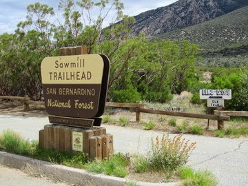 |
| photo: alltrails.com |
http://www.livescience.com/22239-plant-shift-climate-debate.html
 |
| Livescience.com |
First we have a debate between two studies. The first of the Studies saying plant movement uphill into higher elevations is caused only by climate change and it's the increase in this area's temperature and droughts that have caused the plants in the study to migrate uphill in elevation. Okay makes sense, since we find certain plants not doing so well in warmer temps and drought conditions. The first study was conducted in 2006/2007 by graduate student Anne Kelly and Mike Goulden both of the University of California Irvine. What they did was to retrace a 1977 vegetation survey that covered sites from sea level at the desert floor to high upper conifer forests at elevation 8,400 feet (2,560 meters). Now basically this Kelly & Goulden believed that climate change has caused plants to move further up the mountainside of Santa Rosa as climate has warmed. But as we all know, climate change is more than just warming, it's about extreme events of all types. They look at a couple of interesting phenomena and they looked at the 10 dominant native plant species that have appeared to have made the change higher up Santa Rosa Mountain. Now they say that Fire or even smog played no part in ecosystem changes, though they do acknowledge the historical Cal-Forestry Fire data. But they were wrong, Brush or Forest Fires are a major part in plant redistribution which ALSO has resulted in the localized climate change. I've already addressed this when I spoke of my experience in observing back in the 1980s the Cahuilla Mountain cloud formation anomalies during the monsoonal rain season each summer and how the phenomena stopped after the well known Diego Flats Fire in 1996 that I wrote about HERE! That entire localized situation changed completely after that 1996 fire on Cahuilla Mountain which is just west of the Santa Rosa Mountains. The old growth Trees and Chaparral were removed and the almost engineered looking cloud formation I described in my post almost immediately disappeared and never came back the next few summer monsoon seasons. Okay back to this study, there were some other problems I have with their view of smog pollution and/or fire smoke effects on vegetation which would influence Jeffrey Pine more than any other plants. Here is a quote from the study.
Having lived and worked in and around these mountains between 1980 to 2003, I can attest to smog movement by extremely strong prevailing winds from Los Angeles through San Gorgornio Pass into the Coachella Valley for which a possible influence could indeed effect those mountains. I also remember a time when the region west of there in and around Temecula & Murrieta west of Anza Valley had mostly crystal clear days and baby blue skies in those early years, but that all changed to filthy air over time to the present with the building boom. Did they account for this ? No they did not, because they weren't present and were ignorant of these facts and probably didn't think to interview or attempt to ask these questions of locals which was a loss. No doubt such local residents would be considered not scientifically credible enough, which seems to fit the pattern of many research papers these days. Although attitudes are changing."Some montane regions in Southern California are exposed to high levels of ozone and nitrogen deposition, resulting in increased vegetation mortality. However, five considerations lead us to reject air pollution as the main cause of plant redistribution. First, the Deep Canyon Transect is comparatively distant from Los Angeles’ emission sources, and ozone-related conifer mortality has not been reported in the Santa Rosa Mountains"
 |
| Credit: 'Deep Canyon' Blog |
Here again is the full paper of the study done by Anne Kelly & Jon Goulden.
Rapid shifts in plant distribution with recent climate change
http://www.academia.edu/2009705/Climate_influence_on_shifts_in_the_Deep_Canyon_ecocline_1977-2007
SHIFTS IN THE DEEP CANYON ECOCLINE 1977 – 2007
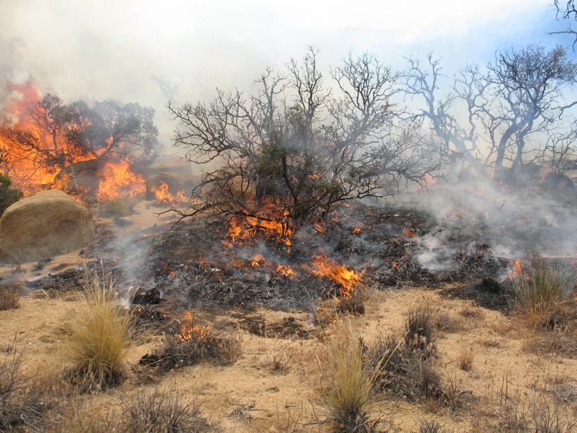 |
| Photo Credit Calphotos: Pinyon Flats Fire |
plosone.org: "A Plant Distribution Shift: Temperature, Drought or Past Disturbance? Dylan W. Schwilk & Jon E. Keeley
Here is the Kelly/Goulden reply to the Schwilk/Keeley Brushfire Hypothesis:
Reply to: Schwilk & Keeley (2012), "A plant distribution shift: temperature, drought or past disturbance?"This is a pity, Kelly/Goulden were clearly irritated in their rebuttal of the Keeley/Schwilk study for which I most agree with BTW. It is logical and can be verified by not only official fire history, but also eyewitness account by older ones living at the time, but now presently gone. There is also the mechanism factor of plant (trees/shrubs) vegetation removed and if not replaced, causing a change in weather or climate. Vegetation facilitates rainfall, especially during monsoonal moisture summer seasons. The second fire wiped out what re-establishment taking place after that first fire and was coming back to not only the Santa Rosa Mountains, but Thomas Mountain and parts of Eastern Anza area of Burnt Valley and Table Mountain. Forest trees need ample time to mature and produce more seed. There was never enough time lapsed between fires. There are no longer any viable heavy forest cover there anymore, though the evidence is still in existence and I'll write a future post with photos on that later. There are other regions of the planet that also express similar plant movement in elevation have been studied, as this one in the video below around Madagascar. Like the San Jacinto Mountains which have clear distinct life zones which start at below Sea Level to high Alpine Elevations, many of these typical mountains have a change in temperature every few hundred or thousand feet, depending on the circumstance. Micro-climates with both plants and animal species are common. But on average cooler temps mean different life zones. Incredibly, if you take all of these 1000s human caused localized plant destruction and plant community pattern changes and combine them all together around the global, it is clear these have effected the macro-climate patterns around the Earth which is why we have Climate Change, despite what the political debates want to argue.
Here are some interesting facts about the plants studied. Table 1. from the first study by Anne Kelly & Mike Goulden where 10 plants were studied. The second study by Dylan Schwilk & Jon Keeley followed on Desert Ceanothus. Change in cover-weighted mean elevation of ten most widely distributed species in the Deep Canyon Transect Species
Mean elevation, in meters from 1977 & 2006–2007
Abies concolor (evergreen needleleaf tree)
http://www.laspilitas.com/nature-of-california/plants/abies-concolor
2,421 meters to 2,518 meters elevation = +96 increase in elevation.
Pinus jeffreyi (evergreen needleleaf tree)
http://www.laspilitas.com/nature-of-california/plants/pinus-jeffreyi
2,240 meters to 2,267 meter elevation = +28 increase in elevation.
Quercus chrysolepis (evergreen broadleaf tree or shrub)
http://www.laspilitas.com/nature-of-california/plants/quercus-chrysolepis
1,987 meters to 2,033 meter elevation = +47 increase in elevation.
Rhus ovata (evergreen shrub)
http://www.laspilitas.com/nature-of-california/plants/rhus-ovata
1,457 meters to 1,518 meter elevation = +61 increase in elevation.
Ceanothus greggii var. perplexans (evergreen shrub)
http://www.laspilitas.com/nature-of-california/plants/ceanothus-greggii-vestitus
1,602 meters to 1,671 meter elevation = +70 increase in elevation.
Quercus cornelius-mulleri (evergreen shrub)
http://www.laspilitas.com/nature-of-california/plants/quercus-cornelius-mulleri
1,485 meters to 1,522 meters elevation = +37 increase in elevation.
Larrea tridentata (Creosote Brush evergreen shrub)
http://www.laspilitas.com/nature-of-california/plants/larrea-tridentata
317 meters to 459 meters elevation = +142 increase in elevation.
Ambrosia dumosa (drought deciduous shrub)
http://www.laspilitas.com/nature-of-california/communities/joshua-tree-woodland
630 meters to 748 meters elevation = +118 increase in elevation.
Encelia farinosa (Brittlebrush drought deciduous shrub)
http://www.laspilitas.com/nature-of-california/plants/encelia-farinosa
574 meters to 674 meters elevation = +100 increase in elevation.
Agave deserti (evergreen succulent)
http://www.laspilitas.com/nature-of-california/plants/agave-deserti
693 meters down to 643 meters in elevation = -50 decrease in elevation.
 |
| Illustration Credit: University of Arizona |
Dominant plant species along an elevation gradient shifted synchronously with one another over a 30-year span that has a concurrent temperature increase, based on a new study by Kelly and Goulden (13). The ranges of the plant species' distributions remained the same, resulting in an overall "leaning" of the vegetation gradient toward higher elevation. At the very least, this clearly illustrates the Jeffrey Pine forest retreat over the historical early time period to the present day.
This Spring I'll photograph some of the old charred Jeffrey Pine stumps I found on both sides well off of Highway 74 (Palms to Pines Scenic Route) which is nothing more than Chaparral Plant Community and I'll post them on a separate link and attach this page to them. What is both interesting and sad with both these studies is that both Research Groups are correct in Fire destruction and Climate Change and but in that very order. But clearly these imperfect human 'Egos' got in the way as a result of this incessant obsession with fame, glitter and glory which can be infectious to many in Science today. Clearly I find Keeley's and Schwilk's study more compelling. Can you imagine what they could accomplish in working and cooperating together as opposed to all this fighting ? It's too bad because many different Research Groups today miss out on a lot of important findings which could lead to rebuilding these ecosystems. While I like the Keeley/Schwilk Study, I was disappointed a bit on the lack of mention of any off the logging operation which harvested large numbers of Jeffrey Pines from Santa Rosa Mountain which also could have also effected climate, though on a localized level, or greater if adding the fire component. - Stay tuned for update!
~~~~~~~~~~~~~~~~~~~~~~~~~~~~~~~~~~
Update: This is an update with regards the subject matter within this post. I have recently documented some out of place plant anomalies I first discovered back in 1984. They are now photo documented and reveal an older forest location of Jeffrey Pine at the foot of Santa Rosa Mountains where no such pines exist today. This is a much lower elevation than even Hwy State Route 74 between Santa Rosa Indian Reservation and the planned housing Community of Spring Crest. This location is specifically explained and easy for anyone to document. Caution, always be careful here - Enjoy
Plant Forensics in Discovering a Climate's Ancient Past
Oh, yes...I remember the FLOODS of 1976 and 1979. We weren't hit by any water in 1976, but in 1979, when I had a 1 year old and when I was pregnant with our son, our home in Palm Desert was flooded. I was alone at the time (my husband was in Los Angeles on business) and I had to grab our daughter, my purse, and our German Shepherd and get out of our house. Fortunately, the house stood (we are still living in it) and some firemen let us stay at their house that night. It was scary. And, YES, I'm sure those canyons, especially Deep Canyon, carried that water to the Salton Sea. We really haven't had rains like that since, but I still get nervous during the monsoon season every time it rains up in the Santa Rosa mountains! Interesting article...WHERE exactly would I look for the tree stumps?
ReplyDeleteThey would actually be in the hills and canyons on both side of Hwy 74 between Spring Crest and Santa Rosa Indian Reservation. It's hard to pinpoint, but you have to do a bit of bushwacking to find them. Many are actually not in washes or creeks areas, but on dry rocky chaparral covered ridge tops and knolls, which is further away from water sources, even temporary runoffs.
DeleteThank you for answering. I assume you will take photos of them during your trip in April? All of this is fascinating and new for me! :-)
DeleteYes I'll be taking numerous pictures of these and documenting everything as possible. Something I should have done back in the 1980s.
DeleteAnd, yes, I remember the Pinyon Flats area fire. Our daughter's best friend lived in a cabin at the edge of where the fire stopped (thank goodness). Their home would have been the next to go...
ReplyDeleteI also remember the Temecula Valley when the vineyards were first planted. I imagine all the smog has wrecked havoc on them. We hardly ever get out there anymore, but there are many, many more vineyards in Temecula now. Frankly, I prefer Spanish reds and Alsatian wines, although I also love Zinfandel!
ReplyDeleteIn 1976, while I was working on my master's degree from UC Riverside, I did a survey for the county. Boy, was it different then! There were only a few apartments in Temecula and it was mostly horse ranches! Awww....the "olden days"...
ReplyDeleteYeah, it's hard to believe how rapidly things have deteriorated.
Delete