Showing posts with label Mystic Lake. Show all posts

Thursday, July 24, 2014

Anza Expedition Summary (also places, people and things of interest in SJ Valley)

Bautista Canyon, San Jacinto Valley & Mystic Lake


A couple of real quick links from my first two Main posts as mere reminders and then to my final post:
(Part 1) Juan Bautista de Anza's Journal sheds light on a past Extinct Ecosystem
(Anza Expedition Part II) The Valley that was, but isn't any longer
~~~~~~~~~~~~~~~~~~~~~~~~~~~~~~~~
Map image:  Juan Bautista de Anza National Historic Trail Guide

This was to be my final and last post on the Anza Expedition which for me the story closes at the Santa Ana Riverside at Mount Rubidoux. But I've had to break it down into smaller sub-subjects as there was just too much to consider and the side points were pertinent to the overall picture of the expedition. That's the curse of knowing the area so well and I still have told the half of it. Beyond the point where Anza comes to the Santa Ana River at Mount Rubidoux in Riverside California, I really have vague knowledge of the natural world beyond that point which has mostly been swallowed up by human development. So I'll merely offer some recap here and add some interesting facts about San Jacinto Valley's history, places and people I've enjoyed meeting down there in my own historical past. So again, some recap of what I've already written about.

Once you enter onto the valley floor from Bautista Canyon's mouth, the area prior to agricultural development would have been more like a Bajada or Alluvial fan. It's interesting that ONLY Fray Pedro Font made mention of the Bautista Creek splitting into separate and distinct two river channels as it emerged from the mouth of Bautista Canyon where he described the waters eventually disappearing into the sand a ways down stream. This to me would indicate that the first trip took the more historical westerly route of the stream and the year after they took the Bautista Wash route more to the north where this water seemed to disappear under the sand and gravel. That would make sense if it were a newer stream which for unknown natural causes was created by flood water debris creating a diversion and siphoning off some of the water from the main original historical channel. Therefore the second Trek's camp would be on the eastern side of Park Hill.
"After about four leagues the canyon becomes wider and the water of the arroyo, which at the end divides into two branches to open out into the Valley of San Joseph [San Jacinto Valley], is lost in the sand."
The present Bautista Creek from the Flood Control Dam is a very deep concrete flood channel which has been routed north towards the San Jacinto River channel. This channel no doubt most likely followed a more westerly pathway in the old channel with meanders northwest on just the east side of Park Hill. The second channel may have even made a more direct western route along present day Stetson Ave on the south side of Hemet. What ever the situation in the past, the present man made concrete channel was likely created to allow the many human agricultural endeavors for the exploitation of the landscape for various Orchard enterprises which are mostly gone now. In any event, I wrote about this here:
Old Bautista Creek Channel East and West side
~~~~~~~~~~~~~~~~~~~~~~~~~~~~~~~~
Image: Jay Beiler

Cahuilla Reservation looking north at Mount Jacinto
and Cahuilla Mountain on the left hand side.
It is also extremely interesting to take special note that the elevation gradient from Hemet to the town of Winchester and points west like Menifee and Sun City is only a mere inch or more. At least this is how it was explained to me by one of the city maintenance people. In any event, this valley has always had drainage issues. Not that this is a bad thing in a wildlife natural world sense, but for human infrastructure and commercial pursuits it's always been a problem. It can and will flood instantly even during a localized heavy summer monsoon thunderstorm event in July/August. This is important for everyone to understand the personal observation written down by the Spanish eye witnesses a few hundred years ago. Because from the very point at which they emerged from the mouth of Bautista Canyon, the first thing that impressed all journal writers was the heavy abundance of wildflowers everywhere just as they had experienced up in Anza valley when traveling through what is now Cahuilla Indian Reservation. Hemet Valley itself was often most likely one large continuous massive vernal pool from it's central and western edge all the way to Winchester and perhaps beyond. I actually found an image below which in an impressive illustrative way depicts almost identically the geography of flat valleys accompanied by pyramid shaped hills or saddle back boulder strewn small hills of this San Jacinto - Hemet Valley region. Notice the landscape in this picture below with slow moving flood meandering water courses which branch off into numerous landscape tributaries to create Vernal Pools ?


Golconda, NV / Humboldt River at flood stage on 6/9/2005
This is my second deviation from this main post. The reason I am veering off track here is to illustrate the beauty that both Juan Bautista de Anza, Francisco Garcès and Fray Pedro Font all expressed about the massive wildflowers displays which seemed to deeply touch their hearts. Most people who have seen such display of wildflowers even on small scales can of course relate. Sadly most of this is gone forever as development has encroached and continues to do so. Please follow this link for a deeper picture of the reality of wildflower strewn Vernal Pool wetlands: 
The Vernal Pools of South and Western Hemet (Anza Expedition extra) 
~~~~~~~~~~~~~~~~~~~~~~~~~~~~~~~ 
Okay, I am veering off here again to create a separate post which can be more detailed in proving just what these men actually saw of the what, why and how of it's existence. Please follow this link for a deeper appreciation of the geography of the valley and other water feature tributaries which will make that long gone historical massive riparian ecosystem a reality for you that Anza, Font, Garcès and others on the expedition wrote so highly and praiseworthy about. Also take note of the comparison Anza finally makes of the Santa Ana River looking exactly like the San Jacinto River Valley. That reality back then no longer exists:
The San Jacinto River Valley that Juan Bautista de Anza saw 
~~~~~~~~~~~~~~~~~~~~~~~~~~~~~~ 
Here is an entirely different post written strictly about the present San Jacinto Wildlife Refuge and what is left of the wetlands they described. I'll also follow the river bed down to Elsinore and through Temescal Canyon, something the explorer's did not do. The main purpose in my veering off course here and following the riparian system which these men did not follow have more to do with wildlife & ecosystem purposes only. The possibilities of Southern California's Steelhead Trout actually living and existing in the upper reaches of the San Jacinto River habitat and evidence for the California Grizzly Bear presence in the area as mentioned by one of the members of the Expedition:
San Jacinto River Wildlife Refuge & the wetlands potential beyond to Corona 
~~~~~~~~~~~~~~~~~~~~~~~~~~~~~~ 
Finally as with anything I write, I'm interested in lessons learned and if there are anything we can come away with as far as practical applications to be used in habitat restoration, urban landscape or just your small garden.  
Anza's Dairy & the Lessons Learned
~~~~~~~~~~~~~~~~~~~~~~~~~~~~~~~~~
Fast Forwarding to the present with places and people I enjoy
Address: 1977 S Hewitt, San Jacinto Ca
Tel: (951) 658 2426
This past June 2014, my wife and I stopped in the San Jacinto/Hemet valley on our way to visit and stay with friends in Phelan California. I decided to revisit some of my most favourite places and the people who live and work there. First stop was the Savala Fruit Market located north of Park Hill on S. Hewitt. When I lived in western Riverside County back in the 80s & 90s, I often stopped here specifically for their Apricots. Hemet valley was a one time a major Apricot producer in times past and in fact when I first moved to Idyllwild, eastern Hemet Valley to Valle Vista still had many major Apricot Orchards. It was sad to see them plowed up and the land used for housing. Savala Ranch is the last hold out and shrinking fast. Their ranch of course is smack in the middle of development country. C&R Farms [the largest grower of Watermelons, Pumpkins, Squashes and Gourds in the Valley] had a large field of watermelons on the west side of the Savala Ranch when we visited.


Savala Ranch Fruit Stand, San Jacinto California
Fernado and Ofelia Savala started the 16 acre Apricot Orchard and Fruit Stand I believe some time back in the 1960s. Fernando came from Mexico in 1940 as an Apricot picker and later enlisted in the Army during World War II, and during this time married his wife Ofelia. Their son now runs the Ranch and told me his father has since died and mother only comes out occasionally when she has the energy. The northern end of the Farm has had it's beautiful Apricot Orchard removed as the water is now scarce and expensive. They can no longer flood irrigate as in times past and use only drip irrigation under the trees on the south side of the Apricot Farm on Hewitt. It makes me sad, as the apricots were far smaller than in times past when they flood irrigated. The trees themselves are of the older larger standard antique variety, which means more potential for deeper root infrastructure if it gets trained properly. I almost wish I could spend a year there and help them turn things around with what I know and understand about deep pipe irrigation (Article Here) . I'm sure the water rates from the municipal water company are outrageous. One wonders how long they will be able to hold out. 

photo Mine


photo Mine
The apricots were very very small by comparison to the old days. In the old days they sold them fresh, but also dried the majority out in the sun behind the sheds. As anyone knows, apricots do not have much of a shelf life and drying is preferable for many. Below here is a picture of some old wood built Ice cooled Boxcars which were later replaced by the common refrigerated unit cars like those of the Pacific Fruit Express cars seen for years. The Savala Ranch has the same two, but at one time these boxcars could be seen everywhere on all the valley farms which were bought up cheap by farmers for storage sheds.

image Mine: old block ice cooled fruit boxcars
The photo below is not mine, but apparently from a Savala Family member's photobucket collection. The uncanny thing here is the photo of the grandmother Ofelia is exactly the way I remember her, as opposed to present. The other uncanny thing is that long extended baby blue Ford Econoline Van looks exactly like mine when I stopped by during the middle 1990s and picked up produce for resale. This was the same Van I used in distributing bread for Dudley's Bakery out of Santa Ysabel. Hmmm, maybe Fernando Jr can help me out here, any idea of the date this was taken ? BTW, it should be noted that the Savala Family has always tried to practice organic farming. Here is their Facebook page: 
https://www.facebook.com/SavalaRanch

Image Lady Daniela

Savala Ranch Photos
~~~~~~~~~~~~~~~~~~~~~~~~~~~~~~~~
image Mine
Little Pantry Cafe (formerly Hamby's Cafe)


Address
  • 980 N State St
  • Hemet, California 92543
Phone
+1 951-929-0908
This location and cafe was originally called Hamby's Cafe. It is now called "Little Pantry Cafe" and has much the same character and atmosphere as before. My favourite food here was breakfast (which they served all day), but sometimes I stopped in the evening for dinner when I drove home from work on my way to Idyllwild where I moved in 1981. What can I say, I was single back then and had money for eating out a lot. I was first introduced to Hamby's by Marvin Lindholm, who now lives in Lake Arrowhead, California. I use to order Hamby's "Lumber Jack Breakfast" which by name causes you to imagine a breakfast fit for only a Paul Bunyan. True to the name, one could rarely finish it. As a side point to my article on the Anza Expedition, just a few meters north of this cafe on State Street, the geography slopes down sharply revealing the old San Jacinto Flood plain and ancient river valley, though I highly doubt any resident or traveler ever gives it any mind. You can actually follow the entire floodplain edge if you know where to look when driving both east and west. The line is very distinct and obvious. Still, from that vantage point one could stand here and imagine the lush scenery Anza, Font, Garcès and others witnessed as the area's first European explorers.

image Mine
This place is basically the same, with the exception of the name and owner. In the above photo, you'll notice the entrance into a larger room. In the early days the Cafe stopped there at the wall. Hamby's owner later remodeled and made the place much larger. Most regulars in the old days would stand in line waiting to get in, morning or night. My wife and I definitely enjoyed the breakfast we had and it was almost identical as I remembered it. It's the kind of food you can tell is made from scratch like all older Cafes of days gone by. The taste test is whether the gravy in their "biscuits n' gravy" taste like wall paper paste or loaded pan drippings from the bacon and sausage. *smile*
~~~~~~~~~~~~~~~~~~~~~~~~~~~~~~~~
 Bats put on a nightly show from under the Bautista Flood Channel bridge at Fairview  in Valle Vista south of  Hwy 74 (Florida Ave)

Image: Press Enterprise - Bat Colony under Bautista Creek Flood Channel bridge - Valle Vista
 Admittedly, Hemet and San Jacinto have never been on most outsider's list of places to go and things to see, but there are some refreshing off the beaten track things to experience if you've got the time. Here is the article link below: 
http://blog.pe.com/news/2012/09/12/can-valle-vista-bats-save-hemet/ 
Here is the updated article on the Bats of Valle Vista in what is known as the Fairview Bat Bridge in Hemet California by Bob Pratte of Press Enterprise on June 24, 2014: 
by Bob Pratte: VALLE VISTA: Sundown show at The Bat Bridge 
~~~~~~~~~~~~~~~~~~~~~~~~~~~~~~~~
(951) 845-1217
38021 US Highway 60
BeaumontCA 92223-1680
Our last stop on the way to Phelan was this well known tourist spot called Dowling Fruit Orchards at the interchange of Hwy 60 & Interstate 10. This was actually one of my customers when I distributed gourmet bread & some produce to western Riverside county clients like Hadleys, Tom's Farms and Rancho Fruit Market in Temecula. The Fruit Stand was only a small part of the larger fruit orchards which once existed to the east and south of the stand which is right on Hwy 60. All manner of tourist, locals and large number of Truckers stop here. It's owned and run by John Dowling who I did run into and had fun catching up on what's been going on in both our lives. I was happy to see his dad was still alive, but of course I already knew his mum had died. But it's very much like the other tourist places referenced above but with more of a Mom n' Pop flavour about it. Below I've got some other reading references about the history of San Jacinto Valley.
~~~~~~~~~~~~~~~~~~~~~~~~~~~~~~~~ 
I also remember the account about the scene named "Massacre Canyon" which is actually Portreo Creek just north of Gilman Springs Rd. Two tribes of Native Americans [Soboba & Pechenga] had a bloody battle here up this canyon. I've heard two accounts, but the main one is about the Chia Seed version. I'll post below here my article on lessons learned about Bajadas or Alluvial Floodplains, where I reference the early 1980s El Nino event flooding which created a lush dense triangular shaped riparian forest from out of the mouth of this canyon all the way to the San Jacinto River. Only a medium percentage of this large sized remnant of those trees exist to this day. This is one of the main tributaries Fray Pedro Font wrote about which he insisted helped fill and maintain Mystic Lake to the west.
Massacre Canyon: The Chia Seed version
Lessons Learned from the Bajada (Alluvial Fans)
 Also, don't forget the USGS Historical Topographic Map Explorer, which I just clicked on an old 1904 Southern California Topographical Survey map. It listed Eden Hot Springs which I had forgotten about halfway between Hwy 79 (Lamb's Canyon) and the old original hwy out of SJ Valley, Jack Rabbit Trail. The older map also shows the long gone railway spur from Perris ending at Lakeview, most folks never have known about this spur. It was mostly a real estate scheme for selling land. You'll understand the name if you've ever taken the trek between Gilman Springs Rd and Hey 60. It is paved, but older pavement and very twisting winding narrow roadway. All along the drop offs along the Canyon edges is the old original wooden guard rail and some Route 66 era steel type guard railing. In Anza, Cahuilla Reservation is spelled Coahulia. Just some interesting side points. well worth bookmarking. enjoy.
http://historicalmaps.arcgis.com/usgs/ 
~~~~~~~~~~~~~~~~~~~~~~~~~~~~~~~~
image by Tom Grubbe (2011)

Looking south towards Mystic Lake and San Jacinto Wildlife Refuge with the community of Lakeview in the far distance long Jack Rabbit Trail.

Monday, May 5, 2014

San Jacinto River Wildlife Refuge & the wetlands potential beyond to Corona

Mystic Lake, Lake Elsinore and Temescal Canyon

Image: Tung Tran

San Jacinto Wildlife Reuge

This is a favourite scenic spot for many who come to visit the San Jacinto Wildlife Refuge. Those hills in the background are what is believed to be the hills on the western side of the Mystic Lake where the Anza Expedition camped on both back to back expeditions. It certainly would be the easiest region to cross over the San Jacinto River as the waters flatten out into shallow pools just down stream of  Mystic Lake itself which would be the largest and deepest. The current of the river also would have been far less swift at this location. While the area does have a few pockets of riparian forest woodlands, it is mostly sedges, rushes, cattails and other tall tule grasses. Below is a closer up view of the same image above.

Image: SoCalHunt Gear

http://socalhunt.wordpress.com/2010/12/
Believe it or not, the area is supported by Duck Hunting Clubs and is kept recharged through agreements with the water agencies for reclaimed water, otherwise these also would disappear during the drier times which have obviously become a more frequent feature resulting from climate change.
Image: Jeff Sullivan
It could be said that such large depressions of dry lake beds around the Lakeview area could also be considered giant vernal pools in many respects as many of the same plants and amphibians thrive in such locations as these Goldfields always do when the waters begin to dry up. BTW, below is a link to western Riverside County wetlands creatures which are dependent on Vernal Pools for their existence:
Western Riverside County  Multiple Species Habitat Conservation Plan (MSHCP)  Biological Monitoring Program 
Vernal Pool Survey Report 2010 

Photo by Mike Wilson

Region where San Jacinto River merges with Mystic Lake
just west of Highway 79 and north of Lakeview California


Photo Mine

Major construction of San Jacinto River
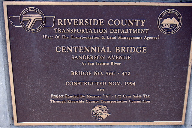
bridge on Hwy 79 in Riverside County 1994
This photograph of the San Jacinto River flowing into Mystic Lake was take by Mike Wilson during the last heavier rainy season the inland empire has experienced in 2005. The predominantly dense Cottonwood Riparian forests & bordering marshlands would have extended all the way to just a little beyond present day Hwy 79 Bridge where it crosses over the San Jacinto River today. This very highway was closed for almost an entire year in the early 1980s before there was any bridge built. Mostly it was a mile long dip through a floodplain wash. That winter's rains washed out the Highway 79 or Sanderson Ave and water flowed over it for most of the year. While the photo above has the appearance of a straight river course to Mystic Lake (lake of San Antonio Bucareli), the difficulty of traveling from Park Hill encampment to this lake region was described by the Priest Francisco Garcès and the others as having great difficulty because of the bogey soil and reedy pool marshes on both sides of the river's Cottonwood Forests which demanded detours here and there. Even the surrounding small hills were described as having miry soil. It illustrates the wetness of the climate and abundance of a extreme high water table, which resulted from no one for 1000s of years previously never tapping into the area's groundwater for human purposes: 
Priest Francisco Garcès (March 19, 1775 1st expedition)
"Winding around by a very miry road, we came to a hill, [Footnote 93] having traveled about four and a half leagues almost to the northwest but with many windings, because the hills as well as the plains are so boggy. The groves are thickly grown with grass, one species of which bears a seed very much like rye."
Juan Bautista de Anza (March 19, 1775 1st expedition)
"At eight o'clock in the morning we took up the march down the valley toward the northwest. Its amenity and the beauty of its trees continued for three leagues, after which the trees came to an end but the amenity continued. We followed it for three more leagues, till we came to the banks of a large and pleasing lake" 
Fray Pedro Font  (December 30, 1775 2nd expedition)
"The land is very soft and when it rains it is somewhat miry. Here and there in the valley there are some hills with rocks and shrubby growths but without any trees, though the soil of the hills is soft like that of the valley. In all the valley there are no other trees than the cottonwoods of the river bottoms. In the high and snow-covered sierras one sees pines and live oaks, and it may be that on their skirts and in their canyons they may have other trees, because they are very moist."


Nature.org

San Jacinto Wildlife Refuge


Juan Bautista de Anza (March 19, 1775 1st expedition)
"We followed it for three more leagues, till we came to the banks of a large and pleasing lake, [Footnote 116] several leagues in circumference and as full of white geese as of water, they being so numerous that it looked like a large, white grove."
Priest Francisco Garcès (March 18, 1775 1st expedition)
"We saw a countless multitude of white geese like those which I saw at Agua Amarilla."
Fray Pedro Font (December 30, 1775 2nd expedition)
"In the valley there is a large lake formed by the San Joseph River, and by other arroyos which come from various springs and brooks in the sierras roundabout and which have no other outlet. Therefore, according to the signs, this lake rises very greatly during the rainy season. In it there are vast numbers of geese which at a distance are seen in large white flocks."
Image: SoCal Hunt Files
Word of note on some of the Hunting Clubs. There has been controversy in the past with the Ramona Duck Club regarding grading with heavy equipment:
SAN JACINTO: Grading prompts wildlife concerns (Sept 2011)
SAN JACINTO: Army Corps probes wetlands area grading
But again if anything could be said about their efforts, they have kept certain regions alive with wetlands upkeep and water agreements with reclamation agencies.
Image: Press Enterprise

Image Wiki
What can I say, one of the most impressive things noted beside the abundance of water, wildflowers and riparian woodland plants were the massive scale of millions of waterfowl, most notably Geese. To bad that often times this ancient lake bed area is a dry mud hole. The year 2005 appears to be the last good year for water availability. Though I'll check back there again this coming late May 2014. The S.J. Wildlife Refuge itself however is maintained by agreements between some of the Duck Hunting & other wildlife organizations for reclaimed water recharging. While those Geese observed by the Anza expedition were certainly on a grand scale at the Mystic Lake location, they and other aquatic birds would have been almost everywhere throughout this region of flatland vernal pool country at this time of year. Of mild interesting note, earlier this year the Riverside County Newspaper had this article about the return of wetlands Geese back to these regions:
HEMET: Canada geese may flock from Temecula, Menifee
 ~~~~~~~~~~~~~~~~~~~~~~~~~~~~
Image: Rancho Vista Nuevo Hills 

Looking north from the hills above Lakeview & Neuvo area back towards Mystic Lake and the San Jacinto Wildlife Refuge Area. This photo is actually from a real estate development company.


Image: Riverside Co Flood Control
Okay, now let's turn in the opposite direction towards the south where the San Jacinto River itself does continue it's flow, which is in the opposite direction that the Anza Expedition did not follow. We'll head down stream and take in some historical facts there from Nuevo and beyond. The river's course is now more channeled here to allow farmers to cultivate the landscape on both sides of it's banks, but that same type of flat valley floor geography extends further south to just the opening in the low hill passes before entering Canyon Lake and then drops steeply into Lake Elsinore. There is a great map of the region by the same group attempting to save precious habitat for the endangered Vernalpool Pincushionplant Navarretia fossalis plant, among other organisms, which need vernal pool environments to exist. Unfortunately these flatland areas are also prime real estate development properties and there are the predictable conflicts by the usual suspects. This area also has it's own history of flooding as the photo at the top right shows near where the river flows under present day Interstate 215 & old Hwy 395 (now Case Rd) around the year of 1927. Most I-215 travelers driving over the bridge where the narrow channel of the once mighty San Jacinto River is presently, hardly give it a notice unless they are lucky enough to see the sign marking it's existence. Even the earliest Railroad which originally went from present day Perris to Oceanside went down what is now known as Railroad Canyon was eventually relocated through the Temescal Canyon route from Corona because of frequent expensive washouts to the Canyon Lake area. But even that old line is now abandoned because of similar flooding washouts in the Santa Margarita River canyon. Below is that wetlands protection area map which runs from S.J. Wildlife Refuge all the way to Canyon Lake.


Map image: EPA

One of the main things I was always curious about when I traveled Hwy 395 and later Interstate 215, was if the San Jacinto River could have at one time back in history maintained some permanency in it's flow even if at times it was nothing more than a mere stream surrounded on both sides with backwater Vernal Pools during the drier periods ? Consider for a moment, there were no upstream  dams and for countless centuries a water table clearly untapped for 1000s of years. Mature old growth riparian forested areas scattered along it's banks here and there, perhaps all the way to Corona California where it would have met the Santa Ana River floodplains. Most maps never show the San Jacinto River as flowing beyond Lake Elsinore, but clearly there always was an outlet where the landscape topography is at it's lowest point through the city center of Elsinore itself and flowed mostly along what is known today as Collier Avenue, but more on that later.


Image: San Jacinto & Lake Elsinore Watershed Authority


This area above is the often favourite area for photographers to stop at a couple of points on the Route 74 also known as the Ortega Highway. You can see the modern version of the lake where the historical southern portion is no longer allowed to flood. You can also see the channelized portion where the San Jacinto River flow inlet extends into the lake near the top middle of this lake photo. Interestingly, if the snow capped Ortega Mountains were a more common occurrence back centuries ago as in this 2008 photograph, then certainly this would have helped to maintain river channel flow from Elsinore to Corona in what is known today as Temescal Creek. Certainly anything was possible, especially considering the second journey of the Anza Expedition where they had a month earlier experienced a major blizzard right next to the Salton Sea. Clearly heavy snowfall would have been more common up in the Ortega Mountains. It could well have been possible for a more maintainable flow of the San Jacinto River with numerous downstream tributaries which could have extended all the way to Corona connecting at the Santa Ana River. In any event this would prove an excellent corridor route for numerous aquatic creatures which I will get to later.


Press Enterprise
I remember such scenes in the 1980s and middle 1990s when rain swollen San Jacinto River finally made it's way down the Railroad Canyon to Lake Elsinore and once again flooded the southern part of Lake Elsinore Airport & Skydiving facilities on the south flood plains. Almost made it to De Jong's Cash & Carry Dairy there on Corydon Road. The scene now however has changed. No longer will the lake be allowed to completely fill up as in times past. The south floodplain will be forever allowed to remain untouched by future flood waters thanks to the government efforts at building a large series of levees forcing the excess lake water through an improve concrete channeled outflow through downtown Lake Elsinore. You should also take note that water which once naturally channeled into the lake from the south by various mountain tributaries has been rerouted towards the direction of a Temecula direction to the south. This allows for less danger of even mild flooding on the south flood plain. The photo above is the San Jacinto River which flows through Railroad Canyon after coming through the Canyon Lake spillway upstream. As I stated previously, this San Jacinto River officially has never been shown on amps to flow beyond Lake Elsinore, but clearly there always has been an outflow channel which has mostly been choked with cattails, reeds and other tule grasses, made it's way along Collier Avenue and even the old Railroad right-of-way followed right along this wetlands strip, much of which remains and is still protected. At times of high water flooding in Lake Elsinore when water did flow through the city, Riverside drive which is also part of Hwy 74 which comes from Perris California has been closed for months as floodwaters impossible to contain inundated the wetlands portion of this roadway. There is a technicality which lists on maps the stream or river outflow from Lake Elsinore to Corona as Temescal Creek. All along the way through this canyon there are also tributaries which sustain the creek. 


Map image: Wikipedia
A much deeper detailed image of the entire Santa Ana River Drainage basin is here below which shows Temescal Creek from Lake Elsinore through Temescal Canyon to Corona and Santa Ana River. Again, notice the other side stream channel contributions. You should also recognize the region near the Pomoma-Ontario area  and the San Antonio Creek where Anza, Garcès and Font made mention of many bears down around this valley floor riparian woodlands. Hmmm, what were those bears doing there, perhaps fishing ? And if so, for what were they fishing for ?


Image: Wiki - Temescal Creek
Here is an extremely interesting and fun interactive wetlands map just released on May 4th 2014 by the U.S. Fish & Wildlife Service of the entire North American region which lists all various forms of documented wetlands habitat types of ecosystems which need protecting of what is left. There are numerous kool interactive tools to use within this map. By all means link the link below and bookmark it for future reference:
 National Wetlands Inventory
http://www.fws.gov/wetlands/Data/Mapper.html
~~~~~~~~~~~~~~~~~~~~~~~~~~~~~~~~
Temescal Canyon & Historical Possibilities
Image: Riverside County Floodcontrol
Sadly like everywhere else in Southern California the area of Temescal Canyon has been the target of major developers for more bedroom districts. The photo below illustrates this fact where Interstate 15 runs through the middle of this canyon allowing for easy access for future commercial development. Some readers may even remember when this area had Hwy 71 running through it all the way from Temecula. Historically the only prior human usage by the pioneering Europeans was the Citrus industry. Still, one wonders about the potential for a more permanently flowing river channel through here which would have allowed for newer upstream native fish habitats to exist. This has also one of my interests for this riparian river system since the 1970s. The area of course does have it's own history of flooding at times such as the storm of February 1969 flooding on Temescal Creek in Corona, Magnolia Avenue and the Pacific Electric Railroad tracks as the photo above reveals. Of course more concrete channeling took care of that problem.

 Sycamore Creek, Temescal Valley, Riverside County, CA


Add caption
There are number of things I have always wondered about with regards possible native fish species in Southern California. First off there really aren't a lot of them and if there are, they are mostly uncommon in most of their former traditional waterways. After becoming interested in many things Arizona and discovering back in the 1970s that at one time there were some 35 native Arizona fish species, I just knew there had to be something about possible native fish in San Diego County where I grew up. Of course there are fish, but mostly nonnative introduced species from the eastern USA. Unfortunately there was very little information at the time. It seemed only logical though that if the dry deserts of the southwest could contain several native varieties of fish in numerous isolated locations, then there must be something to be found in San Diego and other locations of SoCal which have more permanent waterway corridors. About the only thing I found was a native Steelhead Trout in SoCal which seemed to closely resemble a Salmon in appearance and nature of living in both the ocean and streams for spawning purposes. The fish example pictured above here is called the Santa Ana Sucker which still exists today in the Santa Ana River drainage. If the climate and high water table conditions existed without interference from human development, it could logically stand to reason that such fish could have also been common even in the San Jacinto River system as it has other accessible systems along the Santa Ana drainage. While the literature suggests the possible presence of the Trout & Sucker in Temescal Creek system, they are dogmatic in their insistence that the Lake Elsinore basin was a major barrier to their possible presence further upstream. But I call this mere speculation based on what we only know have recorded since the Europeans first arrived and started corrupting the once pristine environment. Worrying about conservation and the environment were not exactly ingrained into the culture back then who exploited the natural resources in the race to see who became the wealthiest. But there clearly are some clues.


The Spanish explorers made no mention what so ever of any kind of fish being found in the San Jacinto River Valley. But they had previously made mention of finding fish as they traveled through western Arizona along  the Gila River. Although they didn't spend much time in the San Jacinto River Valley, this doesn't necessarily mean there were none to be found there. If all the main components of a massive wetlands system which allowed for a self-sustaining uninterrupted river bed to Lake Elsinore, would it not be more than likely possible then that there be a continued connection through the Alberhill area down into the Temescal watershed system towards the confluence with the Santa Ana River to clearly have been possible ? Another reason I personally have for believing in possible fish migration connections are two other native fish I have personally stumbled upon in the early 1980s in the south and middle forks of the San Jacinto River Canyons. Take a look at the picture I have used before of the Middle or Main channel of the San Jacinto River from a Hwy 74 vantage point heading up to Idyllwild.


California Route 74 @ AARoads

San Jacinto River Main River Channel


image: Warwick Sloss
This part of the river above which I call the main canyon and back up into the South Fork Canyon branch of the San Jacinto River which would be to the left and out of view in this photograph is an interesting area where two native fish do live or at least did in the early 1980s. This view during the 1980s almost always ran with rushing crystal clear water. Not only the South fork, but also Cold Creek and Strawberry Creeks which would be up canyon from this photo also contributed. Interestingly enough, both South Fork and Strawberry Creek have diversion check dams fitted with a Coanda Screen to block any debris from blocking any water being siphoned off for infusion of water into the irrigation aqueduct which flows alongside Hwy 74 to southeastern Hemet Valley. In that exact spot in the above photo and further west I use to fish for the wild German Brown Trout which was forced from South Fork Canyon. But oddly enough I found several pools everywhere which teamed with the Three-Spined Sticklebacks (Gasterosteus aculeatus) which you see pictured above right. Most of the pools I found were back up at the mouth of the lower end of South Fork Canyon of the San Jacinto River. But I was surprised because the first thing that came to mind is they were the commonly released Mosquito Fish (Gambusia affinis), but these were more torpedo shaped. Actually there have been studies done with these little native fish and another which I saw which I later found out was the Arroyo Chub (Gila orcuttii). I later did find out that both of these fish are associated with the San Jacinto River ecosystem. Below here is a quote from one of the studies done by one of the researchers from UCR William Walton:
"(Gasterosteus aculeatus) L. Sticklebacks were collected by  dip net in the San Jacinto River near Cranston Station in the San Bernadino National Forest (Riverside County)"
(source)

photo: Mine
This image to the right is the irrigation flume which draws what water there is from upstream diversion dam sources. This exact spot is directly across from the Cranston Ranger Station mentioned in the research article where the collected both Sticklebacks and Arroyo Chubs which were experimented with at the San Jacinto Reclamation ponds over there off of Sanderson Avenue (Hwy 79) just south of the Ramona Expressway. At the very least I am glad to find other verification than just my word for the sighting. At this very irrigation flume valve gate my friends and I have actually found in the past Brown Trout lying on the side of the ditch as if they were trying to somehow escape the flume and make it back to the main river channel. So I would imagine the other fish from time to time get caught up in this canal flume and end up in what is now known as Little Lake, previously Anglers Lake.
photo: Mine
If I were to guess at the location of the place where fish collection was done, I'd say it was further upstream just past Cranston Station at the bridge which crosses over the Hwy 74 to Idyllwild, but Cranston would be the closest reference. There are pools there which I have never seen go dry. One other important feature which interests me as far as river maintenance and sustainability, and that would be Beavers. Yes, in the upper more forested parts of South Fork Canyon there were always beaver dam, but I never have known or heard of them moving further down river anywhere in the San Jacinto Valley or the wildlife refuge at all. The best way for getting back up in there quicker would be to drive up the mountains to the South Fork hiking trail turnout at the CalTrans gravel bunkers. Years back there was one large old dam and some small ones upstream holding back some stagnant pools during drier times. The large one was a bit broken up, but you could clearly see the sharp teeth marks at the end of the smaller logs and branches. I'd be curious as to their condition now during these years of drought and climate change. No mention in the journals of any Beaver either and I looked long and hard even in the Spanish journals by other writers on the expedition. Still, such a riparian river system which I believe would have run all year long, even slowly during dry times would have at least had the connections enough to provide habitat for bigger fish of the Santa Ana. Unfortunately we'll never really know the true condition of the San Jacinto River Valley, but it's fascinating to envision Bears fishing along the river in Spring for Steelhead Trout making their their way to and from the west coast. The only thing that can be done now is develop mere isolated token Parks along the river course to preserve and give folks an idea of what the area once looked like. The reclamation water has other pollution issues for wildlife and I just don't have the heart to report what happened with the Stickleback studies. Hopefully before leaving here I finish up with my main article which I probably should have done first to begin with. Just to much to say about what I've experienced over 30+ years I guess. BTW, I'll also finish the part II of my Beaver series in Riverside County, but I want to actually take photos of known areas by me.

Imaage - Wikimedia
Can anyone else picture or visualize in your mind's eye the San Jacinto River Valley floodplains with Grizzly Bears fishing for Southern California Steelhead Trout as they make their way east  to the South, Middle and North Fork Canyons to spawn ? Well I certainly can!
~~~~~~~~~~~~~~~~~~~~~~~~~~~~~~~~~
Further Reading References of Interesting
Swimming Upstream: "Restoring the Rivers and Streams of Coastal Southern California for Southern Steelhead and other Fishes
California Fish Species
Steelhead/rainbow trout resources of Orange County
Inland Empire Waterkeepers
There are seven species of fish that are endemic to the Santa Ana River, but only three are found today: 
Santa Ana River Native Fish