Showing posts with label geography. Show all posts

Saturday, May 3, 2014

Old Bautista Creek Channel East and West side

Take special note to scroll all the way to the bottom here and click on the link and bookmark the incredible interactive Wetlands Inventory Mapper tool
Eastern Channel of Bautista Creek, Hemet California
Image: Google Earth
These pictures from Google Earth of the original Bautista Creek bed channel are no longer flowing with water as the engineers looking out for human economic agricultural ventures and interests constructed a concrete flood control ditch which runs almost directly north to Valle Vista center just west of Fremont Street. Valle Vista has always seemed to be attributed to the area where Anza, Font, Garcès, Diaz and the rest of the people who accompanied the explorers came out onto the plain at the San Jacino River just north of Valle Vista. This doesn't seem logical given the mention in the journals of a group of hills where they made camp and the route of Bautista Creek where it split into two channels,  both of which old creek channel bed locations can be seen and followed today. The picture above is looking south from Hwy 74 (Florida Avenue) towards the direction of Bautista Canyon and the picture on the bottom is a complete pan around looking north towards the direction of Park Hill and the city of San Jacinto beyond.

Image: Google Earth


The animation to the right beautifully illustrates the progressive development of a stream channel. The eastern branch of Bautista Creek channel noted by Fray Pedro Font is the younger of the two channels he referenced. On maps even today this eastern channel I've noted above from Google Earth is still referred to as Bautista Wash. It is deeply channeled into the earth and has not had the time to softly erode into a more gradual sloping bank scenario like it's partner to the west of Park Hill which I'll show in a minute. Stage #1 in the graphic depicts some disruption from the main Bautista Channel upstream, perhaps a flooding event carrying a debris load of boulders and tree trunks along with branches and other material to form a slight partial diversion in the stream course creating a second branch on a more northerly route towards the San Jacinto River's main channel. I highly doubt the eastern stream course was so deeply eroded as when Anza and his party came through here. What later created the excessive deeply eroded gash in the landscape was caused by Human agrarian activities, first over grazing and partial removal of the streamside riparian vegetation and later more farming of the landscape through total clearance to the ground and replacing the native vegetation with crops, in this case 100s of acres of orchards in the southeastern part of Hemet Valley. More stripped land meant more unrestricted runoff and deeper channeling. Notice another graphic illustration below which shows the consequences of streamside vegetation removal versus Agricultural replacement next to stream channels. 


Image: Iowa State University
"Streambank stabilization is important to a riparian system. Streambanks in healthy riparian systems are held together by tree roots and, to a lesser extent, by deep roots of prairie grasses. Over time, all streams "meander" or cut back and forth across a floodplain. During this process, the stream banks tend to erode which is a major source of sediment. If all the vegetation on a streambank is removed and replaced with crops or grazing livestock, the streambank cutting process can accelerate."
http://www.buffer.forestry.iastate.edu/ 
The process of streambank erosion and acceleration is evidently what happened in the younger channel which is known as Bautista Wash, but it is an unnatural channel in the sense that it's deep cut into the Bajada (Alluvial Fan)  and eventually the flattened out valley floor downstream is very unnatural. 100+ years of irresponsible agricultural practices forcing the streambed to do what humans wanted created the mess in the first place. The only permanent solution was the eventual construction further east and north of the concrete channel that exists today. Below is an example of deeply cut erosion created by terrible agricultural practices which farm crops right up to the very edge of the channel. Excessive water runoff as opposed to water percolation and infiltration into the soil has allowed this situation to go from bad to worse. This is what happened in eastern Hemet Valley, though the average person who lives there no doubt is oblivious to this fact. Such ignorance which is the cause of such damaging practices are also conducted on countless small scale backcountry Ranchettes from various real estate ventures or schemes in most rural areas. Damage on one property by a careless out of touch weekend landowner may not seem serious, but when you 1 X 1000s, it's another catastrophe. You would think people who purchase their dream retirement property would care more, but they don't and for no other reason than ignorance. To bad land management education and custodianship certificates aren't a requirement prior to raw acreage purchase and real estate acquisition. Cities are bad enough with irresponsible care for landscape with chemicals which runoff into storm drains which dump into riparian habitats, but the backcountry is the last line of existence for such natural systems. Unfortunately, people by their very nature resent authority telling them what to do even if it's for their own benefits and general welfare of their surrounding fellow man, otherwise known as their Neighbours.

An unnatural cut through an agricultural landscape
This photograph below here is a good comparison to the example above. This channel taken from Google Earth is the younger channel that Fray (Friar) Pedro Font referenced in his 1776 journal which broke off from the main channel of Bautista creek which went in a more westward direction. Of course in this updated visual today, all manner of housing and commercial infrastructure exists there now as compared to when only farming existed several decades back. The channel really doesn't flow with much water today, mainly used for gardening by property owners or as you can see some small golf putting greens. But basically identical to the unnatural eroded channel through farm fields above which is alluvial soil.
Source Image is Google Earth
 This location is between Hemet on the left and Valle Vist on the right side. It is north of Florida Avenue and angling towaards Park Hill's east side and San Jacinto to the north.
~~~~~~~~~~~~~~~~~~~~~~~~~~~~~~~~
Western branch of Bautista Creek runs along west edge of Park Hill


Image: Google Earth

This is the western edge of the old Toyota of Hemet Store looking east to west towards the next stoplight at Columbia Street. Notice how the road here drops in elevation which is unique and stands out in the otherwise flat valley floor. This is Florida Avenue (Hwy 74) looking west.

Image: Google Earth

This is close to the bottom of the ancient wash where the western channel flank of Bautista Creek no doubt ran it's course for centuries, longer than the eastern flank. The flood zone here is very wide indicating many centuries of flood formation by a meandering riparian streambed, created by riparian woodlands along with vegetation debris jams which would have gradually over time allowed for the wider softer and more gradual elevation dip in the floodplain as opposed to the younger deeper channel which ran to the east closer to Valle Vista. Hemet Car Wash and the old Honda of Hemet store are here on the left.

Image: Google Earth

This is the ditch next to the Vagabond Inn which was dug after so many flooding events on this portion of Florida Avenue (Hwy 74). The water actually runs off Florida and through the front Driveway into the ditch which is on the west side. I seem to remember this place being flooded in the past and why not ? It was built at the very very bottom & center of an ancient flood plain's creekbed. The old Honda of Hemet and Hemet Car wash are across the street and I remember a lake forming just south of the Honda store and taking in half of their back lot parking space where new cars & Customer Service vehicles were parked. They had to be moved. I know because they were one of my clients when I was in Automotive restoration work.

Image: Google Earth
This image above is from Columbia Street looking east on Florida Avenue (Hwy 74) as you would be driving up towards Idyllwild California which you see in the distance up in the San Jacinto Mountains. The street here begins to drop in gradient elevation from the previous several miles of western Hemet which was extremely flat valley floor to this point. Notice the Vagabond Inn on the left and the back of old Hemet Honda which is now Diamond Valley Honda at the Auto Mall on Warren Ave west Hemet. All of this land would have been the once bottomland of the old Bautista Alluvial floodplain wash of it's far western flank. 

Image: Google Earth

This is heading north from Florida Avenue on Columbia  Street in the direction of the city of San Jacinto California. Notice the slight down hill in elevation in the flat landscape here also. At the bottom point below is a drainage culvert which collects all water and sends it into a large flood percolation pond. Such geographical constructs are now a common feature here in the valley floor as there is simply nowhere for water to go without major flooding. 

Image: Google Earth
Once again, the yellow pins represent the still existing wide channel as indicated by the geography on the ground and the blue pins basically aligning up pretty much where the main central stream bed of the western branch of Bautista Creek would have been guided along towards the San Jacinto river. Notice the flood control percolation basin on the left. Again these constructs are everywhere now. There is another flood control construction plan which I've added below which indicates where major flooding occurs and where improvements need to be made. Blue drainage ditch lines are already existing and the red lines are proposals for newer concrete lines drainage ditches. Notice on the map the southern border near the south and west of Park Hill which I have described above which is flood prone ? Notice how it extends further southeast towards the mouth of the Bautista Canyon Floodplain ? At the bottom of that map in the lower righthand corner is a natural line of boulder strewn low hills which act as a natural barrier for Bautista Creek to head directly west into southern Hemet and towards Winchester. Below I'll show the Google image verifying this streambed directing natural barrier.

Animated Image Map: Press Enterpise

SAN JACINTO: Council to consider updating drainage facilities plan

Once again, make comparisons between the flood control plan map and the Google Earth images of the same areas where I have place the Yellow Pins for the wash border outlines which indicate a rather wide floodplain for the western flank of Bautista Creek compared to the Eastern branch of the Creek which is still visible, but narrow and deep. I have indicated the mountains a low chain of hills which would have been a natural directional barrier for the surrounding sloping landscape to encourage a more northwesterly direction towards Park Hill as opposed to straight shot west towards Hemet-Ryan Airport & the town of Winchester California. I also indicated two Mansion home sites on a line of small hills with red symbols, the one being the former Jack Gosch residence which was purchased by his General Manager at his Ford Dealership back in late 1980s and below that his Son Marc Gosch's residence. Now both of these guys may have sold out and moved, but that's where things were when I left there in 2001. Notice Stetson Ave and Hemet High School which I have place there for reference points. The hills and topography again reveal where the original older creek bed would have been directed in a more northwesterly direction.

Image: Google Earth


Image: Fairfax County Virginia
There is really not much more to say about this western flank other than I posted these details for folks who are truly interested in the actual history of the area and how the natural world was  put together and observed first hand by the first Spanish Explorers who discovered and wrote about it. The softer gradual wider dip in the flat valley floor here at the Hemet Car Wash reveals the many centuries of natural stream channel design and would fall into the fifth table of stabilization  category in the chart or graph on the right. I understand there is a tendency to fairytale a lot of things these days when it comes to scientific speculation influenced by a preconception of personal priori or bias, but that's not what I have done here. Only an inspection on the ground can prove otherwise. I am more interested in the facts as I have been obsessed with them for almost 3 decades. Take it or leave it. This is why the scientific discipline we call  Biomimetics or Biomimcry which purposes to replicate rather than force natural channel design in seeking to restore the disturbed stream to emulate a more natural stable channel. Stream bank erosion is a natural process, but can be accelerated by human impacts as is evidenced around the globe. When Humans build roads, buildings, and parking lots, they increase impervious surfaces, and more runoff rushes into the streams or river channels when it rains instead of soaking into the landscape. Stream banks are then eroded and channels are deepened and widened. Tree roots are exposed and the incising stream channel becomes disconnected from its floodplains. Stream buffer zones are impacted, trees fall and die, and without them soil is left to erode away. Over time, a new deeper and wider channel will form, and the stream vegetation will recover, but not before rain carries away huge amounts of sediment.
~~~~~~~~~~~~~~~~~~~~~~~~~~~~~~~~
The U.S. Fish and Wildlife Service announced completion of the National Wetlands Database and Interactive Mapping Tool, to coincide with American Wetlands Month, which began May 1, 2014. This tool is really kool for those with a keen interest for wetlands map details and much appreciation should truly go to those who put the hard work into the project. Here is a quote from the site:
 "The Wetlands Inventory Mapper has digitally mapped and made publicly [sic] available wetlands in the lower 48 states, Hawaii and dependent territories, as well as 35 % of Alaska."
Fish & Wildlife Service releases wetlands database and mapping tool 
 http://www.fws.gov/wetlands/Data/Mapper.html
~~~~~~~~~~~~~~~~~~~~~~~~~~~~~~~~
 Some Further References of local Reading Interest
Jack Gosch (1928 - 2013) Obituary
~~~~~~~~~~~~~~~~~~~~~~~~~~~~~~~~

Wednesday, August 14, 2013

Anyone Really into Using Google Earth ?


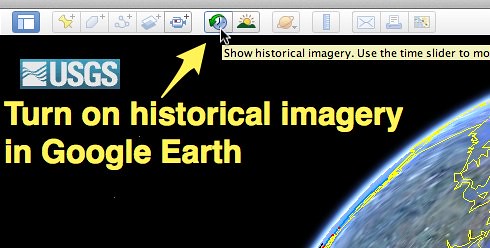
Well, I'm learning more and more. Just learning all their tools and other feature has been fun. Take a look at the 'Going back in Time' image feature where you can go back a couple decades. Definitely has been useful to researchers watching the downwards spiral of the Natural World. Check out the link below here where some amazing uses for this imaging through time are exposing the ecological disintegration of some of earth's resources.
Business Insider: "How to Go Back in Time on Google Earth on a Desktop"
Speed of Creativity
Here are some photos and images I've played around with. For example, yesterday I wrote about the documentary by CNN on Medical Cannabis. Having lived in Anza where Pot Farms were once common and two of my neighbours arrested for growing Pot for Profit, one of whom lost his entire 10 acre homestead which by Law had to be forfeited to the State, I remembered some remote Pot Farms I stumbled upon in my bushwhacking days. One most notable was found along Strawberry Creek below Idyllwild California and physical effects still visible through Google Earth. Take a look.

Google Earth
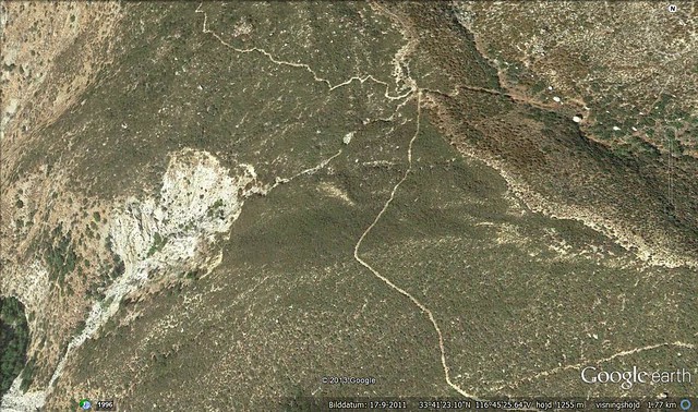
This is a Satellite view of Strawberry Creek with Route 74 at the bottom and the very west end of the Idyllwild Community at the top. Access is more difficult now, but the Pot Farm scars are still visible if you know where to look along the east side [righthand side] of Strawberry Creek.
Google Earth
Incredible isn't it ? Human created scars out in the middle of virtually wilderness. Of course this isn't the only scar on Earth as seen from Satellite in this region. Below Is another shot of the other side of the San Jacinto River which illustrates the damage cause by original Hwy Route 74 paving project and Creek diversion scheme gone terribly wrong. Well, at least from an entire environmental view and Ecological perspective. See image below.
Google Earth
This large abnormal scar along the eastern side of the South Fork of the San Jacinto River Canyon was created when a deliberate diversion was made to run the Baldy Mountain Creek due west instead of it natural and historical meandering towards the north. This no doubt saved the State Road department some $$$ by not having to build a bridge over the section for which the road crossed over this Creekbed. In old photos, this was originally a horse and wagon dirt road. No doubt washouts were a major issue which influenced this irresponsible decision. I previously wrote two post on this place with a preview (Here) and the main subject's article (Here).

Google Earth
Hamilton Creek Alluvial Floodplain in eastern Anza Valley in California. On August second I posted an article on my experiences on my two decades search looking for clues on this regions once far more extended forested areas as referenced by early pioneer homesteader descendants to the area and as well as comparing accounts from Spanish Explorer Juan Bautista de Anza who also mentioned the mountains very heavily wooded Oak Woodlands and Pine Forests. He also mentioned numerous major springs[ a few of which I know about] in the area which were reported back to him by search parties he sent out. As you can see here, the Hamilton Creek once veered to the right n this Satellite photo, as even evidenced on the ground with those two large Interior Live Oaks on the south side of Hwy 371
San Jacinto Mountains: Moving back thru Time by means of Observation

Google Earth
This is down in Nance Canyon just east of Terwilliger Valley and below the San Carlo Pass where Art and Violet Cary once owned and lived at the old Fred Clark Ranch. This is the view at present. If you google map this region and expand or pan around, you'll notice this entire valley has evidence of total past flooding during high wet years. Most new people have no clue to a historical past of a geological location as these people who have stripped the landscape and put animals and several buildings down in this wash. The change seems to have taken place between 2004 - 2005. See below.

Notice the Google Earth Time Travel feature control at the upper left hand corner. The riparian vegetation [which is rare these days] is still present in the wash. When I first came here in 1981, the entire area had numerous mature old growth Cottonwood trees scattered throughout this valley. Now there is barely a handful of any type of riparian habitat left. Oh well, none of my business of course. Just saying!

Photo image - Rick Halsey

And finally here is a visual view of an area I came back to where I met Rick Halsey of the California Chaparral Institute and his young colleague Dylan Michael Tweed. We explored that disastrous irresponsible Cal-Fire Control Burn in the San Felipe Valley areas north of Julian and Scissors Crossing inside the regions of the former 2002 Pines Fire which was started by a government agency's Helicopter looking for Pot Farms up near the top of Banner Grade and burned all the way north of Ranchita. This control burn which took place this past Spring 2013, blitzed over the previous wildfire burn of 2002. I also remember while viewing all of this and reminiscing back about the time in history when I use to travel this road back and forth to El Centro from Anza [1980s] and how lush green the entire valley was in Summertime when the Monsoonal season rains started. The hillsides all around the valley were Mesquite trees and Catsclaw Acacia, with the Acacia being the more abundant on the higher slopes. This area looked more like somewhere in Arizona, than California. The best I can do now is tell you all a story like Art & Violet Cary told me about the early days of the 20th Century up in Anza. There is no guarantee anyone will believe me.

Google Earth (2012)
Take a look at the scene here with almost everything in a dead state. This isn't dormancy, this is simply the past several years of drought and land mismanagement, along with global mismanagement which has resulted in Climate Change. The very first time I drove to this exact spot in the early 1970s was when I got my Drivers License as a young teen and there were massive riparian forests here, mostly majestic old growth Cottonwoods and Willows everywhere. The creek was full and had a heavy meandering flow, even deep in many spots. There were also fish here, large ones too, which darted when you walked past the stream's edge, although I cannot now identify them. But also mostly those small Top Minnow mosquito fish. I know I can't get anyone to believe me about this, but never the less that is what I experienced. At best all I can do now is tell you a story. If I could have foreseen the future and what was to become of this place, maybe I would have taken actual photographs to back up the story. This large dead Cottonwood Skeleton to the right is actually a relatively new comer and not one of the originals. It's incredible, while it does take thousands of years for a health productive ecosystem to develop on a macro level, it only takes 150 years to screw it up under the excuse of enlightenment and manifest destiny over natural resources. Pathetic when you ponder it really! Below I took some of the photograph series of yearly historical photo shots from the Google Earth "Way-Back-Machine"

Google Earth - Scissors Crossing (2002)

Google Earth - Scissors Crossing (2006) 

Google Earth - Scissors Crossing (2009)

Google Earth - Scissors Crossing (2010)

Google Earth - Scissors Crossing (2013)
The opposite side of the San Felipe Creek bridge also use to contain  more old growth Cottonwoods which tapered off until the flood plain became this massive region of lush native Rushes and Sedges. All of that is now gone and the non-native Tamarisk Trees have taken their place. Nothing green really exists here any longer. Everything has changed for the worse now. I have to admit, my trip over there did provide some positive examples of what I wanted to show, but more so I was disappointed at the degradation of all the various plant communities everywhere. Fires most certainly are a major factor, but most are caused by irresponsible Human error. The main thing Google Earth can do is illustrate the past to the present and perhaps in that way could be used as a major research tool. While it can record for you the downward spiral of the nature of things, it can also be utilized as a major research tool for an environmental research projects progress through time. I wish it could go back to the days of the 1800s and further, but that would be the thing Science-Fiction is made of. Still ? *sigh*