"Earth's Internet" attempts to document, reference as much of the natural world networking abilities and strategies as possible. Such Scientific findings are at odds with industrial scientific approaches maintaining our planet. Be warned. If your learning approach it based on Memes with short clever quips, you may be disappointed here.
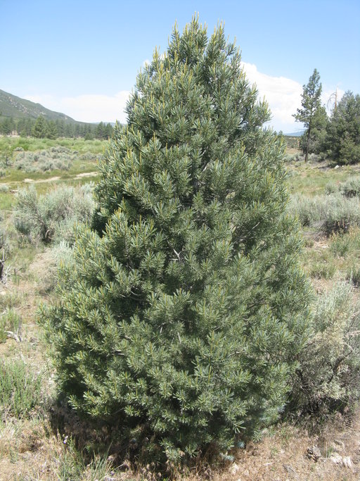
Many people living in the San Jacinto Mountains will recognize this beautiful blue-green dense foliage belonging to the Parry Pinyon(Pinus quadrafolia) pine tree. The photo evidently being taken in the area known locally as Garner Valley where the iconic Big Silver Sagebrush and Jeffrey Pine are just in the background. In fact it is this sagebrush, Greasewood, Redshank and other chaparral that are selected as a nut hoarding stash by Scrub Jays which will provide all the early nursing requirements for these delicate seedlings to reach their adolescent stage of independence. Every year during late August/September, the cones would ripen and Scrub Jays or Pinyon Jays as they are sometimes called, will harvest almost every one of the pinyon nuts they can possibly get their beaks on. Then they hoard them under there favourite chaparral cached location of which there will be many. Every Spring after the next seasons rainfall period is just finishing up, these seedlings will reveal themselves, often times pushing up through snow on the ground if it is present.
Image - pinennut.com
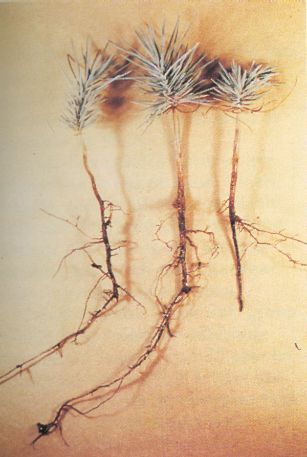
Interestingly, I done many experiments with numerous pine seeds, including Torrey Pines on my property in Anza CA. I was interested in just when seedlings would push up through the ground. Clearly during the frigid months, one would naturally expect some sort of dormancy period. I would out plant them in the the ground in late October, right as the rainy season started up in the mountains. To protect them from any predators, I'd use chicken wire screening and actually mark where each seed was placed. For me it wasn't a matter of waiting for actual breaking of the soil crust emergence of the seedling, but rather I wanted to see the exact timing of when the taproot growth broke through the nut shell. So periodically I would gently brush away soil and view the nut. Most of the actual soil breaking like the above photo and emergence of the the first immature needles would actually happen around early February, but the actual cracking open of the pine nut at it's seam with taproot tip beginning to protrude truthfully took place close to the middle of December.
Photo courtesy Jeffry Mitton. University of Colorado
A decline in the reproduction of pinyon pine nuts in the Southwest in recent decades could effect a number of different bird and mammal species, including the Crossbill seen here feeding on a pinyon pine nut.
This was true of all the various pine species nuts I planted in the ground, including the Torrey Pines. If you ponder it for a moment, it's actually a great strategy. Seedlings have to contend with soil pathogens and allelopathic chemical properties of a shrub's dander or mulch underneath the plant selected by the Scrub Jay. For the most part, even these microbes are dormant, so the emerging root has a chance to develop a healthy networked infrastructure interconnected hopefully to the mycorrhizal fungal grid which will provide a healthy antibiotics against pathogens before the actual green needles part of the plant actually pops up through the soil into the light and before soil becomes warmer favouring the awoken activity of long dormant pathogens. I discovered that the soil temperature didn't require warmth for germination, much like I discovered with my Tecate Seed germination project , which I performed in the refrigerator on a bottom shelf basically in the dark for three months, at which time the seed germ produced the swelling of the white taproot bursting through it's membrane. But each year I always had an abundant supply of newer Parry Pinyon seedlings popping up all over my almost three acres. Funny thing was, I had no mature Parry Pinyons on my actual property. But a few surrounding properties did have some bigger older nut producing trees. Scrub Jays had brought them from very far away. It truly illustrates how a habitat can spread and in the case of these heavy nuts incapable of promoting themselves in ever expanding landscapes, the Scrub Jay gets the credit. I'll have more photos of Western Scrub Jay roles in and around Chaparral when I come back there for a couple of months. I'll have another post associated with this on Western Scrub Jays later.
Image - Penniless Parenting
Now getting to the point of this post, not everything is a rosy picture for not only the Parry Pinyon. Same with most all Pinyons and most likely other southwestern pine species. From 1999 to 2003 I tried to go out at the right time and collect Parry Pinyon pine nut seeds for Mike Evans of Tree of Life Nursery. During that four year period I could fine no viable pine nut. There were thousands of cones on all the trees combined and they were loaded with the pine nuts. But the nuts were hollow and empty inside like the photo you see above. This was odd and Mike said it was common that trees wouldn't produce cones if not enough rain or drought. But that didn't make any sense. These trees actually produced hundreds of cones and have always thrived in drought dry type environments anyway. Something else caused this as yet unknown phenomena. Furthermore, this was not a drought type situation where trees were holding back through an adaptation strategy called 'Phenotypic Plasticity' responding to environmental cues by not producing any cones to conserve the health of the rest of the tree. At Burnt Valley in Anza California there were thousands of them and all with empty hollow pine nut shells. Of course this doesn't mean that somewhere on the San Jacinto Mountains there weren't any cones with viable nuts. But I went to over a dozen key areas and sampled everything around and found nothing. Thing only thing I received is hands full of pitch. All pinyon cones collectors will know what I mean. But this was also year after year for four years in a row before leaving to come here to Sweden. Going to the Forestry office and other individuals with supposedly expert background produced nothing. So I forgot about it. Well, until now. Now the news lately for Pinyon Pine & Juniper Woodland ecosystems isn't looking good and to be honest, I don't see a way out for them any longer. At least under the present System as it's headed.
Dead ponderosa pine (Pinus ponderosa), Jemez Mts, NM. November, 2013. But why even address this news when you can further read about it here if you've got the patience and interest:
But now from the University of Colorado Boulder, comes news of Pinyon Pines being no longer able to reproduce as a result of severe climate change. If high Desert ecosystems like this can't make it then something is clearly wrong and yet there are still millions of deniers with their collective heads in the sand on this one still. And this isn't even from the evil climate scientists. Here's the link with a few important quotes below.
"Creeping climate change in the Southwest appears to be having a negative effect on pinyon pine reproduction, a finding with implications for wildlife species sharing the same woodland ecosystems, says a University of Colorado Boulder-led study."
"The new study showed that pinyon pine seed cone production declined by an average of about 40 percent at nine study sites in New Mexico and northwestern Oklahoma over the past four decades, said CU-Boulder doctoral student Miranda Redmond, who led the study. The biggest declines in pinyon pine seed cone reproduction were at the higher elevation research sites experiencing more dramatic warming relative to lower elevations, said Redmond of CU’s ecology and evolutionary biology department."
"The cones in which the pinyon seeds are produced are initiated two years prior to seed maturity, and research suggests the environmental stimulus for cone initiation is unseasonably low temperatures during the late summer, said Redmond. Between 1969 and 2009, unseasonably low temperatures in late summer decreased in the study areas, likely inhibiting cone initiation and development."
"The study is one of the first to examine the impact of climate change on tree species like pinyon pines that, instead of reproducing annually, shed vast quantities of cones every few years during synchronous, episodic occurrences known as “masting” events. Redmond said such masting in the pinyon pine appears to occur every three to seven years, resulting in massive “bumper crops” of cones covering the ground."
Then of course there is the ever present domino effect on all other organisms like the Crossbill (even scrub jays) feeding off the pinyon nuts in the picture towards the top of this post.
"Wildlife biologists say pinyon-juniper woodlands are popular with scores of bird and mammal species ranging from black-chinned hummingbirds to black bears. A 2007 study by researchers at the University of Northern Arizona estimated that 150 Clark’s Nutcrackers cached roughly 5 million pinyon pine nuts in a single season, benefiting not only the birds themselves but also the pines whose nuts were distributed more widely for possible germination."
"Since each year in the life of a pinyon pine tree is marked by a “whorl” -- a single circle of branches extending around a tree trunk -- the researchers were able to bracket pinyon pine reproductive activity in the nine study areas for the 1969-1978 decade and 2003-2012 decade, which were then compared."
"Pinyon pines take three growing seasons, or about 26 months, to produce mature cones from the time of cone initiation. Low elevation conifers including pinyon pines grow in water-limited environments and have been shown to have higher cone output during cool and/or wet summers, said Redmond. In addition to the climate-warming trend under way in the Southwest, the 2002-03 drought caused significant mortality in pinyon pine forests", Redmond said.
So even wildlife like Scrub Jays dependent on the Nut production of Pinyons will suffer. No argument there. But so will other organisms dependent on their busy work load and hoarding instinctiveness for which they are known for. It's almost depressing to think I will come over and photograph & document everything that's going wrong and point out clues to what that ecosystem once was. I truly don't even know if there is anything positive to detect & report on. One thing is for certain, the Spring will not tell me if their is a good crop of Parry Pinyon nuts last season, but what will tell me is if there are numerous young Parry Pinyon pine seedlings throughout the region as was always the case. On my own small property alone there was always close to a little over 100 new seedlings and keep in mind I had no mature cone bearing Parry Pinyon on my land. I know because I meticulously combed the area and counted. So come April/May I'll be looking for examples as in the pictures below. If you are in tune with nature and know what to look for, you'll find those little blue-grey seedlings everywhere. One of the other comments from the article was this description here - "Since each year in the life of a pinyon pine tree is marked by a 'whorl' -- a single circle of branches extending around a tree trunk" -- This is true, but not always. Depending on rainfall events during the rainy season or during times of prolonged drought, I personally observed many Pinyon Pines not putting on newer growth some years, but remaining in a type of neutral maintenance stasis mode. New growth takes valuable resources and energy. If drought is severe and dryness continues, they will stay stuck in neutral for some time, or depending on their geological location in the landscape which dictates how much moisture they obtain or not. In a way, it's an amazing survival strategy when all other ecosystems are functioning properly.
young Parry Pinyon
In all of the above Pinyon seedling example will be most commonly found under most shrubs within the chaparral plant community site locations. You will see them in the springtime where fully mature Parry Pinyon or Single-Leaf Pinyon pines are present and "IF" producing cones with viable seed, but you may also find later on in late spring or early summer scenes like this below in the photo.
Credit: foresetpests.org
It is also a common occurrence to see dead seedlings brought on by something called Fusarium Root Rot which is a pathogen which causes what it called damping off in nursery germination flats if sterile conditions have not been met to rid the area of this and other similar pests. But again, it is perfectly natural in the wild and necessary for forest health. If every seedling succeeded, trees would never attain old growth majesty, they'd rather be weedy and create an unproductive ecosystem. There is also something else I want to address on this before closing and that was something that appeared in the Riverside County Press Enterprise newspaper back in 2009. I'm not certain, but I may have mentioned this somewhere before. The article was Volunteers pitch in to save special pinyon pines and it payed tribute to some well meaning nature lovers, but sometimes that love of nature can be misplaced if there is a lack or absence of important knowledge, understanding, and wisdom with habitat & ecosystem mechanism functions. I'm referring to the ignorant old school myth that chaparral brush clearance is actually viewed as helping nature in tree (even if they are decades old) establishment and this is totally untrue. Chaparral presence is actually the first stage infrastructure by which a healthy desired forest comes into a reality. Chaparral have much deeper roots than pines and pines will tap into the mycorrhizal grid under the ground and be fed nutritionally and hydrated regularly. Let me first show a couple of pictures from the article, repeat what was said and quoted from the article.
credit: Press Enterprise
Daniel McCarthy, tribal relations program manager for the San Bernardino National Forest, left, and volunteer Bob Sieski clear brush from a Parry Pinyon pine in Anza. The trees are important to the Cahuilla and Serrano bands.
image: Press Enterprise
In addition to saving Pinyon Pines in the area, McCarthy oversees an effort to plant new ones.
Now, here are some important relevant quotes and please keep in mind I'm not demonizing or vilifying Daniel McCarthy, Bob Sieskior any other volunteer who participated in this well intentioned habitat improvement projects, but the science they were using to justify this project is totally wrong. But this isn't the first time things like this have been done. Government funded programs with supposedly top of the line biologists have done exactly this. Here is the first quote:
Special Section: Inland Wildfires
"Volunteers are clearing brush from beneath small outcroppings of pinyon pine trees in the San Jacinto and Santa Rosa Mountains to help them survive wildfires."
Well right from the start, this article has a negative misdirected subtitled which is going to attempt to associate Chaparral plant community as being responsible for Wildfires which in turn will destroy the more desirable vegetation like pines and other conifers. To put a sarcastic slant on it, "It must be the Chaparral plant's "Selfish Genes" attempt at making fire happen so that it can further spread it's own DNA over the landscape and cause the extinction of better looking species for which it is both envious and jealous." Okay okay, I'm being silly, but often times to get a point across, you sometimes need to illustrate absurdity with more absurdity. Read it again:
"Volunteers are clearing brush from beneath small outcroppings of pinyon pine trees in the San Jacinto and Santa Rosa Mountains to help them survive wildfires."
Image - Craig Allen - USGS
Absolutely & totally untrue. Doing this will save nothing. At best it is done for person idea of aesthetic value and eye candy appeal and nothing more. Quickly now, take a quick glance and view the 1000s of acres of dead Pinyon Pines again in the photo at the left. These photos show the massive die-off of pinyon pines that occurred during the recent drought. Pinyons, normally evergreen, have reddish-brown foliage in October 2002 (left). By May 2004, the dead pinyons have lost all their needles, exposing gray trunks. The photos were taken from the same vantage point in the Jemez Mountains near Los Alamos, N.M. Photo credit: Craig D. Allen, U.S. Geological Survey. These Pinyons were NOT killed by fire, these were killed by a variety of Climate Change anomalies. Fire had zero to do with it. However, Control and Prescribed burns quite often targeted in the middle of nowhere will actually remove vital vegetative rainfall mechanisms which would otherwise be hydrating and sheltering the young of these pines and oaks only to self-sacrifice them later on several decades later as the succession plants take over creating that ultimate end game desired forest look.
"Over the past three years, Daniel McCarthy, anarchaeologist and tribal relations program manager for the San Bernardino National Forest, has plotted small populations of these pinyon pines and organized volunteer work parties to clear tinder-dry brush from around the base of the trees."
This is amazing. The chaparral up there is no more tinder dry than the pines they are symbiotically trying to survive with. In fact, the chaparral is far more deeper rooted and likely drawing up moisture from deep sub-soils through a mechanism called hydraulic life and redistribution. However, if the ongoing drought and climate change continues to persist, then even these mechanisms will breakdown. The Chaparral is the ONLY reason those Parry Pinyons exist up there in the first place. Of course, the next quote below is ridiculous too. Brush cleared 15 feet away from the trees will save nothing. If a mega fire comes through these mountains, everything will go up in smoke. I can tell you that from personally having been up and around where they did some of this before, is they provided a perfect environment for non-native Foxtail grasses and other weeds to move in. The ground in a pure chaparral environment is mycorrhizal and provides almost a sterile setting between all plants which generally makes it unfriendly to most weeds and non-native grasses. The other thing chaparral plant community does is provide a water transport from deeper subsoil layers of the earth and by means of hydraulic life and redistribution it are these engineering marvels which actually hydrate and protect these pinyons to maturity.
"During three recent weekends, volunteers ventured into the mountain chaparral to clear brush."
"We clear about 10 to 15 feet away from the tree," said Scott Findlay, 68, of Orange, who wore gloves and used a handsaw and other tools to hack away at the undergrowth around a pinyon on the Ramona reservation.
"It's the fuel ladder. You have got to clear out the lower rung of the ladder, so hopefully the fire doesn't climb up this tree," said Dorothy Degennaro, 65, of Yucca Valley.What Findlay cuts, she drags some distance away from the pinyon pine. The pines thrive under protective filtered light of a larger "Mother Tree."
The last part is clearly misunderstood & inaccurate, is to suggest is that only a large old mature Parry Pinyon qualifies to be labeled as a "Mother Trees". I've never once observed in all my 24 years up there (not that it couldn't be possible) any mature Parry Pinyon being an actual mother tree to any offspring. Unless of course mother tree here is being referred to as a large older mature tree producing cones and viable seed. Most all Chaparral plants have the potential to be a "Mother Tree" to not only Parry Pinyons, but even other more desirable trees like a great variety of Oaks (especially Palmer Scrub Oak) and believe it or not, the biggest most popular mother chaparral trees (or Nurse Tree/Plant) in this Parry Pinyon habitat is Chamise or Greasewood (Adenostoma fasciculatum) AND it's cousin Redshank or Ribbonwood (Adenostoma sparsifolium). I'll prove it when I come out there utilizing photography. But of course nothing like photos and first hand eye witness accounts will mean anything when it comes to evidence. Especially when a deep ingrained ideology employing religious affirmations of FAITH in "Fuel Management" as the 'final solution' against the mythical onslaught of Chaparral. dogmatically defended without facts. See photos of both farther below.
This shrub is probably the single biggest 'Nurse Plant' or "Mother Tree" to Parry Pinyon that I can remember. Why no one, nor any study has ever pointed this out previously is beyond me. Yet in ignorance, this species of chaparral and others are being removed as evil invaders which hinder the creation of beautiful forests. Far from this misguided viewpoint, these plants are the underground & above ground networked foundations for the establishment & eventual self-sacrifice of themselves for any beautiful old growth forested system in the southwestern landscape.
To be fair though, perhaps most of this misinformation comes from the Press Enterprise reporters who are always looking for a controversial slant against Chaparral ecosystems. At least in a report from Daniel McCarthy himself through the U.S. Forest Service website, he at least does acknowledge some importance of Redshank chaparral and other species as Nurse Trees.
Scrub Jay with Pine Nut was uploaded on FineArt America on November 14th, 2015.
I'll do a couple of posts separately on both Redshank and Chamise. In that region between the Anza Valley floor and Thomas Mountain ridge running all the way to the Hwy jct 74 & 371 at Paradise Corners, I'll photograph several very steep dry southern facing slopes with nothing but Chamise or Greasewood and hundreds of 3', 4' & 5',6' foot tall Parry Pinyon pines. The seeds didn't blow there, that's impossible. They were deliberately planted there by Western Scrub Jays during seed & nut hoarding season along with Palmer Oak acorns. Although normally, I've only found Palmer Oak mostly under Redshank. This has always led me to ponder weather or not Scrub Jays specifically pick and choose different species of Nurse Plants for specific seed collected. No matter, it should be fun.
Photo by J. E.(Jed) and Bonnie McClellan
This Chaparral Species above is likewise often vilified and demonized as impeding the growth of forests, when in fact it is a true 'Mother Tree' or otherwise known as 'Nurse Plant'. It has been complete ignorance of this that has actually hindered and doomed many a well meaning forest restoration program.
Oh, and all is not finished when it comes to Parry Pinyon or any other Pinyon for that matter and Juniper trailing not far behind. Incredibly, they have more worth as mere raw biomass materials for Bio-Diesel Ventures. They are actually considered invasive and impede Cattle Operations and removal is essential for the land to be productive once again. This article below is about the issues of Nevada, but Arizona is not far behind. As stated at the outset, for me personally, the problems for Parry Pinyon were just the beginning of what has gone wrong with scientific progress when shackled and motivated by both political and big business interests.
By Ken Cole Wildlife News
Pinyon and Juniper trees, demonized by ranchers, miners and water mining entities, are being eyed by Chinese "biomass" companies with backing of political leaders like Harry Reid who's supposedly part of the Green Party gang. This is yet another removal of weather system mechanisms by human agents for profit.
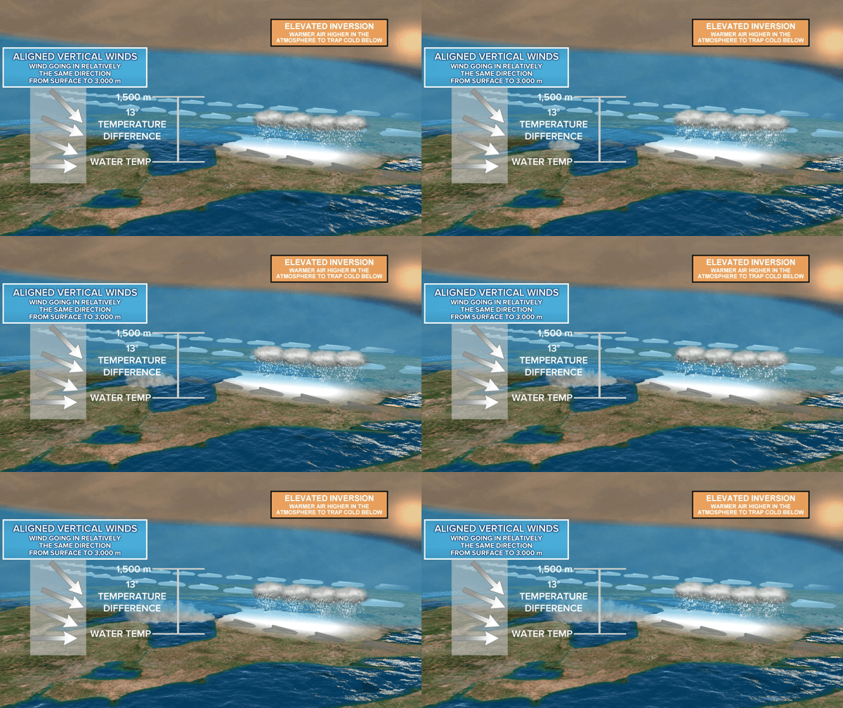
Perhaps many of you reading here have heard of this fascinating, quite often a localized geographic location phenomena called "Lake Effect" ? For example, the city of Buffalo in New Your state which is located on the eastern shores of Lake Erie gets this common anomaly in the form of what is called "Lake Effect Snow". Looking up the definition of this on (weather.com - 'lake effect snow') we see that a large body of water can have a massive influence on the influence of climate and rain precipitation totals on land masses even at some distance away from the large body of water. But there is also something called"Lake Effect Rain" as is illustrated in this animation below. For information on this natural phenomena, here is a link to a New website for the city of Toronto Canada.
City of Toronto News
This is really a beautiful example of lake effect cloud formation over Lake Michigan. Keep this phenomena in mind as it will help you appreciate what I am going to post about next on some newer findings of California's irrigated lands in the Central Valley having effect on rainfall totals in other areas like the 4 corners states (Utah, Arizona, New Mexico & Colorado). I know, almost hard to believe, but it's really interesting.
Lake-effect snow process - NOAA
NOAA-GOES-8 visible animation shows a lake-effect cloud plume over Lake Michigan's wamer water during the morning hours with heavier clouds with snow later on.
With some of this info above in mind, that takes me to an article I read around the 1st of February 2013 in Science Mag online entitled: California Irrigation Changing Weather Patterns in American Southwest which spoke of California's Central Valley being heavily irrigated for agriculture where much of that is going towards evaporation and actually influencing weather even a few states away. You can read the entire article from the link above. I'll quote just a few important paragraphs to point out some pertinent issues and some personal conclusions I've had and always wondered about with ancient Lake Cahuilla in Riverside & Imperial counties of southern California.
"Every year, several cubic kilometers of water are supplied to the Central Valley's fields, about 60% of it from river flow diverted into the region and the rest from wells. A significant amount of that liquid evaporates from fields rather than nourishing crops, says James Famiglietti, a hydrologist at the University of California (UC), Irvine. That boosts humidity in the valley, according to previous research, but scientists haven't evaluated its effects farther afield."
This schematic shows the “anthropogenic loop” in the summer water cycle in the U.S. Southwest, as revealed by computer modeling that compared current levels of irrigation in California’s Central Valley to a scenario in which no irrigation takes place. The blue arrows represent changes in the amount of water vapor that is transported into and out of the Southwest, while the red arrows show the processes of evaporation, precipitation, and runoff within the region.
"The extra moisture boosted rainfall as far away as western Nebraska and the panhandle of Oklahoma, the team reports in Geophysical Research Letters. Most notably, parts of southern Wyoming and the Four Corners states—Utah, Colorado, Arizona, and New Mexico—received between 4 and 14 millimeters more precipitation each June, July, and August. Overall, that boosts summer rainfall in those areas by 15% above average, which in turn increases runoff into the Colorado River by 28%."
So that was interesting. They are speculating that such massive quantities of water evaporation have a strong influence on weather hundreds of miles away. They mention the influence of wetter weather in western Utah, Wyoming and Nebraska and that would make sense as these areas are along the same level, but the actual four corners region is much further south and they were talking about increases in rainfall in July/August which would translate Monsoon Season. But then I also know that most Monsoonal Moisture comes up from Mexico in the summer time, not necessarily from the west and north. Here now this next paragraph gives us something of a hint which even more intriguing as far as water source influence over the four corners region of the southwest. Take a look below.
But not all of the enhanced rainfall comes from California moisture, the team notes. As water vapor in the air condenses, it releases prodigious amounts of heat. When that hot air rises, it creates low pressure at ground level in the region surrounding the storms and draws in moist air from surrounding regions, including the Gulf of California (also known as the Sea of Cortez) and the Gulf of Mexico. "The added moisture really fires up the storm cycle" in the Southwest, Famiglietti says.
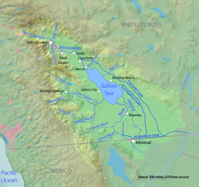
Map of the current Salton Sea boundaries and outline of Lake Cahuilla at its peak size as well as locations of major area faults
Okay, so that helps, but it also triggers something I've always pondered over as far as any type of weather influence of the very large ancient Lake Cahuilla. Many years ago in one of my 1980s issues of Arizona Highways magazine there was an article on Salton Sink and an old west era scheme that was proposed on diverting the Colorado River or opening a canal to the Sea of Cortez and filling up the basin to capacity which was thought would moderate Arizona's hot climate. Of course this never happened and the present sea was created through an error in bringing irrigation water to the valley for farmer around 1904 or 05. But it got me thinking about the weather cooling effects of just such a large body of water on areas east. This same magazine had also published articles of how Science had determined that western Arizona which is less vegetated now than near Tucson's green living Sonoran Desert at one time was much like that present area today, with even some of the higher desert mountains having some Pinyon and Juniper woodlands on this landscape.
Okay, so I have always wondered not ONLY if this ancient sea or fresh water (maybe brackish) lake had an influence on western Arizona desert, but also if it had an influence on the four corners Colorado Plateau region where the Anasazi lived and possibly influenced the climate there when it was in it's heavier forested state. I know there are numerous accounts and circumstantial evidence of Anasazi deforestation and mismanagement of the land, but could also the time frame of the Lake's disappearance have even exacerbated the problem even more ? There is evidence from what I've found to suggest just that. First, let's deal with western Arizona. For years I have traveled Interstate 8 from middle 1970s to 2000s. When I travel I am a freak for picking up on vegetation anomalies. There are places along both sides around Sentinel, Dateland and other locations where foot high to two foot high Saguaro Cacti pop up out of desert varnish volcanic rock on flat to rolling surfaces. Now knowing the life cycle and what is required for Saguaro growth success, I know that they need a Nurse or Mother tree to make it in early life, otherwise it's a no go. So how did these get placed where they are ? The are skinny, scarred and barely hanging on. If you've ever stopped at one of those novelty shops and purchased a packet of Saguaro seeds, with the small red clay terracotta pot with sand and planted them, then you will recognize the delicate ice-plant figures like the ones in the photo above. But delicate plant seedlings like this are in no way going to make life through the first few weeks or months, let alone the first year and many years after that. I'll have photos of these come May 2013. But clearly life and the desert ecosystem in this region from Gila Bend to Yuma was much more different than at present.
anzaborrego.net
Now let's jump back to the time period that the history of the existence of the ancient freshwater Lake Cahuilla. What is known about the entire western North American in states like California, Nevada, Utah and other similar regions, there were countless lakes left over from massive flooding events, perhaps even involving some type of melt-water from Glacial ice sheets. Many of these ancient lake and/or sea basins still exist today with evidence of their past. Here above and to the right is a map of an ancient lake and inland sea map depicting a wetter time period which clearly would have had a great influence on the great abundance of plant and animal life living at that time. You can see how much bigger the Great Salt Lake of Utah was back at that time and the much larger Salton Sea or Lake Cahuilla at the bottom left. At one time when filled to capacity, it overwhelmed the Cites of Mexicali, El Centro and all the way up to Indio/La Quinta. Now scroll back up to the top at the illustration of the San Joaquin Valley evaporation influence on those Four Corner States. In your mind's eye, move that blue arrow lower to the area of Ancient Lake Cahuilla area and point it in a east and northerly direction. The study indicated that the central valley irrigation influences summer monsoonal rains. I also know for a fact that the majority of the monsoonal moisture comes from a southerly sub-tropical flow straight up from Mexico and other points south and further facilitated by a High Pressure system strategically located in just the right location to maximize this Expressway of water vapor to just the right regions of the Colorado Plateau. Through in the huge presence of a Lake Cahuilla, and you have a recipe for a landscape that benefited greatly the extremely healthy Forested ecosystem AND productive agricultural ventures of those ancient Anasazi peoples. But eventually something change in both a loss timeline of ancient Lake Cahuilla and the unproductive environment for agriculture and other environmental impact for the four corners region. Let's see if you don't agree and pay close attention to some dating variables
image by James Q. Jacobs (Wikimedia)
Pueblo Bonito village is located in a New Mexico canyon region where there was a source of water for their agricultural ventures.
I've looked up a number of references on both subjects on the rise and fall of both Anasazi culture and ancient Lake Cahuilla. It's uncanny how closely identical and almost exact these time dating periods truly are and given the latest scientific research on the physical influence of water evaporation from as far away in California's Central Valley to this four corners region, it would be safe to conclude by means of the circumstantial evidence that this ancient Lake Cahuilla had just such a great an influence on this southwestern climate. Maybe that early old west pioneering hair-brained scheme of flooding the Salton Sink again wasn't such a lame idea after all. The artist's conception of a lush vegetative landscape & environment around and other Pueblos in this region is not an exaggeration. Many of the studies agree with this picture as I'll quote you below and list references at the bottom of this page. Let's first visit the timeline for these ancient peoples introduction and existence, and later demise from this region. Of all the readings I've found, they appeared on the scene early on in the historical period referred to as Before Common Era or (BCE) as you can see below in the quote. The main import of information from this quoted study however and focus of the quote for me is that highlighted in the green.
(*See also Dating Method challenges & problems exposed just this past year as revealed by Science itself, I'll explain why below in the footnote).
Origins and Agricultural Beginnings: 11,000 BC: first humans reached the Americas with colonization of the New World from Asia by peoples ancestral to Native Americans (this theory is disputed by some Native American communities). Agriculture arrived from Mexico, where corn (arrived 2000 BC), squash (800 BC), beans (later), and cotton (400 AD) were domesticated. By AD 1, Native Americans were in residence in villages in the SW, and were primarily dependent upon agriculture with ditch irrigation. Their populations exploded until the retrenchments began around 1117 AD.
Mostly I want to pay particular attention to the dates AD 1 which begins the Common Era or ( CE ). Taking the upwards progress of the Anasazi civilization and growth along with increased technology and crop introductions from Mexico, many of the sites with references to dating propose similar time frames when speaking of the peak of Anasazi culture and the turning point in it's demise. As the same reference from http://www.chacoarchive.org continues to explain the successive progress of Anasazi by dates:
Flourished from AD 600 until 1150-1200, deeply advanced, largest buildings in pre-Columbian North America
Today: treeless landscape, deep-cut arroyos and sparse low vegetation
Completely uninhabited except for NPS rangers’ houses
AD 600—lived in underground pit houses, like other SW Native American communities
AD 700—invented techniques of stone construction
AD 920—Pueblo Bonito: two stories, ultimately five or six stories, with 600 rooms, and logs as roof supports weighing up to 700 pounds
From all of the references I've combed through, though there are different varying dates for several things, all appear to agree on an exact point of change in climate & collapse of the Anasazi Kingdoms into fracture warfare factions and cliff dwelling settlements at around that date above of 1117 AD or (CE). This was more of a result in horrible mismanagement of their agriculture practices, but climate certainly factored in. As the Chaco Archive site stated:
"water management and use of channel irrigation resulted in deep arroyos around AD 900. With water levels below field levels, irrigation was impossible until arroyos filled again. Arroyo cutting develops very suddenly."
Now I don't want to get far off track of my original reason for posting this piece. I'm fascinated with the phenomena of "Lake Effect"(I'm actually a mechanisms freak), the recent article on California Agricultural evaporation effects on rainfall hundreds of miles away in other states east and the possible Ancient Lake Cahuilla in a massive "Sea Effect" hydrological phenomena of points east not far back in recent history. There are other evidence reasons for believing in a much more vegetated and biodiverse landscape in this region as illustrated below from the the U.S. Geological Survey website and it's archive about what researchers found in Pack Rat middens. I'm also providing similar landscape morphological animation views from the Texas Parks and Wildlife Department which serve to illustrate change in vegetation ecosystems due to climate shifting.
Images courtesy of Texas Parks and Wildlife Department
Changing scene. Based on findings from pack rat middens, this artist's conception shows what Hueco Tanks may have looked like some 12,000 to 14,000 years ago (far left), some 9,300 years ago (middle) and as it appears today (right). Colorado pinyon needles found in the oldest middens imply that Hueco Tanks was cooler and wetter 14,000 years ago. By 9,000 years ago, the climate had become more arid and the pinyons disappeared, leaving a juniper-oak woodland. Today Hueco Tanks is dominated by xeric grasslands and desert scrubs. However, Arizona oak and juniper still remain in localized, sheltered sites. The photo animation on the right is of Horseshoe Mesa in Grand Canyon National Park and the enhanced animation of what it once looked like just a few thousand years ago is based on evidence found in a large collection of discovered ancient Pack Rat Middens found throughout the western States. This link below and others from the U.S. Geological Survey website are fascinating in what they found. Fossil Packrat Midden Database. In these packrat middens were found collected and scavenged material of pine cones, Pinyon needles and other plant material not present today. The above site continues with regards the Anasazi's own deforestation activity of their environment. But this would be coupled with natural phenomena events from volcanism at this times as well.
deforestation.We know there was deforestation because of the chemical composition of the packrat middens. Packrat middens were first found in 1849 by gold miners who thought they’d try eating them—they’re sweet but make you nauseous because they’re full of dried rat urine, rat feces and rat garbage (packrats gather sticks, plant fragments, mammal dung: the dried urine cements it all together into a tempting ball). The midden can be radiocarbon-dated. They found pine needles in the middens in 1975 in middens collected at the NPS campground near Pueblo Bonito. They knew, then, that the middens were over a thousand years old, and that there had been a pinyon pine and juniper forest within yards of Pueblo Bonito at that time. Middens dated to before 1000 AD still had pine needles in them; after that, they do not. Chaco Canyon was quickly deforested because it is a dry climate where the rate of tree regrowth cannot keep up with the rate of logging.
Now this all brings me to the history of the ancient Lake Cahuilla, presently known only as the Salton Sea. So what's the time frame here with regards this ancient lake and the possible influence it may or may not have had ? Again, like the subject of the Anasazi people's civilization, dates and personal researcher bias and takes on events vary, but the dating is all pretty close to Anasazi sites. The peak of the Lake Cahuilla is said to be around the year 900 AD (CE) and it appears agreed upon that the demise of the Lake comes around 1600. Keep in mind people, this is ONLY a spits distance in time frame of Earth's possible geological history, so it's clear that things can change fast, but clues can be found. The Anasazis seemed to have peaked also then, but through various land mismanagement practices went down hill from there. There also however may have been a downwards decline along this same timeline of Lake Cahuilla's timeline. Last year we had reported some incredible info on the last Eruption of the Salton Buttes volcanoes at the southern end of the Salton Sea. Incredibly, the previous date given was that they had last erupted 30,000 years ago, but newer evidence puts the last eruption between 940 AD to 0 BC. That's a huge correction, but makes sense considering this could have been the possible reason for the lake's demise. The major San Andreas Fault line runs directly under this exact area. Certain questions now come to mind. Could the original Colorado Delta have in any way been more westerly located or pointed towards Imperial Valley ? Could a major Earthquake/Volcanic event have uplifted the landscape and allowed some of the flow from that river to head towards it's present course to the Sea of Cortez ? If we at least take that younger date of 940 AD (BCE) the flow seems to have at least been slowed down a bit with some runoff still entering. It's complete demise is said by most sites to be 1600, maybe a little later before being completely cut off.
Credit Wikipedia
Sunset Crater northeast Flagstaff, Arizona
Indeed the entire southwest region of the United States had perhaps several volcanic events, as even in Arizona, the area called Sunset Crater northeast of flagstaff is said to have erupted around AD 1064 - 1065 judging by tree rings of the region and archaeological evidence puts it at AD 1085. Coincidence ?????? Well, hmmmm = California Lake Effect, Anasazi civilization, deforestation, Lake Cahuilla demise, Salton Buttes eruption, Sunset Crater, most of the dates agree ??? There are also strong scientific reasons that the lake stuck around for quite some time in this hot desert region also has some very strong circumstantial evidence.
Cahuilla Indian Fish Traps - TomTeske
Take a look at the picture of this ancient Lake Cahuilla shoreline which is south of the city of Indio California. This is an area at the extreme south end of Jackson Rd and west of the Date Shop called Valerie Jean on old Hwy 86. I have actually been here. This particular photo was taken in 1929 and further info about ancient lake Cahuilla may be found on UCSD'd website below in references. On an interesting note about this area, how long would it have taken for this lake level to decrease in this hot desert environment ? Each of those terraces represent dropping water levels where the Cahuilla Indian's had to build newer and newer fish traps as the lake level dropped. Would it have been decades apart ? Or hundreds of years in some cases ? Who knows for sure, but the Cahuilla accounts place the last use of their ancestors using this lake at around 400 years ago, which by then would not have even been a very lake lake as in former times. Still with gradual water level drops, so would surrounding climate begin to change.
credit photo: Christopher Richard
I also wrote last year about a researcher named Christopher Richards from Berkeley area who has a site where he retraces Juan Bautista de Anza's 1770s exploration trek across the southwest following riparian water courses. His blog follows the exact route taken by Anza across the southwest where water would be readily available. At one blog entry he reaches the dealt outlet for the San Felipe Creek which comes from the mountains of San Diego County and also has several tributaries like that of Coyote Canyon which flows from the San Jacinto Mountains where I use to live. Now when you read his story at this point, he is strictly looking for exact features written about by Anza in his famous diary. Anza spoke of rich riparian vegetation and springs everywhere in this ancient delta region which for the most part no longer exists as a mighty river delta as the picture above reveals. But the description found in Anza's diary paints a whole different picture. There is the obvious geological physical evidence when viewed from space of the extensive splitting of San Felipe Creek or River into multiple tributaries within the delta like any other delta. But of course most of this is absent. Richard's even cites a U.S. Gov Document where evidence of bio-diverse richness once existed in this marsh delta with even Jaguar having said to be present. Again today, no such habitat even remotely exists. Here is a link to Richard's blog and the account:
Once abundant freshwater Seashells buried in sediment within the once strong flowing Arroyo to Lake Cahuilla.
There is a region of the old San Sebastian Marsh or San Felipe Creek river delta called Harper's well. Christopher Richards even writes about and even photographs many of this findings there which indicates strong water flows and abundant freshwater life there that once existed. It's so terribly sad to realize that all this abundant richness of life once existed at this ancient sea which also influenced the surrounding mountain chains with richness of bio-diverse vegetation plant community systems. I actually wrote Richards giving him some tips on the underground hydrology of Anza Valley which dams up at the western ridge-line of hills at Lake Riverside and actually backs up and flows out through Coyote Canyon. Even though surface water does flow out towards Temecula, that is not the case of the underground system. My finding this out was through another one of my inquisitive visits with a now long since dead retired geologist from the area when I first moved there and who lived in Terwilliger Valley. It was actually a US Government Hydrological survey reporting investigating just how much water flowed through Camp Pendleton on it's way to the Pacific Ocean. Here is a post I ran on the UCSD's Mesquite Dune Projectwhich was located near San Sebastian Marsh or delta off Hwy 78. At the bottom are some good aerial shots of the delta.
The map above is placed there to remind me of the many tributaries that probably greatly influenced the maintenance of the ancient Lake Cahuilla way back when. I'll be taking many photographs this April/May of these areas to illustrate evidence of a wetter period not that long ago in geologic time frame. I remember reading Juan Bautista de Anza's famous expeditionary diary which you could check out of a Riverside County Library. The description of him climbing out of the desert through Coyote Canyon and through the San Carlos Pass which runs through the old Cary Ranch, and describing Anza Valley as a lush green paradise seemed odd back then as no such scenic views existed when I first moved there. In the beginning I laughed and chuckled and joked about this for no other reason than my first moving there I considered perhaps a mistake. Little by little though I began exploring this area and found evidence that such a huge forested plant community did indeed exist and it was very extensive and at much lower elevations. I'll stop here for the moment, as i don't want to get into that right now. I need photographs of the exact locations of mummified forests stumps and logs and the explanation of where and how it all went wrong. Retracing though the effects of moisture on an environment, cloud formation and a host of other phenomena, that original article of California's irrigation evaporation influence on states east actually had an ancient corresponding component to it's present phenomena. Back then in the early pioneering days, the Kern River ran full of water, as compared to the almost dry wash it is today. In fact if you research the history of the place around Bakersfield, large Steamboat Ferries traveled up from San Francisco with passengers and freight. No such a thing is possible now. Most rivers are dammed up in the mountains. Even the large high desert lakes of Mono and Owens Valley before Los Angeles tapped everything would have been formidable influences on climate. Steamboat Ferries are said to have also been on those lakes in the old days. The very idea would be a joke today. Never the less, during the days of ancient Lake Cahuilla's past, all such inland seas and lakes would have had a large influence on a more moderate climate way back when. If anything, we can learn from the past about how nature actually works and what is going on now. Unfortunately ever since World War I, things have rapidly deteriorated to the present. Amazingly, there are skeptics to all of this. Stay tuned, I've got a future post on the timeline for this change and the mechanisms which played the major part for change.
~~~~~~~~~~~~~~~~~~~~~~~~~~~~~~~
One special note about ancient native peoples. They were human beings just like everyone today. There appears to be this white European guilt trip which creates a romanticizing of them as some sub-human animal-like species within historical ecosystems of the ancient past who were the ultimate land stewards. I don't view them as such. In other words they were completely equal to the white Europeans they encountered. They were and are human beings with the same failings and imperfect traits which motivated them to change their surroundings as modern people have done presently. Yes I do respect them for their knowledge of the land and living off of it. My appreciation of their uses of native plants is what got me interested in southwestern Botany. But like Europeans they also displayed the ability to war with each other and abuse the environment for their own economic reasons. When people try and dismiss these past failings, we lose learning about and from the past and where things went wrong ecologically. There is clear evidence other many important factors and many appear to want to re-write history as an act of misplaced kindness and it doesn't help our own understanding of the past with the present. Okay, flame on I guess.
~~~~~~~~~~~~~~~~~~~~~~~~~~~~~~
*Footnote: There have been several interesting articles published recently about strange anomalies and other challenges which bring into questions potential problems with various dating methods. I won't go into nor debate them here, but merely allow readers to view them from the links here. However, though there are many papers on both subjects (Anaszai decline & Lake Cahuilla decline) which offer their own flavour or take on actual dates, they pretty much fail within the same range. Let's face it, there was no one carefully recording anything as we know it today, but much of our speculation and guess work comes from mere scientific inference. Nothing is etched in stone, but it's safe to say that all are pretty much in the same ball park on this. Still Science is finding strange anomalies in dating methods that are calling some dates of events into question.
There was a NASA Satellite timelapse video posted with regards the Earth and weather pattern anomalies. However, the reason and subject for why this was posted had zero to do with weather patterns. But what I noticed in the first four frames are what I am assuming is the southerly Somali-Ethiopia monsoonal current pattern which carries moisture north, but not necessarily in the form of clouds, as is often the case with the Mexican monsoonal pattern which flows into the southwest. Once this moist warm flow interacts with the electrical conductivity of deeply rooted old growth vegetation and the aerosols they release at the same time, only then do the clouds form and create storm systems which even travel 100s of miles away. Eventually someone is going to get this. Once again, please pay close attention to the first four frames and notice where western Saudi Arabia is and the vegetated mountain range running along the Red Sea between Yemen and Jordan. Especially in late afternoon before the sunset horizon reaches that point, each day there is an explosion of clouds and then stretching all the way to Iran. Such important geological locations should be preserved and not allowed to be deforested and remain intact. Also, other important regions should be targeted and replanted to create weather systems which will effect weather down stream in agricultural areas. If they really are serious about Climate Change, then they'll start redirecting where the conversations are headed.
Below is the start of this original post February 2013
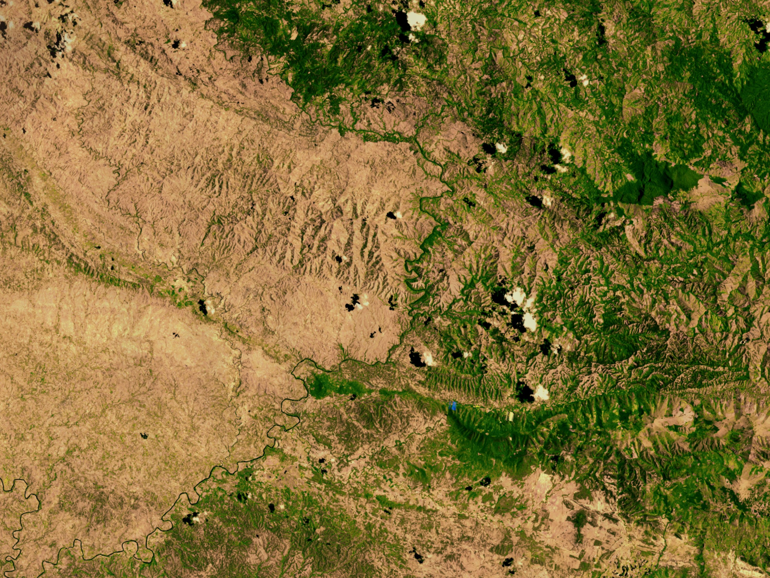
I was just briefly looking up some pictures of the Haitian Deforestation problem and stumbled across a picture of something that caught my eye. I've written several posts on the ability and actual necessity of health fully vegetation ecosystems and the relationship between these plants and cloud formation and rainfall. While I have seen many of the moon-scape photos taken of Haiti's terrible problem with stripping completely bare the land by either greedy commercial interests or just plain desperate poor people through lack of education trying to survive and provide for their families. But something clearly unusual captured my attention this time. On the left of this photo from Wiki-uploads is Haiti which is pretty much bare. To the right is Dominican Republic which though not exactly perfect in their custodianship of the land either, they haven't gone as far and still have a good measure of vegetation cover on the ground. In the old days before European occupation and exploitation of natural resources, such a view from a Satellite would reveal a solid lush green-scape. Now look at this photo and notice where most of the clouds are located. The first photo of the same region is from a site called Logic Manager along with a well animated enhanced borderline and comments.
Credit: New York Times
To illustrate this difference let’s look at this satellite image of the border between Haiti and the Dominican Republic (DR). The two countries share one island and the same goal of preventing deforestation, but their differences of execution are yielding very different results. As a matter of policy both countries claim addressing deforestation is a priority. However Haiti’s once lush forests are turning to desert while the DR has effectively preserved the value of its natural resources. The difference is in aligning activities with governance policy. While both countries share a similar policy, the DR has aligned its activities with its governance policy. Now the purpose of the above photo is to show vivid contrast along the bold white borderline, and you can see some of the cloud formation puffs visible with their shadows underneath on the land itself. Now let's look at the Wiki-Upload Photo. I'll provide the actual link to that photo below and you may magnify it greatly on the map with the zoom symbol.
Now the above link has a much larger full page view of this same area and with far more clarity. You can click on it to reveal the close up views of the white puffs of clouds forming over the landscape. You'll see the shadows of those cloud formations on the landscape. Notice that there are some on the right hand side of the photo which is the country of Haiti, but on closer inspection they are over green patches and even over some of the river valleys rich in Riparian plant community. The in the upper left hand corner of the photo does show some larger clouds in Haiti, but nearer the border and over the ridge-lines, which even takes place in Desert areas. Geology is also important in this instance. It should also be noted that the cloud formations are NOT the result of a tropical storm system like a Hurricane powering it's way through or even the remnants of a system. These are clearly clouds which form during the day during a monsoonal flow of moisture from humid tropical air as it passes over land reacting to the negative electrical discharges given off by vegetation along with the various aerosols which add a nuclei particle component for the invisible gaseous water vapor to form droplets which makes up any cloud.
Further Update: July 23, 2014
Emissions from forests influence very first stage of cloud formation
(NASA image courtesy Jeff Schmaltz, MODIS Rapid Response at NASA GSFC )
"These clouds are almost certainly a result of evapotranspiration. The clouds are distributed evenly across the forest, but no clouds formed over the Amazon River and its floodplain, where there is no tall canopy of trees. While water may evaporate from the Amazon River itself, the air near the ground is too warm for clouds to form. Trees, on the other hand, release water vapor at higher levels of the atmosphere, so the water vapor more quickly reaches an altitude where the air is cool enough for clouds to form. When water vapor condenses, it releases heat into the atmosphere."
"Clouds are the largest source of uncertainty in present climate models. Much of the uncertainty surrounding clouds' effect on climate stems from the complexity of cloud formation. New research sheds light on new particle formation -- the very first step of cloud formation. The findings closely match observations in the atmosphere and can help make climate prediction models more accurate."
I don't have much more to point out, but I hope others will keep an eye out on such phenomena and post it here. I've written about the various mechanical components of cloud formation before over land, but I understand this is probably a boring subject for most since very little interest has been shown. Not surprising since our planet's sad state of health reflects a lack of any interest in such things whatsoever. But pay attention as these things are far more important towards this planet functioning properly and sustaining life on it. You can very any of my archives here as I see no need to re-post them on this page. Keep in mind that I'm specifically talking about cloud formation that has ZERO to do with storm clouds coming in off oceans. Thanks for listening.
The headline here inSweden from the pages of the University of Gothenburgread like this:
Mixed forest provides beneficial effects
"Forestry and nature conservation can benefit from promoting more different varieties of trees, according to a new study in which researchers from the University of Gothenburg, Sweden, were involved."
Image . Gothenburg University
"Modern forestry is based largely on monocultures – usually pine or spruce trees in Sweden – mainly because this is seen to be more rational. However, a forest also contributes ecosystem services other than just wood production, such as biological diversity, carbon sequestration and berries."
Mixed forest provides beneficial effects
"A new study by the Swedish University of Agricultural Sciences (SLU) and Future Forests shows that – in comparison to monocultures – mixed forest provides beneficial effects for a number of different services, including tree growth. Thestudy was led by Lars Gamfeldt from the University of Gothenburg."
“It has often been suggested that a high diversity of tree species has a positive impact on ecosystem processes,” says Lars. “But until now, this relationship has mainly only been analysed for one process or ecosystem service at a time.”
"The study, which was carried out by an international team of researchers, is based on data from the Swedish National Forest Inventory and the Swedish Forest Soil Inventory. By examining the importance of the presence of various tree species in relation to six different ecosystem services (tree growth, carbon sequestration, berry production, food for wildlife, the presence of dead wood and biological diversity in ground vegetation), the study was able to show that all six of these services had a positive relationship to the number of tree species."
Different tree species contribute different services
"For example, the biomass of spruce is linked to high tree growth and the biomass of pine to berry production, while higher levels of carbon sequestration occur in areas with a larger amount of birch. In order to increase all these services, forestry may therefore need to make use of more varieties of trees. Other studies of forests in central Europe, the Mediterranean region and Canada back up these results."
"The study also investigated the relationship between the individual ecosystem services. For example, high levels of tree growth appear to have a negative correlation with the production of both berries and food for wildlife, and with the presence of dead wood. On the other hand, there was a positive correlation between food for wildlife and both berry production and biological diversity in the ground vegetation."
Lars Gamfelt
“It’s not just a simple case of always getting more of everything,” explains Umeå University’s Jon Moen, “Sometimes you have to strike a balance between different ecosystem services.”
Challenging Accepted Opinions
"The new study has been published in the scientific journal Nature Communications, and goes against accepted thinking within Swedish forestry to some extent. “Our findings show that both forestry and nature conservation could benefit from promoting more different varieties of trees, thereby providing a greater diversity of ecosystem services,” concludes Jan Bengtsson from SLU.
Future Forests is a collaboration between SLU, Umeå University and the Forestry Research Institute of Sweden (Skogforsk), and is financed by the Swedish Foundation for Strategic Environmental Research (Mistra), SLU, Umeå University, Skogforsk and the Swedish forest industry.
Contacts: Lars Gamfeldt, The University of Gothenburg, +46 (0)70 3393921, lars.gamfeldt@gu.se Jan Bengtsson, The Swedish University of Agricultural Sciences, +46 (0)70 2335118, jan.bengtsson@slu.se Jon Moen, Umeå University, +46 (0)70 2271513, jon.moen@emg.umu.se
This also comes along with another release of similar News Reports on information about how plants actually help each other during periods of stress as opposed to competing in some Survival of the Fittest game. Brown University on January 20,2013 had this on their website as a headline. Decades of studies support and confirmed the "Strees Gradient Hypothesis"
Abstract: "The Stress Gradient Hypothesis holds that as stress increases in an ecosystem, mutually supportive interactions become more significant and negative interactions, such as competition, become less so. The idea has been hotly debated but is now backed by a review of hundreds of studies co-authored in Ecology Lettersby Mark Bertness, professor of biology at Brown, who first formally proposed the hypothesis in 1994. The time has come, he said, to test its application and predictive value."
Credit: Bertness Lab/Brown University
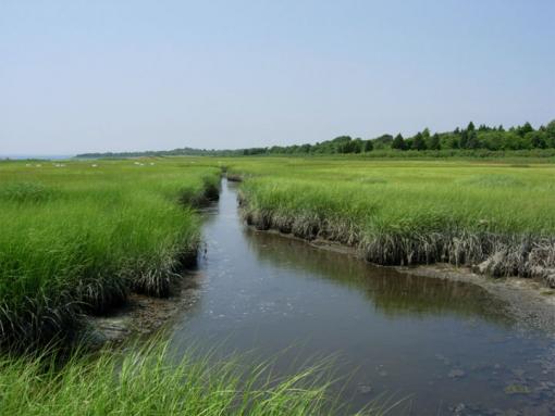
Survival in a Cape Cod Salt Marsh
"In isolation, seaweeds and barnacles could never survive the heat stress above the tides, but they can persist in groups. Organisms under stress - even competitors - are better off together than apart."
The entire article is fantastic in showing that the mutual cooperation that actually exists is truly the rule as opposed to the exception. This concept of "Survival of the Fittest" has hindered our understanding of the natural world more than it ever helped. The photo to the right is an example of how nature is often portrayed on the many science entertainment channels cloaked under the guise of Science like the History, Nature, National Geographic, Discovery and other channels. I've never seen so many shows now springing up where there appears to be dozens and dozens of individuals whose celebrity ambitions are to be the next big Crocodile Hunter wannabe. People should understand how numerous the filming takes are on those shows to pull off the desired defense reaction by the animal. Having the opportunity to narrate some short 15 minute documentaries and the 3 hours of separate takes to get it right, I can only imagine the countless intimidation and tormenting techniques used by the camera guys and their assistants to create the desired angry reaction from a poisonous viper or some other animal that has to be teased into that perfect strike. You know, when you have nature presented in such a way, the average person is not going to go out and show respect for taking care of Nature. Oh yes, the shows are entertaining like most of the Hollywood violent entertainment dishes out, but it's not truly reflective on how Nature really operates, as these recent research articles lays bare. Okay, when it comes to "Survival of the Fittest", I get it. I mean the fittest Sequoia Redwood seeds will do better than those from a sicklySequoia Redwoodtree. I think everybody else gets that too. But both these articles remind me of something I've posted before and bares repeating again. This was the short documentary film by Professor Suzanne Simard and her research on Mother Trees of the forest.
"These plants are not individuals in the sense that Darwin thought they were individuals competing for survival of the fittest. In fact they are interacting with each other trying to help each other survive." Professor Suzanne Simard
Well, let's getting back to Sweden. While I find this positive, there are also some major negatives going on here as well with regards their Government's blessing of Industrial Forestry Programs with regard to the paper pulp technologies. I'm referring to a Genetic Engineering company giant here called SweTree. The restructuring of a tree's genetics makeup to produce less lignin for the paper pulp industry. This lignin is what makes the tree's wood strong to hold up against the storm elements. But this GMO weaker tree has gotten out into the wild. This has dire consequences for healthy forest for which a great biodiverse wildlife community depend on. The problem for land owners here is they need to have harvests of these trees every 25 years, not every 100+ years. Hence the trees have also been engineered to grow much faster and aided with the help of synthetic chemical fertilizers dropped from the sky by Helicopters or on the ground by Tractors pulling spreaders dispensing this fertilizer, they have created a bizarre unnatural situation. I never in my life thought that mankind would ever be feeding forests chemicals from the air over millions of hectares of land.
Speaking with many local residents recently, they have tell me it was never common for trees to fall down in any normal storm, even stronger storms. Engineering a tree to grow extremely rapid with less lignin has also created a weaker root system. The insistence by the Corporate researchers that they have engineered the trees to NOT produce pollen is hollow, as one of their favourite trees for this purpose are Aspen. Anyone know how else an Aspen from the Populus family replicates itself other than seed ? Even the cheap pine wood that is sold in stores here for grilling food in summer fires up and burns like paper because there is nothing to it. It is very light weight and there is hardly any density to it. But hey, this is what many Swedes themselves are telling me. So as not to ruin the positive information presented here, I'll let you reflect on what can be learned and gleaned from the info and how you personally can make practical application in your own personal garden or urban landscape. Who knows, maybe even your own habitat restoration project. I really love both of these research papers. Everyone should keep in mind that every vegetative type of ecosystem operates in the same manner even though there may be differing variables. Both of these studied systems were in the northern hemisphere, but Deserts, Savannas, Oak Woodlands, Chaparral Plant Communities and even Tropical Rainforests are run by the same rules and directions within their own adapted specific parameters. The fact that many corporate entities disrespect much of this may certainly cause a break down in these mechanisms in our future. But, I'll have a Swe-Tree article later.
BTW, there was a film documentary on GeneticistDavid Suzuki's website called "The Nature of Things" which I was not able to watch because of International restrictions as far as the video goes. But it aired earlier in 2012. The film or documentary is called Smarty Plants: Uncovering the Secret World of Plant Behaviour and I'm curious if anyone in North America saw this film ? If you did, do you know if there is a way around viewing it with a safe proxy ? I was hoping some unscrupulous copyright infringing *cough-cough* "Good Samaritan" would have copied it to a YouTube account by now. Oh well! There is a short clip on that link and an article as well. Here is another link to this subject: