Friday, August 2, 2013

San Jacinto Mountains: Moving back thru Time by means of Observation

Hamilton Creek, Old Forest Rd, Burnt Valley, Alder Canyon

Off hand, I'd say these are names of places which were given a description of a former Natural World which no longer exists in the San Jacinto Mountains. 


Photo: Mine
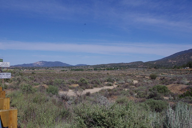
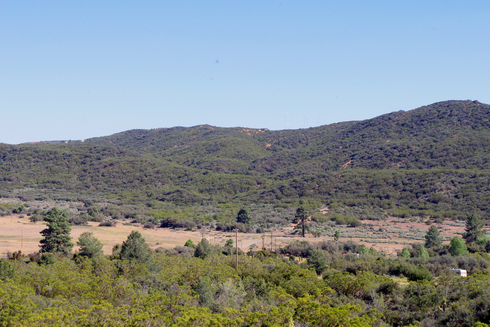
Well, this is going to be a supplement to my journey following the trek of Juan Bautista de Anza and my obsession with wondering what the natural world here in the San Jacinto Mountains most likely would have been like and the clues I've discovered over the years. This photo location is at the mouth of Hamilton Creek where Hwy 371 crosses over it on it's way to Palm Desert or Idyllwild. I'll be taking you back up the canyon as well as out into the Bajada or Alluvial Plains into Anza Valley.


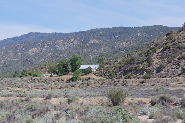
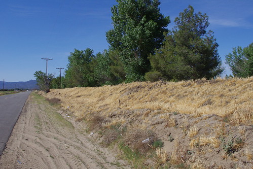
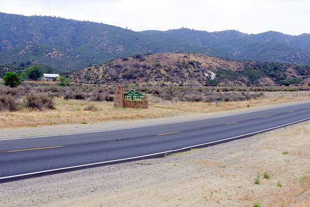
photo: Mine

Former Mike Dunn Ranch now owned by
Agri-Empire. This visual angel is over to
the right of the
 Hamilton Creek sign.
While most people pass by this area, there are a number of things that mostly go unnoticed. This is true of travelers on their way from Temecula to points east and Palm Desert to points west. This region is merely a minor otherwise boring inconvenience for most travelers on their way somewhere else. I'd almost be willing to bet that even most local Anza residents don't pay much attention to certain landmarks which offer no real significance other than it's all part of the local landscape. But if you just slow down a bit, you will see some amazing things that are remnants of a richer ecological past. Of course some sights here are obvious from the roadway, like the old Mike Dunn Ranch which is to the north and west of this bridge. That place like many of the older remnants that are left is made of pure thick walled Adobe brick obtained from local sources.
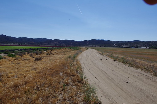
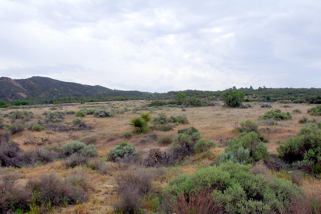
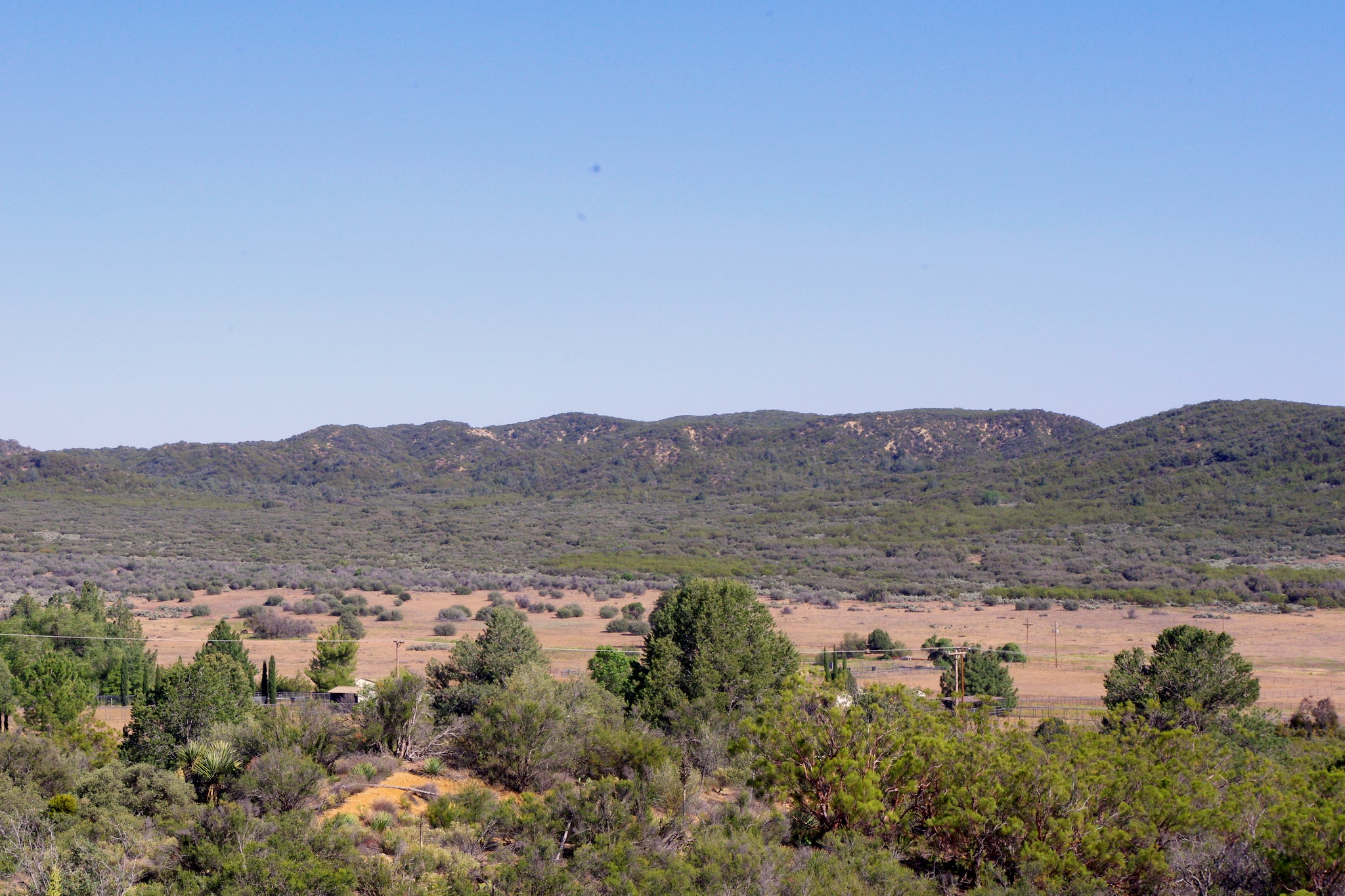
photo: Mine

Main creek flood plain channel running
due west towards Kirby Road
 Then looking straight on to the west of the bridge, you'll see the main alluvial plain where the main creek channel may have meandered and oscillated back and forth over a number of centuries. But I have a theory that this present straighter channel was more of a highway construction diversion which is common with modern road builders who create short-cuts out of convenience to purposely save money and maximize surrounding land use through this channeling of hydrological obstacle courses. (See Here)  The city of Los Angeles & vicinity is also a prime example of the straight river channeling to maximize land for profit.
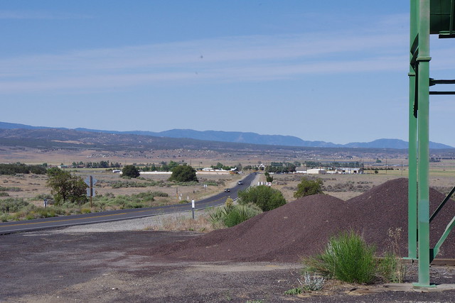
photo: Mine

Cal-Trans gravel bunker just west of  the bridge
But this river channel wasn't always pointed in this straighten westward direction. It actually veered off to the left of that sign and the highway design reflects that old riverbed by way of a rather large dip in the road just west of the Cal-Trans gravel bunker which sets just west of the bridge as well. Looking beyond that bunker you can see a couple of Canyon Live Oak Tree which are clues of an historical past, but more on that later. I call this a river bed because it can flood up something fierce when there is just the right Thunderstorm. Once in the summer of 1983 at around 2:00 on a Sunday afternoon, there came again a massive rainstorm which deluged the entire valley. I was on the road traveling from a friends place just as it started and barely made it back to the Scots Pine Ranch on 371.
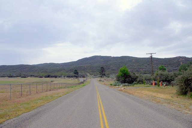
photo: Mine

Flood channel here was created by Agri-Empire
 to Kirby Road where flooding is directed now.
 Keep in mind that it was the last year of that heavy rainfall period I previous wrote about here on (Here) which occurred between 1978 & 1983. The heavily moist ground already saturated from the largest winter rains of that wet winter period facilitating major full coverage Monsoonal cloud development over the entire valley as opposed to anything of a localized nature, dumped big time on this one particular Sunday afternoon with every Canyon at floodstage and converging on this alluvial fan. The water went straight west slamming into this poor residents house[ I don't remember the guy's name, but this guy always blamed Agri-Empire for his bad luck with floods because of Jim Minor's channel straightening] and fanned out eventually making it to jct of Kirby Road and Hwy 371. 
photo: Mine

Large berm built by the resident to block
 all future floods which may come through.
From that point it went directly west all the way towards Agri-Empire's old equipment yard and irrigation lake. It flooded all business along the highway like the old Gas Station and further down the former Chaparral Cafe which is now Hwy 371 Diner. I wanted to drive west in my brand new 1983 Toyota 4X4 Pickup, from the Tree Farm but turned around at Chaparral Restaurant and went back to the Pine tree Farm where flood waters crossed the lower end on that property. Because of the intensity, these flood waters ripped through Agri-Empire potato fields upstream and dump 7 or 8 Kubota Tractor shovels full of potatoes that my room mate and I collected. At it's peak, this flood down Hwy 371 was completely covering the road from should to shoulder and beyond into the fields on both sides and the river rapids in the middle of that highway were 6 to 8 foot in height. The flood was impossible to even attempt a drive.
image: Robert Terwilliger"Laguna del Principe"
is located in the middle of where it says,
Terwilliger Valley
It is interesting here now to note that there was enough volume of water to fill up that normally dry lake bed between Anza and Terwilliger Valleys. Also, please  take note of the historical significance of this mysterious and normally dry lake bed south of the Anza area. There have  been many researchers who have searched for the campsite described by Fray Padre Font who also wrote a diary on the Anza trek where he described a beautiful small lake surrounded by wildflowers. He called it "Laguna del Principe" in Spanish. If you are leaving the county transfer site on Terwilliger Road after heavy rains, you may see it, straight out down on the reservation. Anyone who knows this region knows that during good heavy winter rainy seasons, that lake may fill up and it is surrounded by masses of yellow and violet wildflowers. The yellow being thick blooms of Gold Fields and purple or violet being Owls Clover. Okay, shifting gears back again to the Bajada in eastern Anza Valley. Take a look at the picture below. It's from the same Cal-Trans gravel bunker location, but I've magnified and focused it to reveal the major dip in the road which no one really likely ever pays attention to. 


photo: Mine
(click to enlarge full resolution image)

Notice the constructed design of the Highway 371 between that first and second car coming this way. Take a look at that second car which is actually driving down into the dip. This is where the original river or stream bed crossed this area after emerging from the mouth of Hamilton Creek Canyon. Of this whole alluvial fan, this creek bed last veered left and from there crossed Burnt Valley Road in front of the Baptist Church and made a floodplain bee line towards that ancient dry Lake bed that Juan Bautista de Anza named "Laguna del Principe" . One of the things that made me start investigating this area was a conversation I had in 1982 with Violet Cary who lived with her husband Art Cary at the the Old Fred Clark Ranch which they purchased I believe back in 1938, from Fred Clark who transferred title of La Puerta (The San Carlos Pass Ranch on Coyote Canyon Rd) to Art  and Violet Cary. They must have been in their 80s at the time or close to it. I think she was born in 1904 and he was older. He never spoke all that much, mostly I talked to her. A fiesty gal, Fire & Brimstone Church of Nazarine goer and hated James Minor of Agri-Impire who she insisted was going to Hell for taking all the valley's water. Of course she once told me I was headed there too, but that's another story.  Mostly I wanted to pick both of their minds about the the reasons for names of roads and places like Burnt Valley and Old Forest Road because I had heard rumor that the forest tree level had once come down to the valley floor. They both confirmed the historical accounts of the Fire stories of two major fires coming from the direction of Santa Rosa Indian Reservation, but said that wasn't what took the trees. That was a surprise. But they also said that not only did the forest come down to the valley floor, but it at one time covered the northern and eastern portions of Anza Valley which was interesting. But they said that most of the woodlands on the valley floor were large Oak Grove woodlands and I wasn't expecting that as I always thought in terms of Coulter & Jeffrey pines. They said there were some pines, but mostly Oak Woodlands. They also said that it was the very early pioneers who cut down the trees for grasslands to take their place because people made a living at cattle ranching and trees block heavy grassland development from happening. That was actually a shocker. What is the Ranching Biz's hate relationship with chaparral and tree woodlands ? Anyway, to my satisfaction, the legends of the existence of an old forest in Anza Valley were true after all, despite a later attempt by former newspaper editor Carl Long to dismiss it.


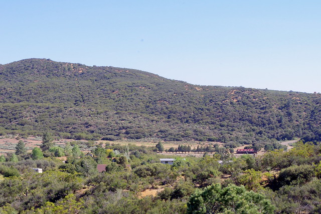
photo: Mine

Looking back upstream in the wash towards 
Hwy 371 and towards the Interior Live Oak
and back towards Hamilton Creek bridge
Anyway, back up at that image and the dip with the dry wash for which I have never seen water running through, even with the common summer heavy downpours because the upstream section was cut off. If you look at the left hand side of that picture again, notice there were two Oak trees along the wash to the south before it crosses Burnt Valley Rd ? These are Interior Live Oak for which there are plentiful huge examples along the Hamilton Creek canyon walls and slopes to the east along both sides of the highway. Every year in the Fall, there are large crops of acorns which if lucky could have washed downstream and germinated on their own under very favourable conditions. Mostly Scrub Jays do this work, but it still may be possible for the wash out to plant them under just the right circumstances of a wetter period. Once established and if other vegetation and wildlife moved in, the ecosystem of Oak woodland cover could recreate or reestablish itself all over again, but now that is mostly a long shot given the challenges of a present climate degradation. 
photo: Mine

Second Interior Live Oak tree further down
this formerly major
Hamilton Creek bed
which ran towards Terwilliger at a diagonal
There is a second Interior Live Oak tree further down the wash and it too looks as if it is in the same age time frame as the one closest to the Hwy 371. So both could have along with others have fortunately germinated, with only these tow trees surviving. For me this was proof enough of what they had told me about the existence of an Oak woodland in eastern and northern Anza Valley. Also, with what I know of trees like Oak and Maple being considered as great Cloud Trees by some researchers, because of their ability at giving off large amount of isoprene aerosols for which cloud and storm formation are greatly increased, it just all seemed to fit together nicely as to how and why a larger than at present forest once existed here. This greater increase of summer rainfall would have helped sustain shallower rooted trees like the pines in the hills above. The Oak trees are also deeper rooted than pines and would have greatly increased hydraulic lift and redistribution of water from deeper subsoil layers within the alluvial fan which are a great geological water storage mechanism anyway. Below is an example of the Interior Live Oak foliage.
photo: Mine

Canyon Live Oak Leaves from the first tree
This foliage is of the Oak nearer the roadway. The interior of the tree has a massive trunk, although you won't notice it as much because of it's growing out in the open. I'd be curious as to trunk core samples to determine it's actual age and comparison to any rainfall data of the time. Now speaking of Bajadas or alluvial fans again, take a look at this next shot I took on the roadway looking up the former creek bed and towards the old Dunn Ranch house. Not much there but denser growth of Silver Sagebrush. Then on the opposite side, I took a photograph of an entirely different alluvial flood plain which merges with the main Hamilton Creek floodplain. Believe it or not, we actually got debris from that Thunderstorm of Oak leaves and acorns, Pine needles and cones on Stanley Swanson's old Pine Tree Farm miles downstream from that Hamilton Creek canyon. It was really something to behold and truly Incredible!


photo: Mine
Viewing former creekbed on opposite side of Hwy 371 towards the old Mike Dunn Ranch homestead. From this point at the old Interior Live Oak there merges another Bajada or Alluvial Fan from the direction of Burnt Valley Road. If you know how to navigate with Google Earth , the viewing of this Bajada floodplain is incredible and you can see detailed outlines of the former creekbed route for which the road department diverted.
photo: Mine
This view is facing east from behind the old Interior Live Oak along the Hwy 371 and looking up the throat of another valley for which Burnt Valley Road switch backs on it's southern edge. This road would be on the right hand side of this picture, though hidden by chaparral. At the very top of this canyon drainage is my old place and the property across the street which I've written about previously (Here)
~~~~~~~~~~~~~~~~~~~~~~~~~~~~~~~~~ 
Old Forest Road

image by Mary Ann Kiger

Parry Pinyon (Pinus quadrafolia)
Just a quarter mile up on Hill Street
Now getting back to northern Anza Valley and a former forested area. You can drive along Mitchell Road where the Hamilton elementary School is and all points north and see some remnants of what once may have existed. There are some large oaks, but mostly large Scrub Oaks and many Parry Pinyon Pines like the one to the right in the photo here taken by Anza resident Mary Ann Kiger. This particular one as you pass it is actually so big, you'll think it's instead some Coulter or young Jeffrey Pine. Not exactly the type of image one gets when they think of a Pinyon pine. Further west on Mitchell Road is an area not well defined of Cahuilla Creek which comes off Thomas Mountain to the north heading south to Cahuilla Reservation where it makes a sharp turn west towards the direction of Lake Riverside. The only real marking of Cahuilla Creek is a normally dry wash next to the last house on the left on Mitchell Road which is a boundary divide  between Agri-Empires potato fields and the house belonging to former Anza Chiropractor Gene and Chantal Abbott's old place. Across the street north to Cahuilla Mountain the perimeters of Cahuilla Creek are quite fuzzy as land owners have blurred these features with their property improvements. However, running north is Old Forest Road which mostly follows this hydrological streambed course. This is another one of those areas which can flashflood out fairly easily. Very little respect for water course features is never Nature's fault. The wash at Gene Abbott's old place and Mitchell Road actually did wash out and created a miniature steep walled Grand Canyon once in the very early 1983 winter. Still, this alluvial fan or floodplain would also have facilitated all manner of forest debris and seed source from off Thomas Mountain just as with the Hamilton Creek flood drainage area.
~~~~~~~~~~~~~~~~~~~~~~~~~~~~~~~~~~
Burnt Valley

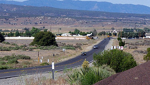
photo: Mine

Burnt Valley area and Burnt Valley Rd
This region back up Hamilton Creek and back into Burnt Valley itself and the surrounding hills and mountainous terrain contains the most damning evidence against negative articles like Carl Long's environmentalist conspiracy article which claimed to expose the myth behind an earlier well forested ecosystem. I understand he was a political right-winger and was always in major opposition with anything he considered counter to his ideology. I'm not political and could care less about anything with regards the Right vrs Left. Therefore I am mostly NOT ideologically nor even philosophically motivated here. I am neutral. What I do care about of course is Nature and learning ways in which to restore many areas back to former glory by incorporating, utilizing and replicating complex sophisticated mechanisms found out in Nature. 


photo: Mine

This is a stump and tree trunk log of an 
Incense Cedar (
Calocedrus decurrens)
killed by forest fire
The hills around Burnt Valley itself are rich with clues of the past. In almost all the surrounding foothill and mountain canyons, you can find all manner completely mummified logs which have not deteriorated. The reason is that this area is extremely dry with very little humidity as a rule, with small exceptions. Hot or Cold, it is always dry here. This prevents the normal rot usually found in old growth forests or on the western side of coastal slopes. Almost every single one of the slopes and washes on the Table Mountain side of Burnt Valley have these mummified remnants of a forested past AND many still contain some smaller stunted living growth examples of both Jeffrey and Coulter Pine. On the land behind the Dunn Ranch property owned by Agri-Empire, there is an area where a controversial irrigation reservoir was constructed but never used. Above this, Jim Minor has also developed some roads and several dead end cul du sacs for which to sell off Ranchette properties, but this never happened either. The land is vacant, but the roads and lots remain. On top of this sort of flat plateau area is where I always collected a permit from Larry Minor to collect PT Mycorrhizae truffles. At this same exact location there also use to be a rather large mummified Incense Cedar stump and trunk knocked over by the Bulldozer which created the roads and building pads. Of course the tree was already dead and Cedars tend to degrade even less than do pine trees. But unlike the still in existence pines trees, I never found a living Incense Cedar, just old remnants. I was hoping to get back and photograph many of these things, but time and money didn't allow for this. In fact in one last desperate attempt to come back before coming back to Sweden and document some areas the very last weekend of my Spring 2013 visit, the VW Bug you see at the top here above the Hamilton Creek Sign broke down on me during the travel up. Whatever! Take a look at the next three pics as they could be lined up from right to left to reveal the entire Burnt Valley looking towards Table Mountain. The photos were taken from a vantage point at the upper elevation Jct of Hwy 371 and Burnt Valley Road. Looking at this area, you can take your pick of any canyon or dry wash to find any of the mummified remnants for which I speak. What I'll do is provide three separate large magnified links to the three photos and you can Zoom in on them as you please. 
1)  Western edge of Burnt Valley & Log Cabin
2)  Center of Burnt Valley where Road turns sharply by hug Jeffrey Pine
3)  Back eastern end of Burnt Valley where it meets Table Mountain and ridge line where Pacific Crest Trail runs along


photo: Mine

Plant Forensics in Discovering a Climate's Ancient Past

I'm posting this to show a comparison of the area around the still in existence CCC Log Cabin refurbished by present owner who I met this past Spring and below here an old historical photograph of the same area when it was a major Civilian Conservation Corp Camp. Now just behind that Log Cabin and small ridge [earthquake fault line ridge] is where I found the only known very old Utah Service Berry tree I first saw back in the early 1980s. I literally over several years scoured adjacent canyons and washes looking for another specimen and found none. Before you question where I got time to go up there, it's easy, I simply lived a couple properties up from that Log Cabin on Burnt Valley Road. And the ancient charred stumps in my post link below of Santa Rosa Mountain BELOW Hwy 74, I also found charred pine stumps on my land which told me that even in history my property had burned. Also found old Manzanita charred stumps as well on my property. This area has since been stripped clean by present property owner.

image from Hamilton Museum
Wouldn't you love to have an archived Way-Back Machine and pan around for other clues ? This is Burnt Valley Road looking west from where the road sharply turns at the old Red Skelton Horse Ranch with the large Jeffrey Pine at the corner, but out of this shot. If you pan over to the upper hillside on the upper left corner of this photo, you'll see painted white boulders and other rocks put there to spell out Camp Anza. These white rocks are still there. I know because in my obsession for finding clues and another Utah Service Berry, I stumbled across them and at the time not knowing what they were. The old original Log Cabin is down on the left hand side below those white rocks.
~~~~~~~~~~~~~~~~~~~~~~~~~~~~~~~~~~
Alder Canyon

topomaps.com
What can I say, this is yet just one of those seemingly out of place names in an otherwise  dry forbidding looking country. The name  is of a canyon below what used to be a once  heavily forested landscape. But like the  northern and eastern Anza Valley areas, this  area is quite different as well. Alders remind  one of an ecosystem that is exceptionally wet,  especially in Southern California and even more  so on the steep desert side of a mountain above Coyote Canyon. This area of mountains are  the Buck Snorts and specifically Combs Peak.


photo: summitpost.org
This is what is left of the forests of Combs Peak. Even before the Coyote Fire of 2003, what existed here before the fire was merely a remnant of it's former glory of historical times past like when Juan Bautista de Anza past through Coyote Canyon and looked up. Still those Alder Trees ? Where did the the seed from their ancestors come from ? Were there also other canyons with these at one time, but later died out when climate changed ? Questions, questions and more questions that most never think of asking them when out and about. Boy, 2003 was a crappy year for fires. I doubt many readers will remember this one, with Cedar Fire on the brain. The area is desolate by human standards and rarely visited by many. It's also another one of those landmarks that travelers never think to give any notice to. Hopefully people will start asking more questions now if this post means anything important at all. Look below here.One last link. This is an online book to a publication which can be found from what I understand at the local Anza Feed Store. It's called Around Anza Valley by Margaret Wellman Jaenke. I want you to look specifically at pages 21 thru 23 which reveals how people made a living in those days. Aside from Cattle Ranching which took out much of the bottomland forests of this region, hunting and fur trapping were huge business enterprises people made a living at in those days. These are just a handful of photographs from a time when such photography was rarer than today. And I'm sure not every Fur Trapping trader is listed, photographed and documented here. But look at the wealth of animals here hunted and killed for their fur. How many of you know of Ringtailed Cat being native to Anza area ? Even the animal chart of the Chaparral Institute didn't list is as I remember. From the photos you can see there were many. I have only in my life seen one and it was at 4:00 a.m. in the morning driving through Burnt Valley on my way to work in El Centro California. The point is, such a wealth and richness of animal life could ONLY have been supported & possible from a much more heavily vegetated ecosystem to allow them to thrive so. Read the link below and pay close attention to photos on pages 21 thru 23:
Around Anza Valley by Margaret Wellman
Recently, the San Diego Union carried a bad piece on fire ecology which did not match what actually goes on in Nature. The work of some Scientific community leaders tend to push an ideological driven policy rather than proper land management. The facts given by the main expert on the latest Mountain fire area having not burned in over 130 years were grossly inaccurate  and environmental observations by many don't even reflect the reality of the natural world up in the high country. Here was my take on the events and commentary which frankly many won't agree with, but I've simply been around this area much too long to know otherwise: (keep in mind, this is only my personal opinion based on what I know and logical observations over 24 years in these mountains)
2013 Mountain Fire: Utilizing a Tragic Event to Evangelize Bad Ideologically Driven Science


5 comments:

  1. Ahhhh...so that's the old Mike Dunn ranch! I never knew that. Yes, people go zipping by and pass me ALL the time! Can't wait to read more!

    ReplyDelete
    Replies
    1. Poor Mike Dunn had to sell it to Agri-Empire, just to cover his legal expenses while fighting the BLM. As you know - Dunn and Samuelson built a 15-mile dirt road from Hwy 74/Pinyon Pines all the way to Palm Springs. They did this undisturbed from 1966 - until the BLM planes finally saw the road, while attempting to count Bighorn Sheep in 1968.

      Delete
  2. Oh, yes, I remember those rains also! We had flooding here in the desert in 1976, which took out part of the Living Desert at the base of Deep Canyon. I remember because we bought our house in 1975. In 1979, our home was flooded in a tropical storm. I had a 1 year old and I was pregnant and HOME ALONE (hubby was in Los Angeles). I grabbed my purse, our German shepherd, and my daughter (of course), headed out in my VW van, and made it to a nearby bridge, where I was stranded. Some WONDERFUL firemen came by and let us stay in their house overnight until the waters went down...Thereafter, every summer when it rained, I'd run around the house and pick up all the shoes! (Silly woman!)

    ReplyDelete
  3. Fascinating article! I learned so much about Anza. We took our 3rd graders to the CVWD (Coachella Valley Water District) one time and I sat there entranced by their maps of the Indian watering holes in Anza. There were a LOT of them!

    I'm going to have to start documenting more of these places on my blog...I certainly am not about to go off hiking ALONE, but I'll do what I can!
    Cheryl Ann

    ReplyDelete
    Replies
    1. In most of my posts i do try and give detailed references for people to observe for themselves and without much difficulty. Although I will admit to you that I have done a fair amount of Bushwhacking off trail and that is tough. Still, if everyone got together and cooperated, i really believe they could make positive changes and a turn around. Unfortunately, under the present system, we don't necessarily have a cooperative bunch of human beings on Earth. For all the supposed scientific understandings available today, science CANNOT make human beings behave and pursue the right course in life. Without the change to personality, it won't happen.

      Delete

Thanks for visiting and stopping by with your comments!

I will try to respond to each comment within a few days, though sometimes I take longer if I'm too busy which appears to be increasing.